

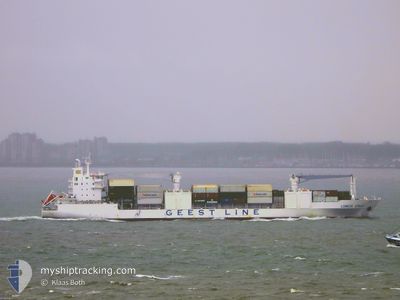
LOMBOK STRAIT
Reefer

Current Trip
| Time Travelled | 6 days |
|---|---|
| Remaining Time | 2 days |
| Distance Travelled | 3192.04 nm |
| Remaining Distance | 1376.56 nm |
| AVG Speed | 19.7 Knopen |
| MAX Speed | 21 Knopen |
| AVG Wind | 15.8 knots |
| MAX Wind | 25.4 knots |
| MIN Temp | 14.2°C / 57.56°F |
| MAX Temp | 28.3°C / 82.94°F |
| Diepgang | 9 M |
| Positie ontvangen | 1 d geleden |
Current Position
| Lengtegraad | --- |
|---|---|
| Breedtegraat | --- |
| Status | Under way using engine |
| Snelheid | 19.8 Knopen |
| Koers | 56.1° |
| Gebied | North Atlantic Ocean |
| Station | T-AIS |
| Positie ontvangen | 1 d geleden |
Information
The current position of LOMBOK STRAIT is in North Atlantic Ocean with coordinates 37.35202° / -23.92875° as reported on 2025-02-16 16:31 by AIS to our vessel tracker app. The vessel's current speed is 19.8 Knopen and is heading at the port of VLISSINGEN. The estimated time of arrival as calculated by MyShipTracking vessel tracking app is 2025-02-19 18:17 LT
The vessel LOMBOK STRAIT (IMO: 9204958, MMSI: 636019777) is a Reefer that was built in 2002 ( 23 Jaar oud ). It's sailing under the flag of [LR] Liberia.
In this page you can find informations about the vessels current position, last detected port calls, and current voyage information. If the vessels is not in coverage by AIS you will find the latest position.
The current position of LOMBOK STRAIT is detected by our AIS receivers and we are not responsible for the reliability of the data. The last position was recorded while the vessel was in Coverage by the Ais receivers of our vessel tracking app.
The current draught of LOMBOK STRAIT as reported by AIS is 9 meters
Weather
| Temperature | 14.2°C / 57.56°F |
|---|---|
| Wind Speed | 21 knots |
| Direction | 191° S |
| Pressure | 1000.9 hPa |
| Humidity | 94.1 % |
| Cloud Coverage | 100 % |


Featured Company
Last Port Calls
| Port | Arrival | Departure | Time In Port |
|---|---|---|---|
| 2025-02-09 03:50 | 2025-02-10 19:39 | 1 d | |
| 2025-02-07 07:17 | 2025-02-07 18:02 | 10 h | |
| 2025-02-04 05:42 | 2025-02-06 16:43 | 2 d | |
| 2025-02-02 09:15 | 2025-02-02 19:39 | 10 h | |
| 2025-01-31 16:08 | 2025-02-01 00:38 | 8 h | |
| 2025-01-31 03:11 | 2025-01-31 09:39 | 6 h | |
| 2025-01-29 23:43 | 2025-01-30 09:27 | 9 h | |
| 2025-01-28 20:54 | 2025-01-29 15:38 | 18 h | |
| 2025-01-18 07:13 | 2025-01-19 16:00 | 1 d | |
| 2025-01-16 02:48 | 2025-01-17 15:39 | 1 d |
Most Visited Ports (Last year)
| Port | Arrivals | |
|---|---|---|
| 11 | ||
| 11 | ||
| 11 | ||
| 11 | ||
| 10 | ||
| 10 |
Last Trips
| Origin | Departure | Destination | Arrival | Distance | |
|---|---|---|---|---|---|
| 2025-02-07 13:02 | 2025-02-08 23:50 | 652.18 nm | |||
| 2025-02-06 11:43 | 2025-02-07 02:17 | 276.62 nm | |||
| 2025-02-02 15:39 | 2025-02-04 00:42 | 607.91 nm | |||
| 2025-01-31 20:38 | 2025-02-02 05:15 | 492.84 nm | |||
| 2025-01-31 05:39 | 2025-01-31 12:08 | 85.70 nm | |||
| 2025-01-30 05:27 | 2025-01-30 23:11 | 140.76 nm | |||
| 2025-01-29 11:38 | 2025-01-29 19:43 | 148.62 nm | |||
| 2025-01-19 16:00 | 2025-01-28 16:54 | 3650.66 nm | |||
| 2025-01-17 16:39 | 2025-01-18 07:13 | 210.06 nm | |||
| 2025-01-06 19:46 | 2025-01-16 03:48 | 4194.14 nm |
Events
| Tijd | Evenement | Details | Positie / Bestemming | Info |
|---|---|---|---|---|
| 2025-02-16 16:43 | Status Changed | Default Under way using engine |
37.38936 / -23.86080
NLVLI
|
Snelheid: 19.8 kn Koers: 56.1° |
| 2025-02-16 16:31 | Buitenbereik |
37.35202 / -23.92875
North Atlantic Ocean
NLVLI
|
Snelheid: 19.8 kn Koers: 56.1° |
|
| 2025-02-16 11:45 | Draught Changed | 9 7.1 |
36.59593 / -25.63486
NLVLI
|
Snelheid: 20 kn Koers: 68.7° |
| 2025-02-16 11:45 | Destination Changed | NLVLI COSMR |
36.59593 / -25.63486
NLVLI
|
Snelheid: 20 kn Koers: 68.7° |
| 2025-02-16 11:45 | ETA Changed | 2025/02/20 00:00 2025/02/07 07:00 |
36.59593 / -25.63486
NLVLI
|
Snelheid: 20 kn Koers: 68.7° |
| 2025-02-16 11:26 | Wijzig zee gebeid | Portuguese (Azores) part of the North Atlantic Ocean Colombian part of the Caribbean Sea |
36.55762 / -25.75448
North Atlantic Ocean
|
Snelheid: 19.4 kn Koers: 68.6° |
| 2025-02-16 11:25 | Status Changed | Under way using engine Default |
36.55741 / -25.75510
COSMR
|
Snelheid: 19.5 kn Koers: 67° |
| 2025-02-16 11:25 | Binnenbereik |
36.55762 / -25.75448
North Atlantic Ocean
|
Snelheid: 19.4 kn Koers: 68.6° |
|
| 2025-02-10 19:39 | Vertrekhaven |
|
19.74207 / -71.78316
COSMR
|
Snelheid: 1.9 kn Koers: 311° |
| 2025-02-09 04:00 | Stop beweging |
19.70999 / -71.74290
[DO] PEPILLO SALCEDO
|
Snelheid: 0.1 kn Koers: 182° |