

LOMBOK STRAIT
Reefer

Current Trip
| Trip Time | 9 days |
|---|---|
| Trip Distance | 4225.38 nm |
| AVG Speed | 18.7 Knots |
| MAX Speed | 21 Knots |
| Dybgang | 9 m |
| AVG Wind | 15.2 knots |
| MAX Wind | 30.8 knots |
| MIN Temp | 3.2°C / 37.76°F |
| MAX Temp | 28.3°C / 82.94°F |
| Position Modtaget | 3 m siden |
Current Position
| Longitude | --- |
|---|---|
| Latitude | --- |
| Status | Moored |
| Fart | |
| Kurs | 239° |
| Område | North Sea |
| Station | T-AIS |
| Position Modtaget | 3 m siden |
Information
The current position of LOMBOK STRAIT is in North Sea with coordinates 51.47758° / 3.70312° as reported on 2025-02-20 08:52 by AIS to our vessel tracker app. The vessel's current speed is 0 Knots and is currently inside the port of VLISSINGEN.
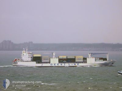
The vessel LOMBOK STRAIT (IMO: 9204958, MMSI: 636019777) is a Reefer that was built in 2002 ( 23 år gamle ). It's sailing under the flag of [LR] Liberia.
In this page you can find informations about the vessels current position, last detected port calls, and current voyage information. If the vessels is not in coverage by AIS you will find the latest position.
The current position of LOMBOK STRAIT is detected by our AIS receivers and we are not responsible for the reliability of the data. The last position was recorded while the vessel was in Coverage by the Ais receivers of our vessel tracking app.
The current draught of LOMBOK STRAIT as reported by AIS is 9 meters
Weather
| Temperature | 6.2°C / 43.16°F |
|---|---|
| Wind Speed | 10 knots |
| Direction | 179° S |
| Pressure | 1018.5 hPa |
| Humidity | 95.3 % |
| Cloud Coverage | 100 % |


Featured Company
Last Port Calls
| Port | Arrival | Departure | Time In Port |
|---|---|---|---|
| 2025-02-20 02:20 | |||
| 2025-02-08 23:50 | 2025-02-10 15:39 | 1 d | |
| 2025-02-07 02:17 | 2025-02-07 13:02 | 10 h | |
| 2025-02-04 00:42 | 2025-02-06 11:43 | 2 d | |
| 2025-02-02 05:15 | 2025-02-02 15:39 | 10 h | |
| 2025-01-31 12:08 | 2025-01-31 20:38 | 8 h | |
| 2025-01-30 23:11 | 2025-01-31 05:39 | 6 h | |
| 2025-01-29 19:43 | 2025-01-30 05:27 | 9 h | |
| 2025-01-28 16:54 | 2025-01-29 11:38 | 18 h | |
| 2025-01-18 07:13 | 2025-01-19 16:00 | 1 d |
Most Visited Ports (Last year)
| Port | Arrivals | |
|---|---|---|
| 11 | ||
| 11 | ||
| 11 | ||
| 10 | ||
| 10 | ||
| 10 |
Last Trips
| Origin | Departure | Destination | Arrival | Distance | |
|---|---|---|---|---|---|
| 2025-02-10 15:39 | 2025-02-20 02:20 | 4225.38 nm | |||
| 2025-02-07 13:02 | 2025-02-08 23:50 | 652.18 nm | |||
| 2025-02-06 11:43 | 2025-02-07 02:17 | 276.62 nm | |||
| 2025-02-02 15:39 | 2025-02-04 00:42 | 607.91 nm | |||
| 2025-01-31 20:38 | 2025-02-02 05:15 | 492.84 nm | |||
| 2025-01-31 05:39 | 2025-01-31 12:08 | 85.70 nm | |||
| 2025-01-30 05:27 | 2025-01-30 23:11 | 140.76 nm | |||
| 2025-01-29 11:38 | 2025-01-29 19:43 | 148.62 nm | |||
| 2025-01-19 16:00 | 2025-01-28 16:54 | 3650.66 nm | |||
| 2025-01-17 16:39 | 2025-01-18 07:13 | 210.06 nm |
Events
| Tid | Hændelsen | Detaljer | Position / Dest | Info |
|---|---|---|---|---|
| 2025-02-20 06:43 | Status er ændret | Moored Default |
51.47760 / 3.70310
[NL] VLISSINGEN
|
Fart: Kurs: 239° |
| 2025-02-20 06:40 | Status er ændret | Default Moored |
51.47754 / 3.70309
[NL] VLISSINGEN
|
Fart: 0.1 kn Kurs: 239° |
| 2025-02-20 02:27 | Status er ændret | Moored Under way using engine |
51.47761 / 3.70311
[NL] VLISSINGEN
|
Fart: Kurs: 238° |
| 2025-02-20 01:49 | STOP Sejllads |
51.47595 / 3.70370
[NL] VLISSINGEN
|
Fart: 0.3 kn Kurs: 325° |
|
| 2025-02-20 01:20 | Skibe i havn |
|
51.44819 / 3.67207
[NL] VLISSINGEN
|
Fart: 7.7 kn Kurs: 41° |
| 2025-02-20 00:26 | Ændre havområde | Dutch part of the North Sea Belgian part of the North Sea |
51.40581 / 3.34693
North Sea
NLVLI
|
Fart: 15.8 kn Kurs: 90.1° |
| 2025-02-19 21:56 | Ændre havområde | Belgian part of the North Sea French part of the North Sea |
51.32755 / 2.37025
North Sea
NLVLI
|
Fart: 19.4 kn Kurs: 58.1° |
| 2025-02-19 21:18 | ETA er ændret | 2025/02/19 22:40 2025/02/20 00:00 |
51.22426 / 2.11775
NLVLI
|
Fart: 13.5 kn Kurs: 66.6° |
| 2025-02-19 20:45 | ETA er ændret | 2025/02/20 00:00 2025/02/19 22:59 |
51.18505 / 1.92641
NLVLI
|
Fart: 16 kn Kurs: 63.8° |
| 2025-02-19 19:58 | ETA er ændret | 2025/02/19 22:59 2025/02/20 00:00 |
51.03895 / 1.70345
NLVLI
|
Fart: 16.5 kn Kurs: 42.5° |