
AQUAGRACE
Cargo
Current Trip
JP CHIBA
| Time Travelled | 9 days |
|---|---|
| Remaining Time | --- |
| Distance Travelled | 2578.86 nm |
| Remaining Distance | --- |
| AVG Speed | 11.4 Knopen |
| MAX Speed | 15.9 Knopen |
| AVG Wind | 12.7 knots |
| MAX Wind | 36.7 knots |
| MIN Temp | -0.3°C / 31.46°F |
| MAX Temp | 9.4°C / 48.92°F |
| Diepgang | 12.1 M |
| Positie ontvangen | 8 d geleden |
Current Position
| Lengtegraad | --- |
|---|---|
| Breedtegraat | --- |
| Status | Under way using engine |
| Snelheid | 9.4 Knopen |
| Koers | 267.1° |
| Gebied | North Pacific Ocean |
| Station | T-AIS |
| Positie ontvangen | 8 d geleden |
Info
Information
The current position of AQUAGRACE is in North Pacific Ocean with coordinates 48.48893° / -127.15728° as reported on 2025-03-08 20:38 by AIS to our vessel tracker app. The vessel's current speed is 9.4 Knopen
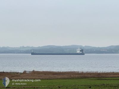
The vessel AQUAGRACE (IMO: 9764087, MMSI: 371355000) is a Cargo It's sailing under the flag of [PA] Panama.
In this page you can find informations about the vessels current position, last detected port calls, and current voyage information. If the vessels is not in coverage by AIS you will find the latest position.
The current position of AQUAGRACE is detected by our AIS receivers and we are not responsible for the reliability of the data. The last position was recorded while the vessel was in Coverage by the Ais receivers of our vessel tracking app.
The current draught of AQUAGRACE as reported by AIS is 12.1 meters
Weather
| Temperature | 1.1°C / 33.98°F |
|---|---|
| Wind Speed | 11 knots |
| Direction | 291° WNW |
| Pressure | 1006.1 hPa |
| Humidity | 83.6 % |
| Cloud Coverage | 9 % |
Featured Company
Last Trips
Events
| Tijd | Evenement | Details | Positie / Bestemming | Info |
|---|---|---|---|---|
| 2025-03-14 16:17 | Start beweging | 17.69 nm, North of AKUTAN |
54.41629 / -165.90915
JP CHIBA
|
Snelheid: 3.6 kn Koers: 306° |
| 2025-03-14 15:47 | Stop beweging | 17.93 nm, North of AKUTAN |
54.41955 / -165.91521
JP CHIBA
|
Snelheid: 0.2 kn Koers: 13° |
| 2025-03-08 20:42 | Status Changed | Default Under way using engine |
48.48846 / -127.17248
JP CHIBA
|
Snelheid: 9.4 kn Koers: 267.1° |
| 2025-03-08 20:38 | Buitenbereik |
48.48893 / -127.15728
North Pacific Ocean
JP CHIBA
|
Snelheid: 9.4 kn Koers: 267.1° |
|
| 2025-03-08 20:32 | Status Changed | Under way using engine Default |
48.48971 / -127.13504
JP CHIBA
|
Snelheid: 8.9 kn Koers: 266° |
| 2025-03-08 20:21 | Binnenbereik |
48.48971 / -127.13504
North Pacific Ocean
JP CHIBA
|
Snelheid: 9.3 kn Koers: 266.1° |
|
| 2025-03-08 18:45 | Status Changed | Default Under way using engine |
48.49850 / -126.70203
JP CHIBA
|
Snelheid: 10.1 kn Koers: 269.9° |
| 2025-03-08 18:40 | Status Changed | Under way using engine Default |
48.49927 / -126.68443
JP CHIBA
|
Snelheid: 10.1 kn Koers: 264° |
| 2025-03-08 18:40 | Buitenbereik |
48.49927 / -126.68443
North Pacific Ocean
JP CHIBA
|
Snelheid: 10.1 kn Koers: 269.9° |
|
| 2025-03-08 18:37 | Status Changed | Default Under way using engine |
48.49989 / -126.67033
JP CHIBA
|
Snelheid: 10.1 kn Koers: 263.6° |