

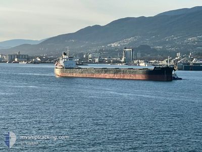
AQUAGRACE
Cargo

Current Trip
| Time Travelled | 22 h, 40 mins |
|---|---|
| Remaining Time | --- |
| Distance Travelled | 148.80 nm |
| Remaining Distance | --- |
| AVG Speed | 11.5 Knots |
| MAX Speed | 13.7 Knots |
| AVG Wind | 21.4 knots |
| MAX Wind | 34.2 knots |
| MIN Temp | 16.5°C / 61.7°F |
| MAX Temp | 19.7°C / 67.46°F |
| Draught | 9.4 m |
| Position Received | 7 h, 45 m ago |
Current Position
| Longitude | --- |
|---|---|
| Latitude | --- |
| Status | Under way using engine |
| Speed | 6.4 Knots |
| Course | 244° |
| Area | Philippine Sea |
| Station | T-AIS |
| Position Received | 7 h, 45 m ago |
Information
The current position of AQUAGRACE is in Philippine Sea with coordinates 34.30020° / 138.41305° as reported on 2025-03-26 12:11 by AIS to our vessel tracker app. The vessel's current speed is 6.4 Knots
The vessel AQUAGRACE (IMO: 9764087, MMSI: 371355000) is a Cargo It's sailing under the flag of [PA] Panama.
In this page you can find informations about the vessels current position, last detected port calls, and current voyage information. If the vessels is not in coverage by AIS you will find the latest position.
The current position of AQUAGRACE is detected by our AIS receivers and we are not responsible for the reliability of the data. The last position was recorded while the vessel was in Coverage by the Ais receivers of our vessel tracking app.
The current draught of AQUAGRACE as reported by AIS is 9.4 meters
Weather
| Temperature | 16.7°C / 62.06°F |
|---|---|
| Wind Speed | 14 knots |
| Direction | 60° ENE |
| Pressure | 1011.2 hPa |
| Humidity | 77.1 % |
| Cloud Coverage | --- |


Featured Company
Last Trips
| Origin | Departure | Destination | Arrival | Distance | |
|---|---|---|---|---|---|
| 2025-03-07 14:50 | 2025-03-24 08:23 | 4414.77 nm | |||
| 2025-02-12 13:40 | 2025-03-06 13:49 | 208.21 nm | |||
| 2025-01-16 02:51 | 2025-02-11 06:07 | 5072.07 nm | |||
| 2025-01-07 23:29 | 2025-01-14 07:11 | 357.69 nm | |||
| 2024-12-13 14:24 | 2025-01-05 14:34 | 4742.22 nm |
Events
| Time | Event | Details | Position / Dest | Info |
|---|---|---|---|---|
| 2025-03-26 12:18 | Status Changed | Default Under way using engine |
34.29640 / 138.40355
JP SMZ
|
Speed: 6.4 kn Course: 244° |
| 2025-03-26 12:11 | Change Sea Area | Japanese part of the Philippine Sea Japanese part of the North Pacific Ocean |
34.30020 / 138.41305
Philippine Sea
JP SMZ
|
Speed: 6.4 kn Course: 244° |
| 2025-03-26 12:11 | Status Changed | Under way using engine Default |
34.30020 / 138.41305
JP SMZ
|
Speed: 7 kn Course: 250° |
| 2025-03-26 12:11 | OUT of Coverage |
34.30020 / 138.41305
Philippine Sea
JP SMZ
|
Speed: 6.4 kn Course: 244° |
|
| 2025-03-26 12:06 | IN Coverage |
34.30020 / 138.41305
Philippine Sea
JP SMZ
|
Speed: 6.4 kn Course: 244° |
|
| 2025-03-26 01:22 | Status Changed | Default Under way using engine |
35.00289 / 139.58073
JP SMZ
|
Speed: 10.4 kn Course: 237.7° |
| 2025-03-26 01:22 | OUT of Coverage |
35.00313 / 139.58119
North Pacific Ocean
JP SMZ
|
Speed: 10.4 kn Course: 237.7° |
|
| 2025-03-25 21:29 | Draught Changed | 9.4 11.9 |
35.57334 / 140.03234
JP SMZ
|
Speed: 12 kn Course: 240.5° |
| 2025-03-25 21:29 | Destination Changed | JP SMZ JP CHB OFF |
35.57334 / 140.03234
JP SMZ
|
Speed: 12 kn Course: 240.5° |
| 2025-03-25 21:29 | ETA Changed | 2025/03/26 18:00 2025/03/24 03:05 |
35.57334 / 140.03234
JP SMZ
|
Speed: 12 kn Course: 240.5° |