
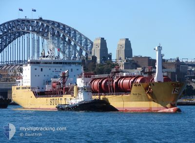
STOLT SEA
Oil/Chemical Tanker
Current Trip
| Time Travelled | 1 day |
|---|---|
| Remaining Time | 3 days |
| Distance Travelled | 353.28 nm |
| Remaining Distance | 957.50 nm |
| AVG Speed | 12.3 Noeuds |
| MAX Speed | 13.9 Noeuds |
| AVG Wind | 9.8 knots |
| MAX Wind | 16 knots |
| MIN Temp | 15.5°C / 59.9°F |
| MAX Temp | 18.6°C / 65.48°F |
| Tirant d eau | 9.2 m |
| Position reçue | 6 h, 50 m depuis |
Current Position
| Longitude | 7.29447° |
|---|---|
| Latitude | 39.07608° |
| Etat | Under way using engine |
| Vitesse | 13.3 Noeuds |
| Parcours | 120.1° |
| Zone | Mediterranean Sea - Western Basin |
| Station | T-AIS |
| Position reçue | 6 h, 50 m depuis |
Info
Information
The current position of STOLT SEA is in Mediterranean Sea - Western Basin with coordinates 39.07608° / 7.29447° as reported on 2024-05-05 02:37 by AIS to our vessel tracker app. The vessel's current speed is 13.3 Noeuds and is heading at the port of RAVENNA. The estimated time of arrival as calculated by MyShipTracking vessel tracking app is 2024-05-08 10:08 LT
The vessel STOLT SEA (IMO: 9149495, MMSI: 319478000) is a Oil/Chemical Tanker that was built in 1999 ( 25 Age ). It's sailing under the flag of [KY] Cayman Is.
In this page you can find informations about the vessels current position, last detected port calls, and current voyage information. If the vessels is not in coverage by AIS you will find the latest position.
The current position of STOLT SEA is detected by our AIS receivers and we are not responsible for the reliability of the data. The last position was recorded while the vessel was in Coverage by the Ais receivers of our vessel tracking app.
The current draught of STOLT SEA as reported by AIS is 9.2 meters
Weather
| Temperature | 17.3°C / 63.14°F |
|---|---|
| Wind Speed | 5 knots |
| Direction | 124° SE |
| Pressure | 1018.6 hPa |
| Humidity | 58.5 % |
| Cloud Coverage | 48 % |
Featured Company
Last Port Calls
| Port | Arrival | Departure | Time In Port |
|---|---|---|---|
| 2024-05-03 02:35 | 2024-05-04 04:19 | 1 d | |
| 2024-05-01 06:36 | 2024-05-01 23:32 | 16 h | |
| 2024-04-08 19:27 | 2024-04-10 03:51 | 1 d | |
| 2024-04-03 03:07 | 2024-04-03 17:15 | 14 h | |
| 2024-04-01 01:55 | 2024-04-02 02:47 | 1 d | |
| 2024-03-31 00:35 | 2024-03-31 16:02 | 15 h | |
| 2024-03-27 17:51 | 2024-03-29 06:35 | 1 d | |
| 2024-03-21 11:23 | 2024-03-22 22:36 | 1 d | |
| 2024-03-18 06:49 | 2024-03-20 13:04 | 2 d | |
| 2024-03-13 21:29 | 2024-03-15 23:30 | 2 d |
Most Visited Ports (Last year)
| Port | Arrivals | |
|---|---|---|
| 33 | ||
| 24 | ||
| 10 | ||
| 6 | ||
| 5 | ||
| 2 |
Last Trips
| Origin | Departure | Destination | Arrival | Distance | |
|---|---|---|---|---|---|
| 2024-05-02 01:32 | 2024-05-03 04:35 | 137.39 nm | |||
| 2024-04-09 22:51 | 2024-05-01 08:36 | 5331.24 nm | |||
| 2024-04-03 12:15 | 2024-04-08 14:27 | 50.94 nm | |||
| 2024-04-01 21:47 | 2024-04-02 22:07 | 123.95 nm | |||
| 2024-03-31 11:02 | 2024-03-31 20:55 | 96.65 nm | |||
| 2024-03-29 01:35 | 2024-03-30 19:35 | 44.92 nm | |||
| 2024-03-22 16:36 | 2024-03-27 12:51 | 916.84 nm | |||
| 2024-03-20 07:04 | 2024-03-21 05:23 | 241.57 nm | |||
| 2024-03-15 18:30 | 2024-03-18 00:49 | 641.68 nm | |||
| 2024-03-10 13:22 | 2024-03-13 16:29 | 506.52 nm |
Events
| Heure | Evenement | Détails | Position/ Destination | Info |
|---|---|---|---|---|
| 2024-05-05 02:44 | Etat Changé | Default Under way using engine |
39.06173 / 7.32607
RAVENNA
|
Vitesse: 13.3 kn Parcours: 120.1° |
| 2024-05-05 02:37 | Etat Changé | Under way using engine Default |
39.07608 / 7.29447
RAVENNA
|
Vitesse: 13.3 kn Parcours: 120° |
| 2024-05-05 02:37 | Hors de la zone couverte |
39.07608 / 7.29447
Mediterranean Sea - Western Basin
RAVENNA
|
Vitesse: 13.3 kn Parcours: 120.1° |
|
| 2024-05-05 02:04 | Etat Changé | Default Under way using engine |
39.13655 / 7.16223
RAVENNA
|
Vitesse: 13 kn Parcours: 120.9° |
| 2024-05-05 01:56 | Etat Changé | Under way using engine Default |
39.15312 / 7.12682
RAVENNA
|
Vitesse: 13 kn Parcours: 118° |
| 2024-05-05 01:16 | Etat Changé | Default Under way using engine |
39.22075 / 6.96575
RAVENNA
|
Vitesse: 13 kn Parcours: 118.3° |
| 2024-05-05 00:45 | Detecté en mer | Italian part of the Mediterranean Sea - Western Basin |
39.27380 / 6.83712
Mediterranean Sea - Western Basin
RAVENNA
|
Vitesse: 13.1 kn Parcours: 117.4° |
| 2024-05-05 00:43 | Etat Changé | Under way using engine Default |
39.27643 / 6.83010
RAVENNA
|
Vitesse: 13.1 kn Parcours: 112° |
| 2024-05-05 00:40 | Dans la zone couverte |
39.27380 / 6.83712
Mediterranean Sea - Western Basin
RAVENNA
|
Vitesse: 13.1 kn Parcours: 117.4° |
|
| 2024-05-04 22:20 | Hors de la zone couverte |
39.52862 / 6.23315
Mediterranean Sea - Western Basin
RAVENNA
|
Vitesse: 13.3 kn Parcours: 118.4° |