
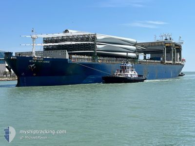
STAR ISFJORD
General Cargo
Current Trip
| Time Travelled | 7 days |
|---|---|
| Remaining Time | --- |
| Distance Travelled | 2069.00 nm |
| Remaining Distance | --- |
| AVG Speed | 12 Noeuds |
| MAX Speed | 17.3 Noeuds |
| AVG Wind | 13 knots |
| MAX Wind | 36.8 knots |
| MIN Temp | -1.2°C / 29.84°F |
| MAX Temp | 10.3°C / 50.54°F |
| Tirant d eau | 11.2 m |
| Position reçue | 7 d depuis |
Current Position
| Longitude | --- |
|---|---|
| Latitude | --- |
| Etat | Under way using engine |
| Vitesse | 12 Noeuds |
| Parcours | 273.4° |
| Zone | North Pacific Ocean |
| Station | T-AIS |
| Position reçue | 7 d depuis |
Info
Information
The current position of STAR ISFJORD is in North Pacific Ocean with coordinates 48.60796° / -126.93021° as reported on 2025-03-01 06:11 by AIS to our vessel tracker app. The vessel's current speed is 12 Noeuds and is heading at the port of SHIMIZU. The estimated time of arrival as calculated by MyShipTracking vessel tracking app is 2025-03-15 21:00 LT
The vessel STAR ISFJORD (IMO: 9182978, MMSI: 257615000) is a General Cargo that was built in 2000 ( 25 Age ). It's sailing under the flag of [NO] Norway.
In this page you can find informations about the vessels current position, last detected port calls, and current voyage information. If the vessels is not in coverage by AIS you will find the latest position.
The current position of STAR ISFJORD is detected by our AIS receivers and we are not responsible for the reliability of the data. The last position was recorded while the vessel was in Coverage by the Ais receivers of our vessel tracking app.
The current draught of STAR ISFJORD as reported by AIS is 11.2 meters
Weather
| Temperature | 0.9°C / 33.62°F |
|---|---|
| Wind Speed | 35 knots |
| Direction | 113° ESE |
| Pressure | 990.2 hPa |
| Humidity | 97.1 % |
| Cloud Coverage | 100 % |
Featured Company
Last Port Calls
| Port | Arrival | Departure | Time In Port |
|---|---|---|---|
| 2025-02-27 13:13 | 2025-02-28 12:09 | 22 h | |
| 2025-02-25 04:12 | 2025-02-27 10:49 | 2 d | |
| 2025-02-18 19:41 | 2025-02-22 07:59 | 3 d | |
| 2025-02-17 10:22 | 2025-02-18 14:17 | 1 d | |
| 2025-02-06 10:20 | 2025-02-07 20:52 | 1 d | |
| 2025-01-31 17:18 | 2025-02-02 15:50 | 1 d | |
| 2025-01-27 10:40 | 2025-01-29 08:54 | 1 d |
Last Trips
| Origin | Departure | Destination | Arrival | Distance | |
|---|---|---|---|---|---|
| 2025-02-27 02:49 | 2025-02-27 05:13 | 28.10 nm | |||
| 2025-02-21 23:59 | 2025-02-24 20:12 | 63.70 nm | |||
| 2025-02-18 06:17 | 2025-02-18 11:41 | 45.94 nm | |||
| 2025-02-07 12:52 | 2025-02-17 02:22 | 1534.43 nm | |||
| 2025-02-02 08:50 | 2025-02-06 02:20 | 1136.05 nm | |||
| 2025-01-29 02:54 | 2025-01-31 10:18 | 666.73 nm | |||
| 2024-12-30 17:54 | 2025-01-27 04:40 | 7714.10 nm |
Events
| Heure | Evenement | Détails | Position/ Destination | Info |
|---|---|---|---|---|
| 2025-03-01 06:26 | Etat Changé | Default Under way using engine |
48.61165 / -127.00763
JPSMZ
|
Vitesse: 12 kn Parcours: 273.4° |
| 2025-03-01 06:11 | Hors de la zone couverte |
48.60796 / -126.93021
North Pacific Ocean
JPSMZ
|
Vitesse: 12 kn Parcours: 273.4° |
|
| 2025-03-01 00:21 | Etat Changé | Under way using engine Default |
48.52746 / -125.18395
JPSMZ
|
Vitesse: 11.7 kn Parcours: 268° |
| 2025-03-01 00:20 | Etat Changé | Default Under way using engine |
48.52744 / -125.17726
JPSMZ
|
Vitesse: 11.6 kn Parcours: 266.2° |
| 2025-02-28 23:35 | Changement de zone | Canadian part of the North Pacific Ocean Canadian part of the The Coastal Waters of Southeast Alaska and British Columbia |
48.52568 / -124.96009
North Pacific Ocean
JPSMZ
|
Vitesse: 11.5 kn Parcours: 269.8° |
| 2025-02-28 23:35 | Etat Changé | Under way using engine Default |
48.52568 / -124.96009
JPSMZ
|
Vitesse: 11.5 kn Parcours: 269° |
| 2025-02-28 23:32 | Dans la zone couverte |
48.52568 / -124.96009
North Pacific Ocean
JPSMZ
|
Vitesse: 11.5 kn Parcours: 269.8° |
|
| 2025-02-28 22:31 | Etat Changé | Default Under way using engine |
48.49402 / -124.67081
JPSMZ
|
Vitesse: 10.9 kn Parcours: 290.5° |
| 2025-02-28 22:26 | Etat Changé | Under way using engine Default |
48.48771 / -124.64523
JPSMZ
|
Vitesse: 10.7 kn Parcours: 291° |
| 2025-02-28 22:26 | Hors de la zone couverte |
48.48771 / -124.64523
The Coastal Waters of Southeast Alaska and British Columbia
JPSMZ
|
Vitesse: 10.9 kn Parcours: 290.5° |