
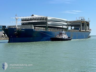
STAR ISFJORD
General Cargo
Current Trip
USEPM
| Time Travelled | 3 days |
|---|---|
| Remaining Time | --- |
| Distance Travelled | 840.25 nm |
| Remaining Distance | --- |
| AVG Speed | 11 Knots |
| MAX Speed | 14.2 Knots |
| AVG Wind | 13.1 knots |
| MAX Wind | 25.4 knots |
| MIN Temp | 10°C / 50°F |
| MAX Temp | 23.1°C / 73.58°F |
| Draught | 8 m |
| Position Received | 1 d ago |
Current Position
| Longitude | -75.54389° |
|---|---|
| Latitude | 34.27916° |
| Status | Under way using engine |
| Speed | 13.9 Knots |
| Course | 44.7° |
| Area | North Atlantic Ocean |
| Station | T-AIS |
| Position Received | 1 d ago |
Info
Information
The current position of STAR ISFJORD is in North Atlantic Ocean with coordinates 34.27916° / -75.54389° as reported on 2024-04-18 08:08 by AIS to our vessel tracker app. The vessel's current speed is 13.9 Knots
The vessel STAR ISFJORD (IMO: 9182978, MMSI: 257615000) is a General Cargo that was built in 2000 ( 24 years old ). It's sailing under the flag of [NO] Norway.
In this page you can find informations about the vessels current position, last detected port calls, and current voyage information. If the vessels is not in coverage by AIS you will find the latest position.
The current position of STAR ISFJORD is detected by our AIS receivers and we are not responsible for the reliability of the data. The last position was recorded while the vessel was in Coverage by the Ais receivers of our vessel tracking app.
The current draught of STAR ISFJORD as reported by AIS is 8 meters
Weather
| Temperature | 10.3°C / 50.54°F |
|---|---|
| Wind Speed | 12 knots |
| Direction | 126° SE |
| Pressure | 1019.3 hPa |
| Humidity | 88.1 % |
| Cloud Coverage | 100 % |
Featured Company
Last Port Calls
| Port | Arrival | Departure | Time In Port |
|---|---|---|---|
| 2024-04-16 03:21 | 2024-04-17 00:24 | 21 h | |
| 2024-04-09 22:31 | 2024-04-12 15:04 | 2 d | |
| 2024-04-01 03:23 | 2024-04-08 02:37 | 6 d | |
| 2024-03-08 11:43 | 2024-03-09 23:38 | 1 d | |
| 2024-02-28 13:03 | 2024-03-08 09:37 | 8 d | |
| 2024-02-22 00:24 | 2024-02-27 09:14 | 5 d | |
| 2024-02-13 11:16 | 2024-02-21 10:25 | 7 d | |
| 2024-02-03 21:22 | 2024-02-04 17:08 | 19 h | |
| 2024-02-03 04:04 | 2024-02-03 13:16 | 9 h |
Last Trips
| Origin | Departure | Destination | Arrival | Distance | |
|---|---|---|---|---|---|
| 2024-04-12 10:04 | 2024-04-15 23:21 | 1184.94 nm | |||
| 2024-04-07 21:37 | 2024-04-09 17:31 | 552.13 nm | |||
| 2024-03-10 00:38 | 2024-03-31 22:23 | 5780.81 nm | |||
| 2024-03-08 10:37 | 2024-03-08 12:43 | 17.01 nm | |||
| 2024-02-27 10:14 | 2024-02-28 14:03 | 358.86 nm | |||
| 2024-02-21 11:25 | 2024-02-22 01:24 | 134.64 nm | |||
| 2024-02-04 18:08 | 2024-02-13 12:16 | 2287.47 nm | |||
| 2024-02-03 14:16 | 2024-02-03 22:22 | 96.14 nm | |||
| 2024-01-20 13:11 | 2024-02-03 05:04 | 4009.95 nm |
Events
| Time | Event | Details | Position / Dest | Info |
|---|---|---|---|---|
| 2024-04-18 08:15 | Status Changed | Default Under way using engine |
34.30019 / -75.51840
USEPM
|
Speed: 13.9 kn Course: 44.7° |
| 2024-04-18 08:08 | OUT of Coverage |
34.27916 / -75.54389
North Atlantic Ocean
USEPM
|
Speed: 13.9 kn Course: 44.7° |
|
| 2024-04-18 07:55 | Status Changed | Under way using engine Default |
34.24447 / -75.58383
USEPM
|
Speed: 13.6 kn Course: 40° |
| 2024-04-18 07:37 | IN Coverage |
34.24540 / -75.58280
North Atlantic Ocean
USEPM
|
Speed: 13.6 kn Course: 43.1° |
|
| 2024-04-18 06:49 | Status Changed | Default Under way using engine |
34.06363 / -75.77753
USEPM
|
Speed: 12.9 kn Course: 44.7° |
| 2024-04-18 06:37 | OUT of Coverage |
34.03306 / -75.81361
North Atlantic Ocean
USEPM
|
Speed: 12.9 kn Course: 44.7° |
|
| 2024-04-18 06:19 | Status Changed | Under way using engine Default |
33.98417 / -75.86858
USEPM
|
Speed: 13 kn Course: 42° |
| 2024-04-18 06:01 | IN Coverage |
33.98687 / -75.86564
North Atlantic Ocean
USEPM
|
Speed: 13.1 kn Course: 42.3° |
|
| 2024-04-18 04:38 | Status Changed | Default Under way using engine |
33.71230 / -76.16338
USEPM
|
Speed: 13 kn Course: 45.1° |
| 2024-04-18 04:31 | OUT of Coverage |
33.69487 / -76.18367
North Atlantic Ocean
USEPM
|
Speed: 13 kn Course: 45.1° |