
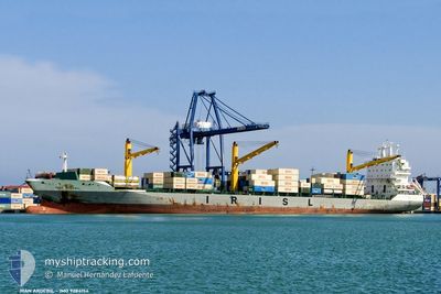
ARTAM
Container Ship
Current Trip
LKCMB
| Time Travelled | 3 days |
|---|---|
| Remaining Time | --- |
| Distance Travelled | 1358.61 nm |
| Remaining Distance | --- |
| AVG Speed | 15.4 Noeuds |
| MAX Speed | 17.9 Noeuds |
| AVG Wind | 6 knots |
| MAX Wind | 17.8 knots |
| MIN Temp | 27.1°C / 80.78°F |
| MAX Temp | 30.3°C / 86.54°F |
| Tirant d eau | 8.1 m |
| Position reçue | 4 d depuis |
Current Position
| Longitude | 77.54123° |
|---|---|
| Latitude | 7.74973° |
| Etat | Under way using engine |
| Vitesse | 16.9 Noeuds |
| Parcours | 114° |
| Zone | Laccadive Sea |
| Station | T-AIS |
| Position reçue | 4 d depuis |
Info
Information
The current position of ARTAM is in Laccadive Sea with coordinates 7.74973° / 77.54123° as reported on 2024-05-09 19:49 by AIS to our vessel tracker app. The vessel's current speed is 16.9 Noeuds
The vessel ARTAM (IMO: 9284154, MMSI: 422038800) is a Container Ship that was built in 2004 ( 20 Age ). It's sailing under the flag of [IR] Iran.
In this page you can find informations about the vessels current position, last detected port calls, and current voyage information. If the vessels is not in coverage by AIS you will find the latest position.
The current position of ARTAM is detected by our AIS receivers and we are not responsible for the reliability of the data. The last position was recorded while the vessel was in Coverage by the Ais receivers of our vessel tracking app.
The current draught of ARTAM as reported by AIS is 8.1 meters
Weather
| Temperature | 29.5°C / 85.1°F |
|---|---|
| Wind Speed | 4 knots |
| Direction | 336° NNW |
| Pressure | 1006.3 hPa |
| Humidity | 72.1 % |
| Cloud Coverage | 100 % |
Featured Company
Last Port Calls
| Port | Arrival | Departure | Time In Port |
|---|---|---|---|
| 2024-05-10 05:32 | 2024-05-10 16:32 | 10 h | |
| 2024-05-01 15:50 | 2024-05-05 02:35 | 3 d | |
| 2024-04-09 18:25 | 2024-04-11 14:14 | 1 d | |
| 2024-04-03 16:57 | 2024-04-04 03:53 | 10 h | |
| 2024-03-28 08:40 | 2024-03-28 20:56 | 12 h | |
| 2024-03-24 21:15 | 2024-03-25 16:37 | 19 h |
Last Trips
| Origin | Departure | Destination | Arrival | Distance | |
|---|---|---|---|---|---|
| 2024-05-05 07:05 | 2024-05-10 11:02 | 1929.74 nm | |||
| 2024-04-11 22:14 | 2024-05-01 20:20 | 3564.56 nm | |||
| 2024-04-04 09:23 | 2024-04-10 02:25 | 1462.38 nm | |||
| 2024-03-29 02:26 | 2024-04-03 22:27 | 1299.51 nm | |||
| 2024-03-25 20:37 | 2024-03-28 14:10 | 934.87 nm | |||
| 2024-02-26 05:13 | 2024-03-25 01:15 | 2969.23 nm |
Events
| Heure | Evenement | Détails | Position/ Destination | Info |
|---|---|---|---|---|
| 2024-05-10 16:32 | PORT DE DEPART |
|
6.97256 / 79.83727
LKCMB
|
Vitesse: 9.5 kn Parcours: 305° |
| 2024-05-10 16:20 | Démarrage |
6.95401 / 79.85169
[LK] COLOMBO
|
Vitesse: 4.7 kn Parcours: 6° |
|
| 2024-05-10 06:00 | Arret |
6.95035 / 79.85300
[LK] COLOMBO
|
Vitesse: 0.1 kn Parcours: 13° |
|
| 2024-05-10 05:32 | Port d'arrivée |
|
6.96154 / 79.84301
[LK] COLOMBO
|
Vitesse: 8.3 kn Parcours: 124° |
| 2024-05-09 19:57 | Etat Changé | Default Under way using engine |
7.73399 / 77.57625
LKCMB
|
Vitesse: 16.9 kn Parcours: 114° |
| 2024-05-09 19:49 | Hors de la zone couverte |
7.74973 / 77.54123
Laccadive Sea
LKCMB
|
Vitesse: 16.9 kn Parcours: 114° |
|
| 2024-05-09 16:53 | Changement de zone | Indian part of the Laccadive Sea Iranian part of the Gulf of Oman |
8.08992 / 76.80786
Laccadive Sea
LKCMB
|
Vitesse: 15.9 kn Parcours: 127.2° |
| 2024-05-09 16:53 | Dans la zone couverte |
8.08992 / 76.80786
Laccadive Sea
LKCMB
|
Vitesse: 15.9 kn Parcours: 127.2° |
|
| 2024-05-05 09:50 | Etat Changé | Default Under way using engine |
25.66482 / 57.14846
LKCMB
|
Vitesse: 15.7 kn Parcours: 142.7° |
| 2024-05-05 09:44 | Hors de la zone couverte |
25.68330 / 57.13279
Gulf of Oman
LKCMB
|
Vitesse: 15.7 kn Parcours: 142.7° |