
ARTAM
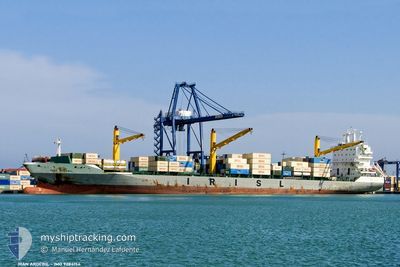
Container Ship
Current Trip
| Trip Time | 1 h, 24 mins |
|---|---|
| Trip Distance | 1.55 nm |
| AVG Speed | 2.3 Knopen |
| MAX Speed | 2.3 Knopen |
| Diepgang | 8.9 M |
| AVG Wind | 23.7 knots |
| MAX Wind | 24 knots |
| MIN Temp | 6.8°C / 44.24°F |
| MAX Temp | 6.8°C / 44.24°F |
| Positie ontvangen | 2025-01-15 11:25 |
Current Position
| Lengtegraad | --- |
|---|---|
| Breedtegraat | --- |
| Status | At anchor |
| Snelheid | 0.1 Knopen |
| Koers | 81° |
| Gebied | South China Sea |
| Station | T-AIS |
| Positie ontvangen | 2025-01-15 11:25 |
Info
Information
The current position of ARTAM is in South China Sea with coordinates 21.83019° / 113.31119° as reported on 2025-01-15 11:25 by AIS to our vessel tracker app. The vessel's current speed is 0.1 Knopen and is currently inside the port of JINHAI HEAVY INDUSTR.
The vessel ARTAM (IMO: 9284154, MMSI: 422038800) is a Container Ship that was built in 2004 ( 21 Jaar oud ). It's sailing under the flag of [IR] Iran.
In this page you can find informations about the vessels current position, last detected port calls, and current voyage information. If the vessels is not in coverage by AIS you will find the latest position.
The current position of ARTAM is detected by our AIS receivers and we are not responsible for the reliability of the data. The last position was recorded while the vessel was in Coverage by the Ais receivers of our vessel tracking app.
The current draught of ARTAM as reported by AIS is 8.9 meters
Weather
| Temperature | 6.8°C / 44.24°F |
|---|---|
| Wind Speed | 15 knots |
| Direction | 13° NNE |
| Pressure | 1027.7 hPa |
| Humidity | 62 % |
| Cloud Coverage | 44 % |
Featured Company
Last Port Calls
| Port | Arrival | Departure | Time In Port |
|---|---|---|---|
| 2025-02-13 01:05 | |||
| 2025-02-09 22:01 | 2025-02-12 23:41 | 3 d | |
| 2025-01-25 11:01 | 2025-01-28 11:53 | 3 d | |
| 2024-12-27 00:45 | 2024-12-29 03:16 | 2 d | |
| 2024-12-23 07:29 | |||
| 2024-12-17 12:16 | 2024-12-19 03:51 | 1 d | |
| 2024-12-04 13:12 | 2024-12-05 08:45 | 19 h |
Last Trips
| Origin | Departure | Destination | Arrival | Distance | |
|---|---|---|---|---|---|
| 2025-02-12 23:41 | 2025-02-13 01:05 | 1.55 nm | |||
| 2025-01-28 11:53 | 2025-02-09 22:01 | 1126.62 nm | |||
| 2024-12-29 03:16 | 2025-01-25 11:01 | 5599.50 nm | |||
| 2024-12-23 07:29 | 2024-12-27 00:45 | 280.42 nm | |||
| 2024-12-05 08:45 | 2024-12-17 12:16 | 2827.44 nm | |||
| 2024-11-24 20:23 | 2024-12-04 13:12 | 234.40 nm |
Events
| Tijd | Evenement | Details | Positie / Bestemming | Info |
|---|---|---|---|---|
| 2025-02-12 16:05 | Aankomsthaven |
|
30.26778 / 122.25583
[JP] JINHAI HEAVY INDUSTR
|
Snelheid: 0.1 kn Koers: 31° |
| 2025-02-12 14:41 | Vertrekhaven |
|
30.25531 / 122.24800
ZHUHAI
|
Snelheid: 0.9 kn Koers: 195° |
| 2025-02-09 13:01 | Aankomsthaven |
|
30.25596 / 122.25050
[JP] JINHAI HEAVY INDUSTR
|
Snelheid: 1 kn Koers: 189° |
| 2025-02-09 07:01 | Stop beweging | 0.78 nm, West of JINHAI HEAVY INDUSTR |
30.25934 / 122.23540
ZHUHAI
|
Snelheid: 0.3 kn Koers: 25° |
| 2025-02-09 02:29 | Start beweging |
29.95594 / 122.73779
ZHUHAI
|
Snelheid: 3.9 kn Koers: 306° |
|
| 2025-02-08 10:18 | Stop beweging |
29.95507 / 122.74149
ZHUHAI
|
Snelheid: Koers: 14° |
|
| 2025-02-07 08:43 | Start beweging |
30.12166 / 123.04839
ZHUHAI
|
Snelheid: 6 kn Koers: 356° |
|
| 2025-02-07 07:26 | Stop beweging |
30.11387 / 123.04728
ZHUHAI
|
Snelheid: Koers: 351° |