
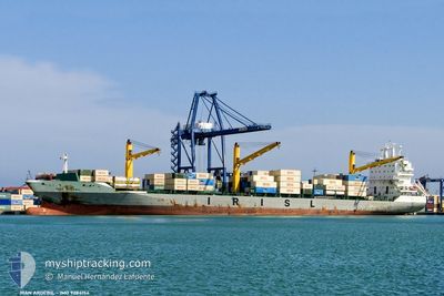
ARTAM
Container Ship
Current Trip
IRZBR
| Time Travelled | 2 days |
|---|---|
| Remaining Time | --- |
| Distance Travelled | 208.49 nm |
| Remaining Distance | --- |
| AVG Speed | 11.7 Knop |
| MAX Speed | 16.5 Knop |
| AVG Wind | 6.4 knots |
| MAX Wind | 10.6 knots |
| MIN Temp | 25.5°C / 77.9°F |
| MAX Temp | 31.6°C / 88.88°F |
| Djupgående | 10.7 m |
| Position mottagen | 1 d sen |
Current Position
| Longitud | --- |
|---|---|
| Latitude | --- |
| Status | Under way using engine |
| Fart | 8.9 Knop |
| Kurs | 304° |
| Område | Indian Ocean |
| Station | T-AIS |
| Position mottagen | 1 d sen |
Info
Information
The current position of ARTAM is in Indian Ocean with coordinates -6.67189° / 39.37257° as reported on 2024-11-25 08:17 by AIS to our vessel tracker app. The vessel's current speed is 8.9 Knop
The vessel ARTAM (IMO: 9284154, MMSI: 422038800) is a Container Ship that was built in 2004 ( 20 År gammal ). It's sailing under the flag of [IR] Iran.
In this page you can find informations about the vessels current position, last detected port calls, and current voyage information. If the vessels is not in coverage by AIS you will find the latest position.
The current position of ARTAM is detected by our AIS receivers and we are not responsible for the reliability of the data. The last position was recorded while the vessel was in Coverage by the Ais receivers of our vessel tracking app.
The current draught of ARTAM as reported by AIS is 10.7 meters
Weather
| Temperature | 26.6°C / 79.88°F |
|---|---|
| Wind Speed | 7 knots |
| Direction | 100° E |
| Pressure | 1011.2 hPa |
| Humidity | 78 % |
| Cloud Coverage | 11 % |
Featured Company
Last Port Calls
| Port | Arrival | Departure | Time In Port |
|---|---|---|---|
| 2024-11-22 01:27 | 2024-11-24 17:23 | 2 d | |
| 2024-11-13 16:24 | 2024-11-14 09:36 | 17 h | |
| 2024-11-10 12:50 | 2024-11-11 16:13 | 1 d | |
| 2024-11-06 17:06 | 2024-11-07 10:05 | 16 h | |
| 2024-11-06 13:53 | 2024-11-06 17:00 | 3 h | |
| 2024-11-06 10:57 | 2024-11-06 12:06 | 1 h | |
| 2024-11-01 15:24 | 2024-11-03 06:44 | 1 d | |
| 2024-10-30 07:51 | 2024-10-31 13:40 | 1 d | |
| 2024-10-28 02:06 | 2024-10-28 11:50 | 9 h | |
| 2024-10-21 09:48 | 2024-10-22 07:38 | 21 h |
Most Visited Ports (Last year)
| Port | Arrivals | |
|---|---|---|
| 12 | ||
| 8 | ||
| 6 | ||
| 5 | ||
| 4 | ||
| 4 |
Last Trips
| Origin | Departure | Destination | Arrival | Distance | |
|---|---|---|---|---|---|
| 2024-11-14 15:06 | 2024-11-22 04:27 | 2617.88 nm | |||
| 2024-11-11 21:43 | 2024-11-13 21:54 | 471.96 nm | |||
| 2024-11-07 13:35 | 2024-11-10 18:20 | 600.46 nm | |||
| 2024-11-06 20:30 | 2024-11-06 20:36 | 1.90 nm | |||
| 2024-11-06 15:36 | 2024-11-06 17:23 | 21.81 nm | |||
| 2024-11-03 10:44 | 2024-11-06 14:27 | 267.20 nm | |||
| 2024-10-31 17:10 | 2024-11-01 19:24 | 154.33 nm | |||
| 2024-10-28 15:20 | 2024-10-30 11:21 | 31.10 nm | |||
| 2024-10-22 13:08 | 2024-10-28 05:36 | 1163.84 nm | |||
| 2024-10-19 00:45 | 2024-10-21 15:18 | 471.82 nm |
Events
| Tid | Event | Detaljer | Position / Dest | Information |
|---|---|---|---|---|
| 2024-11-26 19:17 | STOPPAR förflyttning | 10.08 nm, North of DAR ES SALAAM |
-6.65724 / 39.33033
IRZBR
|
Fart: 0.3 kn Kurs: 143° |
| 2024-11-26 17:09 | STARTAR förflyttning | 9.97 nm, North of DAR ES SALAAM |
-6.66189 / 39.34114
IRZBR
|
Fart: 7.6 kn Kurs: 121° |
| 2024-11-25 09:17 | STOPPAR förflyttning | 9.99 nm, North of DAR ES SALAAM |
-6.65897 / 39.33133
IRZBR
|
Fart: Kurs: 112° |
| 2024-11-25 08:23 | Status ändrad | Default Under way using engine |
-6.66426 / 39.36128
IRZBR
|
Fart: 8.9 kn Kurs: 304° |
| 2024-11-25 08:17 | UTANFÖR täckningsområde |
-6.67189 / 39.37257
Indian Ocean
|
Fart: 8.9 kn Kurs: 304° |
|
| 2024-11-25 08:06 | Byter havsområde | Tanzanian part of the Indian Ocean Iranian part of the Gulf of Oman |
-6.68731 / 39.39521
Indian Ocean
|
Fart: 9.1 kn Kurs: 303.7° |
| 2024-11-25 08:05 | Status ändrad | Under way using engine Default |
-6.68898 / 39.39773
IRZBR
|
Fart: 10.5 kn Kurs: 302° |
| 2024-11-25 07:58 | I täckningsområde |
-6.68731 / 39.39521
Indian Ocean
|
Fart: 9.1 kn Kurs: 303.7° |
|
| 2024-11-24 17:23 | AVGÅTT HAMN |
|
-4.04740 / 39.63576
IRZBR
|
Fart: 3.8 kn Kurs: 86° |
| 2024-11-24 17:19 | STARTAR förflyttning |
-4.04831 / 39.62842
[KE] MOMBASA
|
Fart: 3.8 kn Kurs: 86° |