
KOM
Cargo
Current Trip
| Trip Time | 8 days |
|---|---|
| Trip Distance | 815.89 nm |
| AVG Speed | 11.2 Knots |
| MAX Speed | 15 Knots |
| Dybgang | 8.7 m |
| AVG Wind | 8.4 knots |
| MAX Wind | 32.3 knots |
| MIN Temp | 5.1°C / 41.18°F |
| MAX Temp | 14.8°C / 58.64°F |
| Position Modtaget | 17 h, 3 m siden |
Current Position
| Longitude | --- |
|---|---|
| Latitude | --- |
| Status | At anchor |
| Fart | |
| Kurs | 339° |
| Område | Adriatic Sea |
| Station | T-AIS |
| Position Modtaget | 17 h, 3 m siden |
Info
Information
The current position of KOM is in Adriatic Sea with coordinates 44.49311° / 12.48154° as reported on 2025-02-16 12:38 by AIS to our vessel tracker app. The vessel's current speed is 0 Knots and is currently inside the port of RAVENNA.
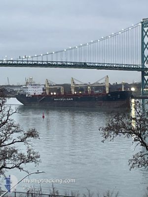
The vessel KOM (IMO: 9905708, MMSI: 229255000) is a Cargo It's sailing under the flag of [MT] Malta.
In this page you can find informations about the vessels current position, last detected port calls, and current voyage information. If the vessels is not in coverage by AIS you will find the latest position.
The current position of KOM is detected by our AIS receivers and we are not responsible for the reliability of the data. The last position was recorded while the vessel was in Coverage by the Ais receivers of our vessel tracking app.
The current draught of KOM as reported by AIS is 8.7 meters
Weather
| Temperature | 3.8°C / 38.84°F |
|---|---|
| Wind Speed | 3 knots |
| Direction | 288° WNW |
| Pressure | 1017.3 hPa |
| Humidity | 83.2 % |
| Cloud Coverage | 46 % |
Featured Company
Last Port Calls
| Port | Arrival | Departure | Time In Port |
|---|---|---|---|
| 2025-02-16 17:30 | |||
| 2025-02-03 10:46 | 2025-02-08 16:06 | 5 d | |
| 2025-01-13 15:29 | 2025-01-14 02:08 | 10 h | |
| 2024-12-24 19:59 | 2024-12-30 12:52 | 5 d | |
| 2024-12-24 15:57 | 2024-12-24 17:11 | 1 h | |
| 2024-12-22 22:23 | 2024-12-22 23:09 | 46 m | |
| 2024-12-20 15:22 | 2024-12-20 16:26 | 1 h | |
| 2024-12-13 14:21 | 2024-12-19 09:26 | 5 d |
Most Visited Ports (Last year)
| Port | Arrivals | |
|---|---|---|
| 6 | ||
| 4 | ||
| 2 | ||
| 2 | ||
| 2 | ||
| 1 |
Last Trips
| Origin | Departure | Destination | Arrival | Distance | |
|---|---|---|---|---|---|
| 2025-02-08 17:06 | 2025-02-16 18:30 | 815.89 nm | |||
| 2025-01-13 21:08 | 2025-02-03 11:46 | 4559.98 nm | |||
| 2024-12-30 07:52 | 2025-01-13 10:29 | 1854.46 nm | |||
| 2024-12-24 12:11 | 2024-12-24 14:59 | 6.42 nm | |||
| 2024-12-22 18:09 | 2024-12-24 10:57 | 289.53 nm | |||
| 2024-12-20 11:26 | 2024-12-22 17:23 | 526.63 nm | |||
| 2024-12-19 03:26 | 2024-12-20 10:22 | 346.27 nm | |||
| 2024-11-26 20:26 | 2024-12-13 08:21 | 410.36 nm |
Events
| Tid | Hændelsen | Detaljer | Position / Dest | Info |
|---|---|---|---|---|
| 2025-02-16 18:25 | STOP Sejllads |
44.46101 / 12.25151
[IT] RAVENNA
|
Fart: Kurs: 196° |
|
| 2025-02-16 17:30 | Skibe i havn |
|
44.49574 / 12.30859
[IT] RAVENNA
|
Fart: 9.3 kn Kurs: 256° |
| 2025-02-16 16:18 | START Sejllads | 8.8 nm, East of MARINA ROMEA |
44.49202 / 12.47615
RAVENNA
|
Fart: 3.5 kn Kurs: 264° |
| 2025-02-16 12:41 | Status er ændret | Default At anchor |
44.49305 / 12.48146
RAVENNA
|
Fart: Kurs: 339° |
| 2025-02-16 12:38 | Status er ændret | At anchor Default |
44.49311 / 12.48154
RAVENNA
|
Fart: Kurs: 339° |
| 2025-02-16 12:38 | Udenfor Dækning |
44.49311 / 12.48154
Adriatic Sea
|
Fart: Kurs: 130° |
|
| 2025-02-16 12:32 | Indenfor Dækning |
44.49311 / 12.48154
Adriatic Sea
|
Fart: Kurs: 130° |
|
| 2025-02-16 04:08 | Status er ændret | Default At anchor |
44.49305 / 12.48065
RAVENNA
|
Fart: Kurs: 5° |
| 2025-02-16 04:05 | Status er ændret | At anchor Default |
44.49305 / 12.48064
RAVENNA
|
Fart: Kurs: 2° |
| 2025-02-16 04:05 | Udenfor Dækning |
44.49305 / 12.48064
Adriatic Sea
|
Fart: Kurs: 130° |