

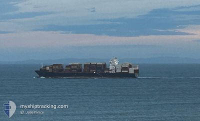
HAWK I
Cargo

Current Trip
| Time Travelled | 25 days |
|---|---|
| Remaining Time | --- |
| Distance Travelled | 4004.12 nm |
| Remaining Distance | --- |
| AVG Speed | 13.5 Knots |
| MAX Speed | 19.6 Knots |
| AVG Wind | 17.1 knots |
| MAX Wind | 33.3 knots |
| MIN Temp | 5°C / 41°F |
| MAX Temp | 25.2°C / 77.36°F |
| Draught | 12.5 m |
| Position Received | 7 d ago |
Current Position
| Longitude | --- |
|---|---|
| Latitude | --- |
| Status | Under way using engine |
| Speed | 9.4 Knots |
| Course | 173.4° |
| Area | Japan Sea |
| Station | T-AIS |
| Position Received | 7 d ago |
Information
The current position of HAWK I is in Japan Sea with coordinates 34.86202° / 128.84638° as reported on 2025-03-17 16:12 by AIS to our vessel tracker app. The vessel's current speed is 9.4 Knots
The vessel HAWK I (IMO: 9960564, MMSI: 636023874) is a Cargo It's sailing under the flag of [LR] Liberia.
In this page you can find informations about the vessels current position, last detected port calls, and current voyage information. If the vessels is not in coverage by AIS you will find the latest position.
The current position of HAWK I is detected by our AIS receivers and we are not responsible for the reliability of the data. The last position was recorded while the vessel was in Coverage by the Ais receivers of our vessel tracking app.
The current draught of HAWK I as reported by AIS is 12.5 meters
Weather
| Temperature | 6.3°C / 43.34°F |
|---|---|
| Wind Speed | 9 knots |
| Direction | 252° WSW |
| Pressure | 1016.8 hPa |
| Humidity | 46.6 % |
| Cloud Coverage | --- |


Featured Company
Most Visited Ports (Last year)
| Port | Arrivals | |
|---|---|---|
| 3 | ||
| 3 | ||
| 2 | ||
| 2 | ||
| 2 | ||
| 2 |
Last Trips
| Origin | Departure | Destination | Arrival | Distance | |
|---|---|---|---|---|---|
| 2025-02-25 14:24 | 2025-02-27 01:57 | 540.49 nm | |||
| 2025-02-22 02:57 | 2025-02-23 12:24 | 590.23 nm | |||
| 2025-02-15 16:01 | 2025-02-20 15:38 | 1140.31 nm | |||
| 2025-02-02 06:48 | 2025-02-14 10:55 | 3771.09 nm | |||
| 2024-11-30 04:44 | 2025-02-01 19:07 | 2241.98 nm |
Events
| Time | Event | Details | Position / Dest | Info |
|---|---|---|---|---|
| 2025-03-17 16:12 | OUT of Coverage |
34.86202 / 128.84638
Japan Sea
QINGDAO
|
Speed: 9.4 kn Course: 173.4° |
|
| 2025-03-17 15:32 | Destination Changed | QINGDAO PUSAN NEW PORT |
34.96437 / 128.80929
QINGDAO
|
Speed: 9.9 kn Course: 150.9° |
| 2025-03-17 15:32 | ETA Changed | 2025/03/18 22:00 2025/03/16 09:45 |
34.96437 / 128.80929
QINGDAO
|
Speed: 9.9 kn Course: 150.9° |
| 2025-03-17 15:27 | IN Coverage |
34.97164 / 128.80451
Japan Sea
|
Speed: 9.8 kn Course: 153.6° |
|
| 2025-03-16 09:43 | OUT of Coverage |
34.97691 / 128.81630
Japan Sea
PUSAN NEW PORT
|
Speed: 6.3 kn Course: 337.3° |
|
| 2025-03-16 07:39 | START Moving | 16.78 nm, South East of OKPO |
34.74399 / 129.00034
PUSAN NEW PORT
|
Speed: 4.8 kn Course: 300° |
| 2025-03-16 07:24 | STOP Moving | 16.91 nm, South East of OKPO |
34.74229 / 129.00236
PUSAN NEW PORT
|
Speed: 0.3 kn Course: 318° |
| 2025-03-16 07:20 | Draught Changed | 12.5 12.2 |
34.74246 / 129.00375
PUSAN NEW PORT
|
Speed: 1.8 kn Course: 296° |
| 2025-03-16 07:20 | ETA Changed | 2025/03/16 09:45 2025/03/11 08:30 |
34.74246 / 129.00375
PUSAN NEW PORT
|
Speed: 1.8 kn Course: 296° |
| 2025-03-16 05:18 | Change Sea Area | South Korean part of the Japan Sea Australian part of the Coral Sea |
34.75559 / 129.01333
Japan Sea
|
Speed: 7 kn Course: 305.8° |