

YU PENG
Cargo
Current Trip
| Time Travelled | 2 days |
|---|---|
| Remaining Time | --- |
| Distance Travelled | 960.66 nm |
| Remaining Distance | --- |
| AVG Speed | 14.2 Knots |
| MAX Speed | 16.1 Knots |
| AVG Wind | 18 knots |
| MAX Wind | 31.7 knots |
| MIN Temp | 17.4°C / 63.32°F |
| MAX Temp | 24.1°C / 75.38°F |
| Draught | 7.2 m |
| Position Received | 1 d ago |
Current Position
| Longitude | --- |
|---|---|
| Latitude | --- |
| Status | Under way using engine |
| Speed | 13.9 Knots |
| Course | 140° |
| Area | Gulf of Oman |
| Station | T-AIS |
| Position Received | 1 d ago |
Information
The current position of YU PENG is in Gulf of Oman with coordinates 25.65317° / 57.14817° as reported on 2025-03-25 13:20 by AIS to our vessel tracker app. The vessel's current speed is 13.9 Knots and is heading at the port of TANJUNG LANGSAT. The estimated time of arrival as calculated by MyShipTracking vessel tracking app is 2025-04-04 14:00 LT
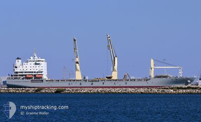
The vessel YU PENG (IMO: 9723473, MMSI: 412212110) is a Cargo It's sailing under the flag of [CN] China.
In this page you can find informations about the vessels current position, last detected port calls, and current voyage information. If the vessels is not in coverage by AIS you will find the latest position.
The current position of YU PENG is detected by our AIS receivers and we are not responsible for the reliability of the data. The last position was recorded while the vessel was in Coverage by the Ais receivers of our vessel tracking app.
The current draught of YU PENG as reported by AIS is 7.2 meters
Weather
| Temperature | 24.2°C / 75.56°F |
|---|---|
| Wind Speed | 8 knots |
| Direction | 328° NNW |
| Pressure | 1010.6 hPa |
| Humidity | 60.3 % |
| Cloud Coverage | 3 % |
Featured Company
Most Visited Ports (Last year)
| Port | Arrivals | |
|---|---|---|
| 2 | ||
| 2 | ||
| 2 | ||
| 2 | ||
| 1 | ||
| 1 |
Last Trips
| Origin | Departure | Destination | Arrival | Distance | |
|---|---|---|---|---|---|
| 2025-03-14 20:59 | 2025-03-21 13:30 | 503.88 nm | |||
| 2025-03-09 17:43 | 2025-03-12 09:16 | 17.64 nm | |||
| 2025-02-11 08:58 | 2025-03-06 20:03 | 5759.71 nm | |||
| 2025-01-12 07:09 | 2025-02-05 13:37 | 619.49 nm | |||
| 2024-12-27 03:59 | 2025-01-10 07:13 | 3427.71 nm |
Events
| Time | Event | Details | Position / Dest | Info |
|---|---|---|---|---|
| 2025-03-25 13:28 | Status Changed | Default Under way using engine |
25.62967 / 57.17017
TANJUNG LANGSAT MY
|
Speed: 13.9 kn Course: 140° |
| 2025-03-25 13:20 | OUT of Coverage |
25.65317 / 57.14817
Gulf of Oman
TANJUNG LANGSAT MY
|
Speed: 13.9 kn Course: 140° |
|
| 2025-03-25 12:22 | Detected in Sea | Iranian part of the Gulf of Oman |
25.84883 / 57.02167
Gulf of Oman
TANJUNG LANGSAT MY
|
Speed: 13.8 kn Course: 148° |
| 2025-03-25 12:18 | Status Changed | Under way using engine Default |
25.86067 / 57.01350
TANJUNG LANGSAT MY
|
Speed: 13.9 kn Course: 150° |
| 2025-03-25 12:18 | IN Coverage |
25.84883 / 57.02167
Gulf of Oman
TANJUNG LANGSAT MY
|
Speed: 13.8 kn Course: 148° |
|
| 2025-03-25 06:26 | Status Changed | Default Under way using engine |
26.30219 / 55.89459
TANJUNG LANGSAT MY
|
Speed: 14.5 kn Course: 71° |
| 2025-03-25 06:17 | OUT of Coverage |
26.28934 / 55.85867
Persian Gulf
TANJUNG LANGSAT MY
|
Speed: 14.5 kn Course: 71° |
|
| 2025-03-25 05:55 | Change Sea Area | Omani part of the Persian Gulf United Arab Emirates part of the Persian Gulf |
26.26034 / 55.76983
Persian Gulf
TANJUNG LANGSAT MY
|
Speed: 14 kn Course: 69° |
| 2025-03-25 05:47 | Change Sea Area | United Arab Emirates part of the Persian Gulf Iranian part of the Persian Gulf |
26.24900 / 55.73400
Persian Gulf
TANJUNG LANGSAT MY
|
Speed: 14 kn Course: 69° |
| 2025-03-25 04:29 | ETA Changed | 2025/04/04 14:00 2025/04/04 05:00 |
26.14816 / 55.41633
TANJUNG LANGSAT MY
|
Speed: 13.5 kn Course: 72° |