
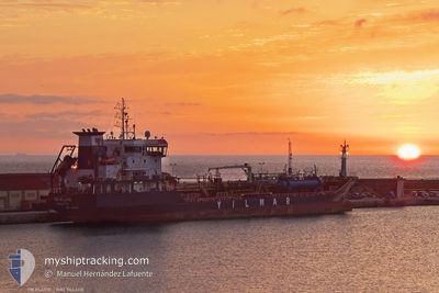
YM PLUTO
Oil/Chemical Tanker
Current Trip
| Time Travelled | 1 day |
|---|---|
| Remaining Time | 8 h, 0 mins |
| Distance Travelled | 427.08 nm |
| Remaining Distance | 97.77 nm |
| AVG Speed | 11.8 Knots |
| MAX Speed | 12.4 Knots |
| AVG Wind | 1.6 knots |
| MAX Wind | 6 knots |
| MIN Temp | 13.6°C / 56.48°F |
| MAX Temp | 15.8°C / 60.44°F |
| Draught | 5.5 m |
| Position Received | 1 m ago |
Current Position
| Longitude | --- |
|---|---|
| Latitude | --- |
| Status | Under way using engine |
| Speed | 11.7 Knots |
| Course | 132.1° |
| Area | Tyrrhenian Sea |
| Station | T-AIS |
| Position Received | 1 m ago |
Info
Information
The current position of YM PLUTO is in Tyrrhenian Sea with coordinates 38.55257° / 15.35913° as reported on 2025-12-12 22:37 by AIS to our vessel tracker app. The vessel's current speed is 11.7 Knots and is heading at the port of AUGUSTA. The estimated time of arrival as calculated by MyShipTracking vessel tracking app is 2025-12-13 07:38 LT
The vessel YM PLUTO (IMO: 9464118, MMSI: 249957000) is a Oil/Chemical Tanker that was built in 2009 ( 16 years old ). It's sailing under the flag of [MT] Malta.
In this page you can find informations about the vessels current position, last detected port calls, and current voyage information. If the vessels is not in coverage by AIS you will find the latest position.
The current position of YM PLUTO is detected by our AIS receivers and we are not responsible for the reliability of the data. The last position was recorded while the vessel was in Coverage by the Ais receivers of our vessel tracking app.
The current draught of YM PLUTO as reported by AIS is 5.5 meters
Weather
| Temperature | 15.8°C / 60.44°F |
|---|---|
| Wind Speed | 1 knots |
| Direction | 324° NW |
| Pressure | 1022.9 hPa |
| Humidity | 65.9 % |
| Cloud Coverage | 41 % |
Featured Company
Last Port Calls
| Port | Arrival | Departure | Time In Port |
|---|---|---|---|
| 2025-12-10 08:09 | 2025-12-11 11:20 | 1 d | |
| 2025-12-06 16:49 | 2025-12-07 17:49 | 1 d | |
| 2025-11-28 16:09 | 2025-11-29 13:50 | 21 h | |
| 2025-11-23 09:20 | 2025-11-24 16:17 | 1 d | |
| 2025-11-17 17:26 | 2025-11-19 03:22 | 1 d | |
| 2025-11-09 09:40 | 2025-11-10 11:42 | 1 d | |
| 2025-11-02 02:08 | 2025-11-04 22:00 | 2 d | |
| 2025-10-29 11:15 | 2025-10-30 03:06 | 15 h | |
| 2025-10-28 00:22 | 2025-10-28 17:49 | 17 h | |
| 2025-10-25 15:02 | 2025-10-26 00:28 | 9 h |
Most Visited Ports (Last year)
| Port | Arrivals | |
|---|---|---|
| 15 | ||
| 11 | ||
| 7 | ||
| 5 | ||
| 5 | ||
| 4 |
Last Trips
| Origin | Departure | Destination | Arrival | Distance | |
|---|---|---|---|---|---|
| 2025-12-07 17:49 | 2025-12-10 08:09 | 267.75 nm | |||
| 2025-11-29 13:50 | 2025-12-06 16:49 | 321.10 nm | |||
| 2025-11-24 16:17 | 2025-11-28 16:09 | 417.70 nm | |||
| 2025-11-19 03:22 | 2025-11-23 09:20 | 975.45 nm | |||
| 2025-11-10 11:42 | 2025-11-17 17:26 | 566.88 nm | |||
| 2025-11-04 22:00 | 2025-11-09 09:40 | 826.66 nm | |||
| 2025-10-30 03:06 | 2025-11-02 02:08 | 822.10 nm | |||
| 2025-10-28 17:49 | 2025-10-29 11:15 | 178.00 nm | |||
| 2025-10-26 00:28 | 2025-10-28 00:22 | 255.38 nm | |||
| 2025-10-24 20:06 | 2025-10-25 15:02 | 195.32 nm |
Events
| Time | Event | Details | Position / Dest | Info |
|---|---|---|---|---|
| 2025-12-12 20:07 | Status Changed | Under way using engine Default |
38.89183 / 14.90083
ITLIV>ITAUG
|
Speed: 11.9 kn Course: 138° |
| 2025-12-12 20:01 | Status Changed | Default Under way using engine |
38.90550 / 14.88250
ITLIV>ITAUG
|
Speed: 11.9 kn Course: 136.6° |
| 2025-12-12 19:43 | Status Changed | Under way using engine Default |
38.94967 / 14.82650
ITLIV>ITAUG
|
Speed: 11.9 kn Course: 129° |
| 2025-12-12 19:28 | IN Coverage |
38.94967 / 14.82650
Tyrrhenian Sea
ITLIV>ITAUG
|
Speed: 11.8 kn Course: 128.5° |
|
| 2025-12-11 18:40 | OUT of Coverage |
42.26600 / 9.99850
Tyrrhenian Sea
ITLIV>ITAUG
|
Speed: 11.6 kn Course: 129.9° |
|
| 2025-12-11 18:39 | Status Changed | Under way using engine Default |
42.26846 / 9.99457
ITLIV>ITAUG
|
Speed: 11.6 kn Course: 128° |
| 2025-12-11 18:32 | Status Changed | Default Under way using engine |
42.28233 / 9.97083
ITLIV>ITAUG
|
Speed: 11.7 kn Course: 127.7° |
| 2025-12-11 18:09 | Status Changed | Under way using engine Default |
42.33244 / 9.89425
ITLIV>ITAUG
|
Speed: 11.5 kn Course: 140° |
| 2025-12-11 18:05 | Status Changed | Default Under way using engine |
42.34300 / 9.88167
ITLIV>ITAUG
|
Speed: 11.8 kn Course: 159.7° |
| 2025-12-11 17:47 | Detected in Sea | Italian part of the Tyrrhenian Sea |
42.39801 / 9.85328
Tyrrhenian Sea
ITLIV>ITAUG
|
Speed: 11.7 kn Course: 160.2° |