

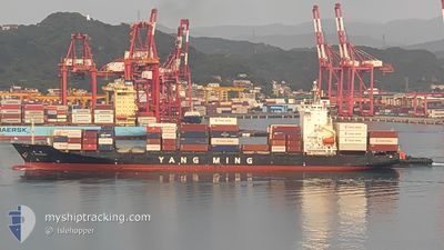
YM IMPROVEMENT
Container Ship

Current Trip
| Trip Time | 10 h, 15 mins |
|---|---|
| Trip Distance | 128.25 nm |
| AVG Speed | 12.1 Knots |
| MAX Speed | 17.1 Knots |
| Draught | 10 m |
| AVG Wind | 28.4 knots |
| MAX Wind | 39 knots |
| MIN Temp | 17.9°C / 64.22°F |
| MAX Temp | 25.5°C / 77.9°F |
| Position Received | 16 h, 31 m ago |
Current Position
| Longitude | --- |
|---|---|
| Latitude | --- |
| Status | Under way using engine |
| Speed | 16.9 Knots |
| Course | 332.8° |
| Area | South China Sea |
| Station | T-AIS |
| Position Received | 16 h, 31 m ago |
Information
The current position of YM IMPROVEMENT is in South China Sea with coordinates 22.58058° / 120.17178° as reported on 2025-03-29 03:34 by AIS to our vessel tracker app. The vessel's current speed is 16.9 Knots and is currently inside the port of TAICHUNG.
The vessel YM IMPROVEMENT (IMO: 9334014, MMSI: 636013121) is a Container Ship that was built in 2007 ( 18 years old ). It's sailing under the flag of [LR] Liberia.
In this page you can find informations about the vessels current position, last detected port calls, and current voyage information. If the vessels is not in coverage by AIS you will find the latest position.
The current position of YM IMPROVEMENT is detected by our AIS receivers and we are not responsible for the reliability of the data. The last position was recorded while the vessel was in Coverage by the Ais receivers of our vessel tracking app.
The current draught of YM IMPROVEMENT as reported by AIS is 10 meters
Weather
| Temperature | 17.4°C / 63.32°F |
|---|---|
| Wind Speed | 31 knots |
| Direction | 26° NNE |
| Pressure | 1017.9 hPa |
| Humidity | 81.9 % |
| Cloud Coverage | 100 % |


Featured Company
Last Port Calls
| Port | Arrival | Departure | Time In Port |
|---|---|---|---|
| 2025-03-29 21:29 | |||
| 2025-03-28 22:29 | 2025-03-29 11:14 | 12 h | |
| 2025-03-27 07:46 | 2025-03-27 20:42 | 12 h | |
| 2025-03-21 17:53 | 2025-03-22 04:18 | 10 h | |
| 2025-03-20 07:02 | 2025-03-21 06:37 | 23 h | |
| 2025-03-19 15:24 | 2025-03-20 04:13 | 12 h | |
| 2025-03-15 17:02 | 2025-03-16 03:28 | 10 h | |
| 2025-03-14 11:13 | 2025-03-14 21:10 | 9 h | |
| 2025-03-13 08:33 | 2025-03-13 21:27 | 12 h | |
| 2025-03-10 17:22 | 2025-03-10 23:18 | 5 h |
Last Trips
| Origin | Departure | Destination | Arrival | Distance | |
|---|---|---|---|---|---|
| 2025-03-29 11:14 | 2025-03-29 21:29 | 128.25 nm | |||
| 2025-03-27 20:42 | 2025-03-28 22:29 | 370.40 nm | |||
| 2025-03-22 04:18 | 2025-03-27 07:46 | 1555.01 nm | |||
| 2025-03-21 06:37 | 2025-03-21 17:53 | 48.92 nm | |||
| 2025-03-20 04:13 | 2025-03-20 07:02 | 34.82 nm | |||
| 2025-03-16 03:28 | 2025-03-19 15:24 | 1441.33 nm | |||
| 2025-03-14 21:10 | 2025-03-15 17:02 | 348.86 nm | |||
| 2025-03-13 21:27 | 2025-03-14 11:13 | 234.00 nm | |||
| 2025-03-10 23:18 | 2025-03-13 08:33 | 924.80 nm | |||
| 2025-03-10 16:17 | 2025-03-10 17:22 | 8.71 nm |
Events
| Time | Event | Details | Position / Dest | Info |
|---|---|---|---|---|
| 2025-03-29 13:37 | STOP Moving |
24.27481 / 120.52622
[TW] TAICHUNG
|
Speed: 0.1 kn Course: 332° |
|
| 2025-03-29 13:29 | PORT ARRIVAL |
|
24.27452 / 120.52481
[TW] TAICHUNG
|
Speed: 9 kn Course: 102° |
| 2025-03-29 03:34 | Status Changed | Default Under way using engine |
22.58107 / 120.17153
HK HKG >TW KHH
|
Speed: 16.9 kn Course: 332.8° |
| 2025-03-29 03:34 | Status Changed | Under way using engine Default |
22.58058 / 120.17178
HK HKG >TW KHH
|
Speed: 17.1 kn Course: 308° |
| 2025-03-29 03:34 | OUT of Coverage |
22.58058 / 120.17178
South China Sea
|
Speed: 16.9 kn Course: 332.8° |
|
| 2025-03-29 03:30 | Status Changed | Default Under way using engine |
22.56649 / 120.18413
HK HKG >TW KHH
|
Speed: 17.5 kn Course: 289.5° |
| 2025-03-29 03:15 | Status Changed | Under way using engine Default |
22.54776 / 120.25798
HK HKG >TW KHH
|
Speed: 16.5 kn Course: 267° |
| 2025-03-29 03:14 | IN Coverage |
22.54776 / 120.25798
South China Sea
|
Speed: 16.7 kn Course: 270.2° |
|
| 2025-03-29 03:14 | PORT DEPARTURE |
|
22.54777 / 120.26296
HK HKG >TW KHH
|
Speed: 15.2 kn Course: 265° |
| 2025-03-29 02:54 | START Moving |
22.55319 / 120.32359
[TW] KAOHSIUNG
|
Speed: 3.2 kn Course: 260° |