
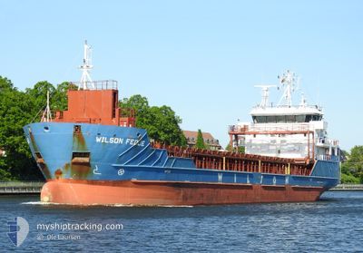
WILSON FEDJE
General Cargo
Current Trip
| Time Travelled | 1 day |
|---|---|
| Remaining Time | 3 days |
| Distance Travelled | 269.86 nm |
| Remaining Distance | 786.25 nm |
| AVG Speed | 9.4 Knots |
| MAX Speed | 10.7 Knots |
| AVG Wind | 12.4 knots |
| MAX Wind | 21.5 knots |
| MIN Temp | 3.4°C / 38.12°F |
| MAX Temp | 5.5°C / 41.9°F |
| Draught | 5.5 m |
| Position Received | 1 m ago |
Current Position
| Longitude | --- |
|---|---|
| Latitude | --- |
| Status | Under way using engine |
| Speed | 9.2 Knots |
| Course | 320.6° |
| Area | Kattegat |
| Station | T-AIS |
| Position Received | 1 m ago |
Info
Information
The current position of WILSON FEDJE is in Kattegat with coordinates 57.75362° / 11.04298° as reported on 2025-01-18 21:38 by AIS to our vessel tracker app. The vessel's current speed is 9.2 Knots and is heading at the port of MOIRANA. The estimated time of arrival as calculated by MyShipTracking vessel tracking app is 2025-01-22 09:49 LT
The vessel WILSON FEDJE (IMO: 9491757, MMSI: 314397000) is a General Cargo that was built in 2012 ( 13 years old ). It's sailing under the flag of [BB] Barbados.
In this page you can find informations about the vessels current position, last detected port calls, and current voyage information. If the vessels is not in coverage by AIS you will find the latest position.
The current position of WILSON FEDJE is detected by our AIS receivers and we are not responsible for the reliability of the data. The last position was recorded while the vessel was in Coverage by the Ais receivers of our vessel tracking app.
The current draught of WILSON FEDJE as reported by AIS is 5.5 meters
Weather
| Temperature | 5.4°C / 41.72°F |
|---|---|
| Wind Speed | 16 knots |
| Direction | 235° SW |
| Pressure | 1026.9 hPa |
| Humidity | 89.9 % |
| Cloud Coverage | 100 % |
Featured Company
Last Port Calls
| Port | Arrival | Departure | Time In Port |
|---|---|---|---|
| 2025-01-16 11:12 | 2025-01-17 17:17 | 1 d | |
| 2025-01-13 06:05 | 2025-01-14 20:16 | 1 d | |
| 2025-01-04 01:23 | 2025-01-05 00:53 | 23 h | |
| 2024-12-15 11:45 | 2024-12-18 19:46 | 3 d | |
| 2024-12-02 17:01 | 2024-12-05 09:13 | 2 d | |
| 2024-11-29 20:21 | 2024-12-01 05:14 | 1 d | |
| 2024-11-27 23:10 | 2024-11-28 21:55 | 22 h | |
| 2024-11-26 00:13 | 2024-11-26 23:04 | 22 h | |
| 2024-11-18 14:05 | 2024-11-20 17:14 | 2 d | |
| 2024-11-13 11:10 | 2024-11-14 09:14 | 22 h |
Last Trips
| Origin | Departure | Destination | Arrival | Distance | |
|---|---|---|---|---|---|
| 2025-01-14 21:16 | 2025-01-16 12:12 | 267.80 nm | |||
| 2025-01-05 00:53 | 2025-01-13 07:05 | 1457.26 nm | |||
| 2024-12-18 20:46 | 2025-01-04 01:23 | 1689.34 nm | |||
| 2024-12-05 10:13 | 2024-12-15 12:45 | 1922.48 nm | |||
| 2024-12-01 06:14 | 2024-12-02 18:01 | 107.62 nm | |||
| 2024-11-28 21:55 | 2024-11-29 21:21 | 210.78 nm | |||
| 2024-11-27 00:04 | 2024-11-27 23:10 | 193.27 nm | |||
| 2024-11-20 18:14 | 2024-11-26 01:13 | 781.64 nm | |||
| 2024-11-14 09:14 | 2024-11-18 15:05 | 937.75 nm | |||
| 2024-11-12 06:15 | 2024-11-13 11:10 | 129.12 nm |
Events
| Time | Event | Details | Position / Dest | Info |
|---|---|---|---|---|
| 2025-01-18 20:41 | Change Sea Area | Danish part of the Kattegat Swedish part of the Kattegat |
57.63667 / 11.21925
Kattegat
NOMQN
|
Speed: 9.6 kn Course: 320.7° |
| 2025-01-18 10:02 | Change Sea Area | Swedish part of the Kattegat Danish part of the Kattegat |
56.13408 / 12.51686
Kattegat
NOMQN
|
Speed: 9.5 kn Course: 316.3° |
| 2025-01-18 09:47 | Detected in Sea | Danish part of the Kattegat |
56.10612 / 12.56645
Kattegat
NOMQN
|
Speed: 9.3 kn Course: 314.1° |
| 2025-01-18 07:41 | Change Sea Area | Swedish part of the Kattegat Danish part of the Kattegat |
55.81461 / 12.73409
Kattegat
NOMQN
|
Speed: 9.1 kn Course: 19.1° |
| 2025-01-18 05:32 | Change Sea Area | Danish part of the Kattegat Swedish part of the Kattegat |
55.48894 / 12.70855
Kattegat
NOMQN
|
Speed: 9.8 kn Course: 9.5° |
| 2025-01-18 04:38 | Change Sea Area | Swedish part of the Kattegat Swedish part of the Baltic Sea |
55.33984 / 12.68264
Kattegat
NOMQN
|
Speed: 9.8 kn Course: 1.5° |
| 2025-01-17 17:17 | PORT DEPARTURE |
|
56.02233 / 14.57742
NOMQN
|
Speed: 6.1 kn Course: 205° |
| 2025-01-17 17:11 | START Moving |
56.03063 / 14.58021
[SE] SOLVESBORG
|
Speed: 3.8 kn Course: 167° |
|
| 2025-01-17 16:38 | Status Changed | Under way using engine Moored |
56.03171 / 14.57751
[SE] SOLVESBORG
|
Speed: Course: 30° |
| 2025-01-17 16:36 | Status Changed | Moored Default |
56.03171 / 14.57751
[SE] SOLVESBORG
|
Speed: Course: 30° |