
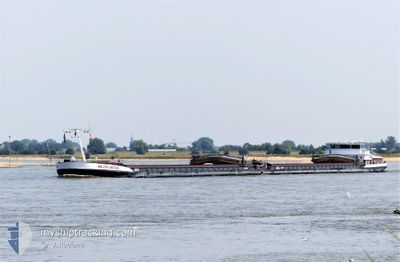
WILLEM ANTONIE
Cargo
Current Trip
WAALHAVEN
| Time Travelled | 5 days |
|---|---|
| Remaining Time | --- |
| Distance Travelled | 279.70 nm |
| Remaining Distance | --- |
| AVG Speed | 6.2 Knots |
| MAX Speed | 9.9 Knots |
| AVG Wind | 4.4 knots |
| MAX Wind | 14 knots |
| MIN Temp | 6.8°C / 44.24°F |
| MAX Temp | 17.4°C / 63.32°F |
| Draught | 0 m |
| Position Received | 18 m ago |
Current Position
| Longitude | 8.34633° |
|---|---|
| Latitude | 49.87320° |
| Status | Under way using engine |
| Speed | 8.5 Knots |
| Course | 334.5° |
| Area | North Sea |
| Station | T-AIS |
| Position Received | 18 m ago |
Info
Information
The current position of WILLEM ANTONIE is in North Sea with coordinates 49.87320° / 8.34633° as reported on 2024-05-07 04:42 by AIS to our vessel tracker app. The vessel's current speed is 8.5 Knots
The vessel WILLEM ANTONIE (MMSI: 244650799) is a Cargo It's sailing under the flag of [NL] Netherlands.
In this page you can find informations about the vessels current position, last detected port calls, and current voyage information. If the vessels is not in coverage by AIS you will find the latest position.
The current position of WILLEM ANTONIE is detected by our AIS receivers and we are not responsible for the reliability of the data. The last position was recorded while the vessel was in Coverage by the Ais receivers of our vessel tracking app.
Weather
| Temperature | 9.3°C / 48.74°F |
|---|---|
| Wind Speed | 5 knots |
| Direction | 264° W |
| Pressure | 1013.4 hPa |
| Humidity | 90.4 % |
| Cloud Coverage | 89 % |
Featured Company
Last Port Calls
| Port | Arrival | Departure | Time In Port |
|---|---|---|---|
| 2024-05-02 01:12 | 2024-05-02 01:25 | 13 m | |
| 2024-05-01 01:57 | 2024-05-01 02:21 | 23 m | |
| 2024-04-29 19:59 | 2024-04-30 22:05 | 1 d | |
| 2024-04-27 01:41 | 2024-04-29 12:20 | 2 d | |
| 2024-04-21 12:59 | 2024-04-22 05:03 | 16 h | |
| 2024-04-17 15:22 | 2024-04-17 16:37 | 1 h | |
| 2024-04-17 05:23 | 2024-04-17 06:26 | 1 h | |
| 2024-04-15 18:15 | 2024-04-16 11:09 | 16 h | |
| 2024-04-14 19:50 | 2024-04-15 15:56 | 20 h | |
| 2024-04-13 07:16 | 2024-04-14 18:08 | 1 d |
Most Visited Ports (Last year)
| Port | Arrivals | |
|---|---|---|
| 32 | ||
| 23 | ||
| 17 | ||
| 16 | ||
| 14 | ||
| 12 |
Last Trips
| Origin | Departure | Destination | Arrival | Distance | |
|---|---|---|---|---|---|
| 2024-05-01 04:21 | 2024-05-02 03:12 | 125.09 nm | |||
| 2024-05-01 00:05 | 2024-05-01 03:57 | 31.15 nm | |||
| 2024-04-29 14:20 | 2024-04-29 21:59 | 59.51 nm | |||
| 2024-04-22 07:03 | 2024-04-27 03:41 | 470.17 nm | |||
| 2024-04-17 18:37 | 2024-04-21 14:59 | 256.72 nm | |||
| 2024-04-17 08:26 | 2024-04-17 17:22 | 44.84 nm | |||
| 2024-04-16 13:09 | 2024-04-17 07:23 | 113.68 nm | |||
| 2024-04-15 17:56 | 2024-04-15 20:15 | 21.27 nm | |||
| 2024-04-14 20:08 | 2024-04-14 21:50 | 13.50 nm | |||
| 2024-04-07 22:18 | 2024-04-13 09:16 | 519.65 nm |
Events
| Time | Event | Details | Position / Dest | Info |
|---|---|---|---|---|
| 2024-05-06 23:10 | IN Coverage |
49.25734 / 8.43181
North Sea
|
Speed: 9.8 kn Course: 54.1° |
|
| 2024-05-04 09:11 | OUT of Coverage |
48.68113 / 7.90592
North Sea
|
Speed: 9.3 kn Course: 224.2° |
|
| 2024-05-04 06:44 | START Moving | 5.46 nm, South of MUNCHHAUSEN |
48.83009 / 8.11225
WAALHAVEN
|
Speed: 7 kn Course: 190.1° |
| 2024-05-04 06:36 | STOP Moving | 5.35 nm, South of MUNCHHAUSEN |
48.83187 / 8.11266
WAALHAVEN
|
Speed: Course: 190° |
| 2024-05-03 22:22 | START Moving | 0.93 nm, North West of RHEINAU |
49.44434 / 8.49203
WAALHAVEN
|
Speed: 4.4 kn Course: 104° |
| 2024-05-03 22:07 | Status Changed | Under way using engine Moored |
49.44472 / 8.48610
WAALHAVEN
|
Speed: 0.6 kn Course: 92° |
| 2024-05-03 17:21 | IN Coverage |
49.44485 / 8.48554
North Sea
|
Speed: Course: 186.3° |
|
| 2024-05-03 15:15 | OUT of Coverage |
49.44483 / 8.48553
North Sea
|
Speed: Course: 186.3° |
|
| 2024-05-03 14:30 | Status Changed | Moored Under way using engine |
49.44484 / 8.48551
WAALHAVEN
|
Speed: Course: 90° |
| 2024-05-03 14:06 | Status Changed | Under way using engine Moored |
49.44467 / 8.48497
WAALHAVEN
|
Speed: Course: 92° |