

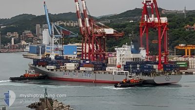
WAN HAI 308
Container Ship

Current Trip
| Time Travelled | 12 days |
|---|---|
| Remaining Time | 1 h, 39 mins |
| Distance Travelled | 4774.89 nm |
| Remaining Distance | 152.21 nm |
| AVG Speed | 16 Knots |
| MAX Speed | 18.8 Knots |
| AVG Wind | 7.1 knots |
| MAX Wind | 15.3 knots |
| MIN Temp | 21.2°C / 70.16°F |
| MAX Temp | 29.1°C / 84.38°F |
| Draught | 11.2 m |
| Position Received | 7 h, 2 m ago |
Current Position
| Longitude | --- |
|---|---|
| Latitude | --- |
| Status | Under way using engine |
| Speed | 16.9 Knots |
| Course | 310° |
| Area | Gulf of Suez |
| Station | T-AIS |
| Position Received | 7 h, 2 m ago |
Information
The current position of WAN HAI 308 is in Gulf of Suez with coordinates 27.68537° / 33.92222° as reported on 2025-03-27 13:28 by AIS to our vessel tracker app. The vessel's current speed is 16.9 Knots and is heading at the port of SOKHNA. The estimated time of arrival as calculated by MyShipTracking vessel tracking app is 2025-03-28 00:10 LT
The vessel WAN HAI 308 (IMO: 9536985, MMSI: 563160800) is a Container Ship that was built in 2011 ( 14 years old ). It's sailing under the flag of [SG] Singapore.
In this page you can find informations about the vessels current position, last detected port calls, and current voyage information. If the vessels is not in coverage by AIS you will find the latest position.
The current position of WAN HAI 308 is detected by our AIS receivers and we are not responsible for the reliability of the data. The last position was recorded while the vessel was in Coverage by the Ais receivers of our vessel tracking app.
The current draught of WAN HAI 308 as reported by AIS is 11.2 meters
Weather
| Temperature | 20.7°C / 69.26°F |
|---|---|
| Wind Speed | 9 knots |
| Direction | 145° SE |
| Pressure | 1008.9 hPa |
| Humidity | 66.9 % |
| Cloud Coverage | 100 % |


Featured Company
Last Port Calls
| Port | Arrival | Departure | Time In Port |
|---|---|---|---|
| 2025-03-14 22:14 | 2025-03-15 09:54 | 11 h | |
| 2025-03-09 16:15 | 2025-03-10 14:16 | 22 h | |
| 2025-03-07 21:50 | 2025-03-08 06:58 | 9 h | |
| 2025-03-03 14:01 | 2025-03-04 00:21 | 10 h | |
| 2025-02-17 11:41 | 2025-02-18 13:41 | 1 d | |
| 2025-02-15 11:57 | 2025-02-16 14:49 | 1 d | |
| 2025-02-13 20:37 | 2025-02-14 22:17 | 1 d | |
| 2025-01-29 09:10 | 2025-01-30 07:29 | 22 h | |
| 2025-01-27 06:41 | 2025-01-28 03:33 | 20 h | |
| 2025-01-23 23:38 | 2025-01-24 13:06 | 13 h |
Last Trips
| Origin | Departure | Destination | Arrival | Distance | |
|---|---|---|---|---|---|
| 2025-03-10 14:16 | 2025-03-14 22:14 | 1662.82 nm | |||
| 2025-03-08 06:58 | 2025-03-09 16:15 | 93.77 nm | |||
| 2025-03-04 00:21 | 2025-03-07 21:50 | 1082.31 nm | |||
| 2025-02-18 13:41 | 2025-03-03 14:01 | 2470.87 nm | |||
| 2025-02-16 14:49 | 2025-02-17 11:41 | 203.34 nm | |||
| 2025-02-14 22:17 | 2025-02-15 11:57 | 198.67 nm | |||
| 2025-01-30 07:29 | 2025-02-13 20:37 | 4816.00 nm | |||
| 2025-01-28 03:33 | 2025-01-29 09:10 | 289.55 nm | |||
| 2025-01-24 13:06 | 2025-01-27 06:41 | 611.18 nm | |||
| 2025-01-13 05:13 | 2025-01-23 23:38 | 4217.14 nm |
Events
| Time | Event | Details | Position / Dest | Info |
|---|---|---|---|---|
| 2025-03-27 13:32 | Status Changed | Default Under way using engine |
27.69793 / 33.90517
EGSOK
|
Speed: 16.9 kn Course: 310° |
| 2025-03-27 13:28 | OUT of Coverage |
27.68537 / 33.92222
Gulf of Suez
EGSOK
|
Speed: 16.9 kn Course: 310° |
|
| 2025-03-27 12:55 | Status Changed | Under way using engine Default |
27.59078 / 34.06353
EGSOK
|
Speed: 16.9 kn Course: 308° |
| 2025-03-27 12:46 | Status Changed | Default Under way using engine |
27.56548 / 34.09868
EGSOK
|
Speed: 16.7 kn Course: 313° |
| 2025-03-27 12:40 | Change Sea Area | Egyptian part of the Gulf of Suez Egyptian part of the Red Sea |
27.54770 / 34.12233
Gulf of Suez
EGSOK
|
Speed: 16.7 kn Course: 313° |
| 2025-03-27 10:23 | ETA Changed | 2025/03/27 23:00 2025/03/28 01:00 |
27.03545 / 34.53867
EGSOK
|
Speed: 16.2 kn Course: 330° |
| 2025-03-27 04:10 | Status Changed | Under way using engine Default |
25.75670 / 35.42815
EGSOK
|
Speed: 14.1 kn Course: 328° |
| 2025-03-27 03:54 | Status Changed | Default Under way using engine |
25.70408 / 35.46530
EGSOK
|
Speed: 14.1 kn Course: 326° |
| 2025-03-27 02:05 | Change Sea Area | Egyptian part of the Red Sea Saudi Arabian part of the Red Sea |
25.33848 / 35.71938
Red Sea
EGSOK
|
Speed: 14.4 kn Course: 330° |
| 2025-03-27 02:04 | Status Changed | Under way using engine Default |
25.33437 / 35.72203
EGSOK
|
Speed: 14.4 kn Course: 328° |