
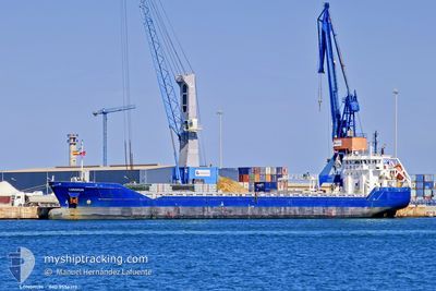
VERTOM JOSE
General Cargo
Current Trip
| Trip Time | 1 day |
|---|---|
| Trip Distance | 231.42 nm |
| AVG Speed | 6.2 Knots |
| MAX Speed | 10.2 Knots |
| Draught | 4 m |
| AVG Wind | 17.2 knots |
| MAX Wind | 30 knots |
| MIN Temp | 11.9°C / 53.42°F |
| MAX Temp | 17.3°C / 63.14°F |
| Position Received | 4 d ago |
Current Position
| Longitude | --- |
|---|---|
| Latitude | --- |
| Status | Under way using engine |
| Speed | 9.6 Knots |
| Course | 141.4° |
| Area | Mediterranean Sea - Western Basin |
| Station | T-AIS |
| Position Received | 4 d ago |
Info
Information
The current position of VERTOM JOSE is in Mediterranean Sea - Western Basin with coordinates 38.08790° / -0.24655° as reported on 2025-12-04 17:32 by AIS to our vessel tracker app. The vessel's current speed is 9.6 Knots and is currently inside the port of TENES.
The vessel VERTOM JOSE (IMO: 9556313, MMSI: 244790509) is a General Cargo that was built in 2013 ( 12 years old ). It's sailing under the flag of [NL] Netherlands.
In this page you can find informations about the vessels current position, last detected port calls, and current voyage information. If the vessels is not in coverage by AIS you will find the latest position.
The current position of VERTOM JOSE is detected by our AIS receivers and we are not responsible for the reliability of the data. The last position was recorded while the vessel was in Coverage by the Ais receivers of our vessel tracking app.
The current draught of VERTOM JOSE as reported by AIS is 4 meters
Weather
| Temperature | 14.4°C / 57.92°F |
|---|---|
| Wind Speed | 3 knots |
| Direction | 191° S |
| Pressure | 1021.9 hPa |
| Humidity | 59.1 % |
| Cloud Coverage | 97 % |
Featured Company
Last Port Calls
| Port | Arrival | Departure | Time In Port |
|---|---|---|---|
| 2025-12-06 08:48 | |||
| 2025-12-01 06:14 | 2025-12-04 16:47 | 3 d | |
| 2025-11-26 17:08 | |||
| 2025-11-20 09:46 | 2025-11-21 19:55 | 1 d | |
| 2025-11-12 10:28 | 2025-11-14 11:12 | 2 d | |
| 2025-11-10 13:07 | 2025-11-10 23:47 | 10 h | |
| 2025-11-06 17:54 | 2025-11-07 15:39 | 21 h | |
| 2025-11-04 08:24 | 2025-11-05 13:11 | 1 d | |
| 2025-10-21 13:54 | 2025-10-24 14:50 | 3 d | |
| 2025-10-13 22:30 | 2025-10-15 18:18 | 1 d |
Most Visited Ports (Last year)
| Port | Arrivals | |
|---|---|---|
| 4 | ||
| 3 | ||
| 2 | ||
| 2 | ||
| 2 | ||
| 2 |
Last Trips
| Origin | Departure | Destination | Arrival | Distance | |
|---|---|---|---|---|---|
| 2025-12-04 16:47 | 2025-12-06 08:48 | 231.42 nm | |||
| 2025-11-26 17:08 | 2025-12-01 06:14 | 849.34 nm | |||
| 2025-11-14 11:12 | 2025-11-20 09:46 | 1048.28 nm | |||
| 2025-11-10 23:47 | 2025-11-12 10:28 | 256.86 nm | |||
| 2025-11-07 15:39 | 2025-11-10 13:07 | 364.63 nm | |||
| 2025-11-05 13:11 | 2025-11-06 17:54 | 270.13 nm | |||
| 2025-10-24 14:50 | 2025-11-04 08:24 | 2326.15 nm | |||
| 2025-10-15 18:18 | 2025-10-21 13:54 | 305.94 nm | |||
| 2025-10-08 14:07 | 2025-10-13 22:30 | 1159.29 nm | |||
| 2025-10-02 20:02 | 2025-10-03 04:18 | 84.42 nm |
Events
| Time | Event | Details | Position / Dest | Info |
|---|---|---|---|---|
| 2025-12-06 08:06 | STOP Moving |
36.52334 / 1.31500
[DZ] TENES
|
Speed: Course: -1° |
|
| 2025-12-06 07:48 | PORT ARRIVAL |
|
36.52500 / 1.31667
[DZ] TENES
|
Speed: 2.8 kn Course: 74° |
| 2025-12-04 17:39 | Status Changed | Default Under way using engine |
38.07389 / -.23249
TENES
|
Speed: 9.6 kn Course: 141.4° |
| 2025-12-04 17:32 | OUT of Coverage |
38.08790 / -.24655
Mediterranean Sea - Western Basin
TENES
|
Speed: 9.6 kn Course: 141.4° |
|
| 2025-12-04 17:07 | Status Changed | Under way using engine Moored |
38.14168 / -.30244
TENES
|
Speed: 10.3 kn Course: 136.6° |
| 2025-12-04 16:27 | Draught Changed | 4 4.1 |
38.22682 / -.39373
TENES
|
Speed: 9.6 kn Course: 140.2° |
| 2025-12-04 16:27 | Destination Changed | TENES GABES |
38.22682 / -.39373
TENES
|
Speed: 9.6 kn Course: 140.2° |
| 2025-12-04 16:27 | ETA Changed | 2025/12/05 06:30 2025/11/22 20:00 |
38.22682 / -.39373
TENES
|
Speed: 9.6 kn Course: 140.2° |
| 2025-12-04 16:08 | Change Sea Area | Spanish part of the Mediterranean Sea - Western Basin Maltese part of the Mediterranean Sea - Eastern Basin |
38.26580 / -.43451
Mediterranean Sea - Western Basin
|
Speed: 9.5 kn Course: 140.1° |
| 2025-12-04 16:08 | Status Changed | Moored Default |
38.26580 / -.43451
GABES
|
Speed: 9.5 kn Course: 142° |