
VALPARAISO EXPRESS
Cargo
Current Trip
ECPSJ>PAPCN
| Time Travelled | 6 h, 37 mins |
|---|---|
| Remaining Time | --- |
| Distance Travelled | 93.93 nm |
| Remaining Distance | --- |
| AVG Speed | 15.1 Knots |
| MAX Speed | 18 Knots |
| AVG Wind | 13.7 knots |
| MAX Wind | 24 knots |
| MIN Temp | 23.3°C / 73.94°F |
| MAX Temp | 26.7°C / 80.06°F |
| Draught | 13.4 m |
| Position Received | 2 h, 35 m ago |
Current Position
| Longitude | --- |
|---|---|
| Latitude | --- |
| Status | Under way using engine |
| Speed | 16.7 Knots |
| Course | 36° |
| Area | Caribbean Sea |
| Station | T-AIS |
| Position Received | 2 h, 35 m ago |
Info
Information
The current position of VALPARAISO EXPRESS is in Caribbean Sea with coordinates 11.03700° / -75.59573° as reported on 2026-01-07 11:43 by AIS to our vessel tracker app. The vessel's current speed is 16.7 Knots
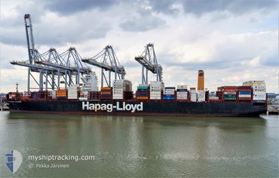
The vessel VALPARAISO EXPRESS (IMO: 9777589, MMSI: 218833000) is a Cargo It's sailing under the flag of [DE] Germany.
In this page you can find informations about the vessels current position, last detected port calls, and current voyage information. If the vessels is not in coverage by AIS you will find the latest position.
The current position of VALPARAISO EXPRESS is detected by our AIS receivers and we are not responsible for the reliability of the data. The last position was recorded while the vessel was in Coverage by the Ais receivers of our vessel tracking app.
The current draught of VALPARAISO EXPRESS as reported by AIS is 13.4 meters
Weather
| Temperature | 26.2°C / 79.16°F |
|---|---|
| Wind Speed | 24 knots |
| Direction | 64° ENE |
| Pressure | 1012.7 hPa |
| Humidity | 77.8 % |
| Cloud Coverage | --- |
Featured Company
Last Port Calls
| Port | Arrival | Departure | Time In Port |
|---|---|---|---|
| 2026-01-06 08:55 | 2026-01-07 02:42 | 17 h | |
| 2025-12-30 05:01 | 2025-12-31 03:21 | 22 h | |
| 2025-12-25 12:56 | 2025-12-27 09:33 | 1 d | |
| 2025-12-19 12:27 | 2025-12-20 15:11 | 1 d | |
| 2025-12-16 11:58 | 2025-12-17 06:59 | 19 h | |
| 2025-12-13 22:39 | 2025-12-14 10:59 | 12 h | |
| 2025-12-10 08:43 | 2025-12-10 21:07 | 12 h | |
| 2025-12-08 10:27 | 2025-12-09 12:22 | 1 d | |
| 2025-12-04 04:34 | 2025-12-05 09:56 | 1 d | |
| 2025-11-22 05:41 | 2025-11-23 08:41 | 1 d |
Most Visited Ports (Last year)
| Port | Arrivals | |
|---|---|---|
| 11 | ||
| 11 | ||
| 10 | ||
| 6 | ||
| 5 | ||
| 5 |
Last Trips
| Origin | Departure | Destination | Arrival | Distance | |
|---|---|---|---|---|---|
| 2025-12-31 03:21 | 2026-01-06 08:55 | 1795.18 nm | |||
| 2025-12-27 09:33 | 2025-12-30 05:01 | 1335.31 nm | |||
| 2025-12-20 15:11 | 2025-12-25 12:56 | 1364.76 nm | |||
| 2025-12-17 06:59 | 2025-12-19 12:27 | 708.47 nm | |||
| 2025-12-14 10:59 | 2025-12-16 11:58 | 582.49 nm | |||
| 2025-12-10 21:07 | 2025-12-13 22:39 | 431.15 nm | |||
| 2025-12-09 12:22 | 2025-12-10 08:43 | 283.41 nm | |||
| 2025-12-05 09:56 | 2025-12-08 10:27 | 733.97 nm | |||
| 2025-11-23 08:41 | 2025-12-04 04:34 | 4142.96 nm | |||
| 2025-11-19 22:39 | 2025-11-22 05:41 | 444.05 nm |
Events
| Time | Event | Details | Position / Dest | Info |
|---|---|---|---|---|
| 2026-01-07 11:48 | Status Changed | Default Under way using engine |
11.05333 / -75.58167
ECPSJ>PAPCN
|
Speed: 16.7 kn Course: 36° |
| 2026-01-07 11:43 | OUT of Coverage |
11.03700 / -75.59573
Caribbean Sea
|
Speed: 16.7 kn Course: 36° |
|
| 2026-01-07 10:27 | Status Changed | Under way using engine Default |
10.74694 / -75.79274
ECPSJ>PAPCN
|
Speed: 17.2 kn Course: 1° |
| 2026-01-07 10:22 | Status Changed | Default Under way using engine |
10.72607 / -75.79314
ECPSJ>PAPCN
|
Speed: 17.2 kn Course: 0.8° |
| 2026-01-07 08:52 | Status Changed | Under way using engine Default |
10.34901 / -75.69610
ECPSJ>PAPCN
|
Speed: 17.7 kn Course: 289° |
| 2026-01-07 08:38 | Status Changed | Default Under way using engine |
10.32728 / -75.63356
ECPSJ>PAPCN
|
Speed: 14.5 kn Course: 289.5° |
| 2026-01-07 08:38 | Status Changed | Under way using engine Default |
10.32728 / -75.63356
ECPSJ>PAPCN
|
Speed: 11.3 kn Course: 290° |
| 2026-01-07 08:21 | Status Changed | Default Under way using engine |
10.31500 / -75.58167
ECPSJ>PAPCN
|
Speed: 8.8 kn Course: 267° |
| 2026-01-07 08:15 | Status Changed | Under way using engine Default |
10.31694 / -75.56997
ECPSJ>PAPCN
|
Speed: 8.9 kn Course: 266° |
| 2026-01-07 08:15 | Status Changed | Default Under way using engine |
10.31708 / -75.56748
ECPSJ>PAPCN
|
Speed: 10.3 kn Course: 252° |