

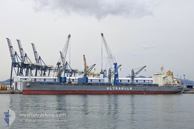
ULTRA SILVA
Cargo

Current Trip
HAMAD
| Time Travelled | 2 days |
|---|---|
| Remaining Time | --- |
| Distance Travelled | 797.99 nm |
| Remaining Distance | --- |
| AVG Speed | 12.7 Knots |
| MAX Speed | 14.2 Knots |
| AVG Wind | 8.5 knots |
| MAX Wind | 23 knots |
| MIN Temp | 23.7°C / 74.66°F |
| MAX Temp | 26°C / 78.8°F |
| Draught | 7.2 m |
| Position Received | 2 h, 33 m ago |
Current Position
| Longitude | --- |
|---|---|
| Latitude | --- |
| Status | Under way using engine |
| Speed | 13.7 Knots |
| Course | 348.9° |
| Area | Gulf of Oman |
| Station | T-AIS |
| Position Received | 2 h, 33 m ago |
Information
The current position of ULTRA SILVA is in Gulf of Oman with coordinates 25.90392° / 56.80271° as reported on 2025-03-29 13:28 by AIS to our vessel tracker app. The vessel's current speed is 13.7 Knots
The vessel ULTRA SILVA (IMO: 9873890, MMSI: 374152000) is a Cargo It's sailing under the flag of [PA] Panama.
In this page you can find informations about the vessels current position, last detected port calls, and current voyage information. If the vessels is not in coverage by AIS you will find the latest position.
The current position of ULTRA SILVA is detected by our AIS receivers and we are not responsible for the reliability of the data. The last position was recorded while the vessel was in Coverage by the Ais receivers of our vessel tracking app.
The current draught of ULTRA SILVA as reported by AIS is 7.2 meters
Weather
| Temperature | 24°C / 75.2°F |
|---|---|
| Wind Speed | 3 knots |
| Direction | 235° SW |
| Pressure | 1012.1 hPa |
| Humidity | 63.8 % |
| Cloud Coverage | --- |


Featured Company
Last Port Calls
| Port | Arrival | Departure | Time In Port |
|---|---|---|---|
| 2025-03-24 12:46 | 2025-03-27 00:57 | 2 d | |
| 2025-02-16 18:01 | 2025-02-25 21:57 | 9 d | |
| 2025-01-25 10:13 | 2025-02-13 12:19 | 19 d |
Most Visited Ports (Last year)
| Port | Arrivals | |
|---|---|---|
| 3 | ||
| 2 | ||
| 1 | ||
| 1 | ||
| 1 | ||
| 1 |
Last Trips
| Origin | Departure | Destination | Arrival | Distance | |
|---|---|---|---|---|---|
| 2025-02-26 07:57 | 2025-03-24 18:16 | 6666.99 nm | |||
| 2025-02-13 22:19 | 2025-02-17 04:01 | 910.70 nm | |||
| 2024-12-16 18:27 | 2025-01-25 20:13 | 8481.41 nm |
Events
| Time | Event | Details | Position / Dest | Info |
|---|---|---|---|---|
| 2025-03-29 13:34 | Status Changed | Default Under way using engine |
25.92522 / 56.79789
HAMAD
|
Speed: 13.7 kn Course: 348.9° |
| 2025-03-29 13:28 | OUT of Coverage |
25.90392 / 56.80271
Gulf of Oman
HAMAD
|
Speed: 13.7 kn Course: 348.9° |
|
| 2025-03-29 12:25 | Change Sea Area | Omani part of the Gulf of Oman Iranian part of the Gulf of Oman |
25.67234 / 56.84139
Gulf of Oman
HAMAD
|
Speed: 13.1 kn Course: 349.8° |
| 2025-03-29 12:07 | Change Sea Area | Iranian part of the Gulf of Oman United Arab Emirates part of the Gulf of Oman |
25.60502 / 56.85592
Gulf of Oman
HAMAD
|
Speed: 13 kn Course: 346.9° |
| 2025-03-29 10:25 | Detected in Sea | United Arab Emirates part of the Gulf of Oman |
25.28516 / 57.00052
Gulf of Oman
HAMAD
|
Speed: 12.9 kn Course: 294.9° |
| 2025-03-29 08:55 | Draught Changed | 7.2 8.6 |
25.15179 / 57.33272
HAMAD
|
Speed: 13.3 kn Course: 292.6° |
| 2025-03-29 08:55 | Destination Changed | HAMAD MUNDRA |
25.15179 / 57.33272
HAMAD
|
Speed: 13.3 kn Course: 292.6° |
| 2025-03-29 08:55 | ETA Changed | 2025/03/30 11:00 2025/03/23 11:00 |
25.15179 / 57.33272
HAMAD
|
Speed: 13.3 kn Course: 292.6° |
| 2025-03-29 08:49 | Change Sea Area | Iranian part of the Gulf of Oman Indian part of the Laccadive Sea |
25.14398 / 57.35329
Gulf of Oman
|
Speed: 13.2 kn Course: 292.4° |
| 2025-03-29 08:49 | Status Changed | Under way using engine Default |
25.14303 / 57.35585
MUNDRA
|
Speed: 13.2 kn Course: 293° |