
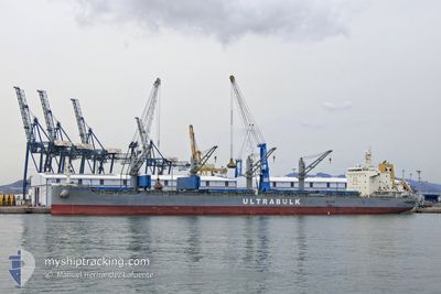
ULTRA SILVA
Cargo
Current Trip
| Time Travelled | 10 days |
|---|---|
| Remaining Time | --- |
| Distance Travelled | 2713.86 nm |
| Remaining Distance | --- |
| AVG Speed | 13 Knopen |
| MAX Speed | 14.3 Knopen |
| AVG Wind | 11.6 knots |
| MAX Wind | 19 knots |
| MIN Temp | 18.1°C / 64.58°F |
| MAX Temp | 30°C / 86°F |
| Diepgang | 6.8 M |
| Positie ontvangen | 5 d geleden |
Current Position
| Lengtegraad | -30.37747° |
|---|---|
| Breedtegraat | -6.42677° |
| Status | Under way using engine |
| Snelheid | 13.2 Knopen |
| Koers | 210° |
| Gebied | South Atlantic Ocean |
| Station | T-AIS |
| Positie ontvangen | 5 d geleden |
Info
Information
The current position of ULTRA SILVA is in South Atlantic Ocean with coordinates -6.42677° / -30.37747° as reported on 2024-04-15 00:25 by AIS to our vessel tracker app. The vessel's current speed is 13.2 Knopen
The vessel ULTRA SILVA (IMO: 9873890, MMSI: 374152000) is a Cargo It's sailing under the flag of [PA] Panama.
In this page you can find informations about the vessels current position, last detected port calls, and current voyage information. If the vessels is not in coverage by AIS you will find the latest position.
The current position of ULTRA SILVA is detected by our AIS receivers and we are not responsible for the reliability of the data. The last position was recorded while the vessel was in Coverage by the Ais receivers of our vessel tracking app.
The current draught of ULTRA SILVA as reported by AIS is 6.8 meters
Weather
| Temperature | 25.4°C / 77.72°F |
|---|---|
| Wind Speed | 13 knots |
| Direction | 182° S |
| Pressure | 1018.8 hPa |
| Humidity | 69.4 % |
| Cloud Coverage | 37 % |
Featured Company
Last Port Calls
| Port | Arrival | Departure | Time In Port |
|---|---|---|---|
| 2024-04-04 11:03 | 2024-04-09 17:11 | 5 d | |
| 2024-03-12 01:15 | 2024-03-13 18:30 | 1 d | |
| 2024-03-01 05:04 | 2024-03-07 18:04 | 6 d | |
| 2024-02-13 22:03 | 2024-02-22 18:35 | 8 d | |
| 2024-02-01 19:43 | 2024-02-06 00:23 | 4 d |
Most Visited Ports (Last year)
| Port | Arrivals | |
|---|---|---|
| 3 | ||
| 2 | ||
| 1 | ||
| 1 | ||
| 1 | ||
| 1 |
Last Trips
| Origin | Departure | Destination | Arrival | Distance | |
|---|---|---|---|---|---|
| 2024-03-13 19:30 | 2024-04-04 11:03 | 2311.81 nm | |||
| 2024-03-07 19:04 | 2024-03-12 02:15 | 662.23 nm | |||
| 2024-02-22 20:35 | 2024-03-01 06:04 | 2019.16 nm | |||
| 2024-02-06 01:23 | 2024-02-14 00:03 | 357.55 nm | |||
| 2024-01-18 03:39 | 2024-02-01 20:43 | 4222.18 nm |
Events
| Tijd | Evenement | Details | Positie / Bestemming | Info |
|---|---|---|---|---|
| 2024-04-18 11:33 | Stop beweging | 6.08 nm, East of JARDIM CAMBURI |
-20.30355 / -40.14510
PRAIA MOLE
|
Snelheid: 0.1 kn Koers: 9° |
| 2024-04-15 00:31 | Status Changed | Default Under way using engine |
-6.44365 / -30.38750
PRAIA MOLE
|
Snelheid: 13.2 kn Koers: 210° |
| 2024-04-15 00:25 | Buitenbereik |
-6.42677 / -30.37747
South Atlantic Ocean
PRAIA MOLE
|
Snelheid: 13.2 kn Koers: 210° |
|
| 2024-04-15 00:19 | Status Changed | Under way using engine Default |
-6.40764 / -30.36621
PRAIA MOLE
|
Snelheid: 13.1 kn Koers: 210° |
| 2024-04-15 00:14 | Status Changed | Default Under way using engine |
-6.39062 / -30.35641
PRAIA MOLE
|
Snelheid: 13.2 kn Koers: 212.3° |
| 2024-04-14 22:48 | Draught Changed | 6.8 10.9 |
-6.11867 / -30.18983
PRAIA MOLE
|
Snelheid: 13.6 kn Koers: 211.2° |
| 2024-04-14 22:48 | Destination Changed | PRAIA MOLE MR NKC |
-6.11867 / -30.18983
PRAIA MOLE
|
Snelheid: 13.6 kn Koers: 211.2° |
| 2024-04-14 22:48 | ETA Changed | 2024/04/18 16:00 2024/03/22 06:00 |
-6.11867 / -30.18983
PRAIA MOLE
|
Snelheid: 13.6 kn Koers: 211.2° |
| 2024-04-14 22:29 | Status Changed | Under way using engine Default |
-6.05832 / -30.15336
MR NKC
|
Snelheid: 13.4 kn Koers: 211° |
| 2024-04-14 22:25 | Status Changed | Default Under way using engine |
-6.04549 / -30.14572
MR NKC
|
Snelheid: 13.4 kn Koers: 209.6° |