
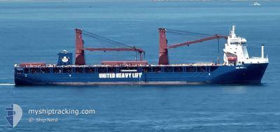
UHL FIERCE
Cargo
Current Trip
| Time Travelled | 15 days |
|---|---|
| Remaining Time | 3 days |
| Distance Travelled | 5506.38 nm |
| Remaining Distance | 1110.53 nm |
| AVG Speed | 14.4 Knots |
| MAX Speed | 18.4 Knots |
| AVG Wind | 12.1 knots |
| MAX Wind | 24 knots |
| MIN Temp | 19.7°C / 67.46°F |
| MAX Temp | 27.7°C / 81.86°F |
| Draught | 7.4 m |
| Position Received | 8 d ago |
Current Position
| Longitude | --- |
|---|---|
| Latitude | --- |
| Status | Under way using engine |
| Speed | 14.4 Knots |
| Course | 311.4° |
| Area | South Atlantic Ocean |
| Station | T-AIS |
| Position Received | 8 d ago |
Info
Information
The current position of UHL FIERCE is in South Atlantic Ocean with coordinates -31.48605° / 14.55350° as reported on 2025-12-30 13:35 by AIS to our vessel tracker app. The vessel's current speed is 14.4 Knots and is heading at the port of LAS PALMAS. The estimated time of arrival as calculated by MyShipTracking vessel tracking app is 2026-01-11 22:16 LT
The vessel UHL FIERCE (IMO: 9892509, MMSI: 255806356) is a Cargo It's sailing under the flag of [PT] Portugal.
In this page you can find informations about the vessels current position, last detected port calls, and current voyage information. If the vessels is not in coverage by AIS you will find the latest position.
The current position of UHL FIERCE is detected by our AIS receivers and we are not responsible for the reliability of the data. The last position was recorded while the vessel was in Coverage by the Ais receivers of our vessel tracking app.
The current draught of UHL FIERCE as reported by AIS is 7.4 meters
Weather
| Temperature | 24.8°C / 76.64°F |
|---|---|
| Wind Speed | 15 knots |
| Direction | 26° NNE |
| Pressure | 1014.4 hPa |
| Humidity | 67.2 % |
| Cloud Coverage | 19 % |
Featured Company
Events
| Time | Event | Details | Position / Dest | Info |
|---|---|---|---|---|
| 2025-12-30 13:44 | Status Changed | Default Under way using engine |
-31.46303 / 14.52433
ESLPA
|
Speed: 14.4 kn Course: 311.4° |
| 2025-12-30 13:35 | Status Changed | Under way using engine Default |
-31.48605 / 14.55350
ESLPA
|
Speed: 14.4 kn Course: 313° |
| 2025-12-30 13:35 | IN Coverage |
-31.48605 / 14.55350
South Atlantic Ocean
ESLPA
|
Speed: 14.4 kn Course: 311.4° |
|
| 2025-12-30 13:35 | OUT of Coverage |
-31.48605 / 14.55350
South Atlantic Ocean
ESLPA
|
Speed: 14.4 kn Course: 311.4° |
|
| 2025-12-30 12:27 | Status Changed | Default Under way using engine |
-31.67398 / 14.78033
ESLPA
|
Speed: 13.9 kn Course: 316.1° |
| 2025-12-30 12:22 | OUT of Coverage |
-31.68776 / 14.79603
South Atlantic Ocean
ESLPA
|
Speed: 13.9 kn Course: 316.1° |
|
| 2025-12-30 12:17 | Status Changed | Under way using engine Default |
-31.70218 / 14.81231
ESLPA
|
Speed: 14 kn Course: 317° |
| 2025-12-30 12:05 | IN Coverage |
-31.69471 / 14.80384
South Atlantic Ocean
ESLPA
|
Speed: 13.8 kn Course: 316.8° |
|
| 2025-12-30 03:08 | Status Changed | Default Under way using engine |
-33.29200 / 16.83722
ESLPA
|
Speed: 15.6 kn Course: 309.5° |
| 2025-12-30 03:02 | OUT of Coverage |
-33.30721 / 16.85856
South Atlantic Ocean
ESLPA
|
Speed: 15.6 kn Course: 309.5° |