
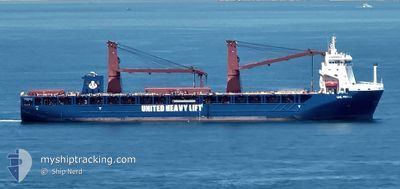
UHL FIERCE
Cargo
Current Trip
| Time Travelled | 4 days |
|---|---|
| Remaining Time | 1 day |
| Distance Travelled | 1673.83 nm |
| Remaining Distance | 329.18 nm |
| AVG Speed | 14.2 Knopen |
| MAX Speed | 18.2 Knopen |
| AVG Wind | 12.2 knots |
| MAX Wind | 19.8 knots |
| MIN Temp | 10.1°C / 50.18°F |
| MAX Temp | 19.1°C / 66.38°F |
| Diepgang | 6.9 M |
| Positie ontvangen | Nu |
Current Position
| Lengtegraad | 2.11556° |
|---|---|
| Breedtegraat | 51.29056° |
| Status | Under way using engine |
| Snelheid | 13.6 Knopen |
| Koers | 28.1° |
| Gebied | North Sea |
| Station | T-AIS |
| Positie ontvangen | Nu |
Info
Information
The current position of UHL FIERCE is in North Sea with coordinates 51.29056° / 2.11556° as reported on 2024-05-04 16:32 by AIS to our vessel tracker app. The vessel's current speed is 13.6 Knopen and is heading at the port of BRUNSBUETTEL. The estimated time of arrival as calculated by MyShipTracking vessel tracking app is 2024-05-05 17:22 LT
The vessel UHL FIERCE (IMO: 9892509, MMSI: 255806356) is a Cargo It's sailing under the flag of [PT] Portugal.
In this page you can find informations about the vessels current position, last detected port calls, and current voyage information. If the vessels is not in coverage by AIS you will find the latest position.
The current position of UHL FIERCE is detected by our AIS receivers and we are not responsible for the reliability of the data. The last position was recorded while the vessel was in Coverage by the Ais receivers of our vessel tracking app.
The current draught of UHL FIERCE as reported by AIS is 6.9 meters
Weather
| Temperature | 11.3°C / 52.34°F |
|---|---|
| Wind Speed | 6 knots |
| Direction | 177° S |
| Pressure | 1010.4 hPa |
| Humidity | 79.9 % |
| Cloud Coverage | 92 % |
Featured Company
Last Port Calls
| Port | Arrival | Departure | Time In Port |
|---|---|---|---|
| 2024-04-29 14:44 | 2024-04-29 22:45 | 8 h | |
| 2024-03-22 11:56 | 2024-03-26 10:20 | 3 d | |
| 2024-03-15 09:09 | 2024-03-19 15:24 | 4 d |
Most Visited Ports (Last year)
| Port | Arrivals | |
|---|---|---|
| 2 | ||
| 2 | ||
| 2 | ||
| 2 | ||
| 1 | ||
| 1 |
Events
| Tijd | Evenement | Details | Positie / Bestemming | Info |
|---|---|---|---|---|
| 2024-05-04 14:35 | Wijzig zee gebeid | French part of the North Sea French part of the English Channel |
51.00811 / 1.60430
North Sea
DE BRB
|
Snelheid: 13 kn Koers: 42.7° |
| 2024-05-04 14:07 | ETA Changed | 2024/05/05 11:00 2024/05/05 10:00 |
50.92678 / 1.49447
DE BRB
|
Snelheid: 13.5 kn Koers: 37.4° |
| 2024-05-04 12:44 | Wijzig zee gebeid | French part of the English Channel United Kingdom part of the English Channel |
50.64525 / 1.26021
English Channel
DE BRB
|
Snelheid: 14.7 kn Koers: 47.9° |
| 2024-05-04 12:44 | Status Changed | Under way using engine Default |
50.64411 / 1.25823
DE BRB
|
Snelheid: 14.8 kn Koers: 47° |
| 2024-05-04 12:28 | Binnenbereik |
50.64525 / 1.26021
English Channel
DE BRB
|
Snelheid: 14.7 kn Koers: 47.9° |
|
| 2024-05-04 11:36 | Status Changed | Default Under way using engine |
50.47699 / .78497
DE BRB
|
Snelheid: 14.6 kn Koers: 76.4° |
| 2024-05-04 11:27 | Status Changed | Under way using engine Default |
50.48573 / .84235
DE BRB
|
Snelheid: 14.7 kn Koers: 76° |
| 2024-05-04 11:27 | Buitenbereik |
50.48573 / .84235
English Channel
DE BRB
|
Snelheid: 14.6 kn Koers: 76.4° |
|
| 2024-05-04 11:24 | Status Changed | Default Under way using engine |
50.48387 / .82995
DE BRB
|
Snelheid: 14.7 kn Koers: 76.3° |
| 2024-05-04 11:16 | Status Changed | Under way using engine Default |
50.47608 / .77878
DE BRB
|
Snelheid: 14.6 kn Koers: 76° |