
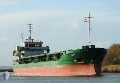
TUNA
General Cargo
Current Trip
| Time Travelled | 4 h, 28 mins |
|---|---|
| Remaining Time | 1 day |
| Distance Travelled | 40.58 nm |
| Remaining Distance | 409.47 nm |
| AVG Speed | 9.1 Knots |
| MAX Speed | 10.7 Knots |
| AVG Wind | 8.2 knots |
| MAX Wind | 10 knots |
| MIN Temp | 4.2°C / 39.56°F |
| MAX Temp | 5.6°C / 42.08°F |
| Draught | 3.7 m |
| Position Received | 2 m ago |
Current Position
| Longitude | --- |
|---|---|
| Latitude | --- |
| Status | Under way using engine |
| Speed | 10.4 Knots |
| Course | 143.1° |
| Area | Kattegat |
| Station | T-AIS |
| Position Received | 2 m ago |
Info
Information
The current position of TUNA is in Kattegat with coordinates 54.96532° / 10.13422° as reported on 2025-12-12 22:29 by AIS to our vessel tracker app. The vessel's current speed is 10.4 Knots and is heading at the port of KLAIPEDA. The estimated time of arrival as calculated by MyShipTracking vessel tracking app is 2025-12-14 15:52 LT
The vessel TUNA (IMO: 9306691, MMSI: 244321000) is a General Cargo that was built in 2004 ( 21 years old ). It's sailing under the flag of [NL] Netherlands.
In this page you can find informations about the vessels current position, last detected port calls, and current voyage information. If the vessels is not in coverage by AIS you will find the latest position.
The current position of TUNA is detected by our AIS receivers and we are not responsible for the reliability of the data. The last position was recorded while the vessel was in Coverage by the Ais receivers of our vessel tracking app.
The current draught of TUNA as reported by AIS is 3.7 meters
Weather
| Temperature | 5.4°C / 41.72°F |
|---|---|
| Wind Speed | 9 knots |
| Direction | 172° S |
| Pressure | 1022.6 hPa |
| Humidity | 90.2 % |
| Cloud Coverage | 100 % |
Featured Company
Last Port Calls
| Port | Arrival | Departure | Time In Port |
|---|---|---|---|
| 2025-12-12 08:53 | 2025-12-12 19:03 | 10 h | |
| 2025-12-09 09:57 | 2025-12-10 20:17 | 1 d | |
| 2025-12-08 11:37 | 2025-12-09 06:05 | 18 h | |
| 2025-12-07 18:45 | 2025-12-07 19:03 | 18 m | |
| 2025-12-04 08:08 | 2025-12-05 01:05 | 16 h | |
| 2025-11-30 05:19 | 2025-11-30 23:11 | 17 h | |
| 2025-11-26 06:15 | 2025-11-28 10:41 | 2 d | |
| 2025-11-24 03:00 | 2025-11-24 15:31 | 12 h | |
| 2025-11-20 06:57 | 2025-11-22 20:03 | 2 d | |
| 2025-11-16 11:12 | 2025-11-18 16:08 | 2 d |
Last Trips
| Origin | Departure | Destination | Arrival | Distance | |
|---|---|---|---|---|---|
| 2025-12-10 20:17 | 2025-12-12 08:53 | 314.50 nm | |||
| 2025-12-09 06:05 | 2025-12-09 09:57 | 39.82 nm | |||
| 2025-12-07 19:03 | 2025-12-08 11:37 | 119.25 nm | |||
| 2025-12-05 01:05 | 2025-12-07 18:45 | 601.59 nm | |||
| 2025-11-30 23:11 | 2025-12-04 08:08 | 608.88 nm | |||
| 2025-11-28 10:41 | 2025-11-30 05:19 | 436.82 nm | |||
| 2025-11-24 15:31 | 2025-11-26 06:15 | 300.82 nm | |||
| 2025-11-22 20:03 | 2025-11-24 03:00 | 245.11 nm | |||
| 2025-11-18 16:08 | 2025-11-20 06:57 | 264.72 nm | |||
| 2025-11-14 18:16 | 2025-11-16 11:12 | 315.08 nm |
Events
| Time | Event | Details | Position / Dest | Info |
|---|---|---|---|---|
| 2025-12-12 22:04 | Status Changed | Under way using engine Default |
55.02402 / 10.05791
LTKLJ
|
Speed: 10.4 kn Course: 142° |
| 2025-12-12 22:01 | Status Changed | Default Under way using engine |
55.03057 / 10.04913
LTKLJ
|
Speed: 10.4 kn Course: 142.2° |
| 2025-12-12 20:19 | Status Changed | Under way using engine Default |
55.27537 / 9.83607
LTKLJ
|
Speed: 10.1 kn Course: 228° |
| 2025-12-12 20:13 | Status Changed | Default Under way using engine |
55.28836 / 9.85300
LTKLJ
|
Speed: 10 kn Course: 179.7° |
| 2025-12-12 20:07 | Status Changed | Under way using engine Default |
55.30389 / 9.86716
LTKLJ
|
Speed: 9.8 kn Course: 178° |
| 2025-12-12 19:53 | IN Coverage |
55.30389 / 9.86716
Kattegat
LTKLJ
|
Speed: 10 kn Course: 179.7° |
|
| 2025-12-12 18:49 | Status Changed | Default Under way using engine |
55.47965 / 9.67213
LTKLJ
|
Speed: 10.2 kn Course: 124.8° |
| 2025-12-12 18:41 | OUT of Coverage |
55.49812 / 9.64245
Kattegat
LTKLJ
|
Speed: 10.2 kn Course: 124.8° |
|
| 2025-12-12 18:38 | Status Changed | Under way using engine Default |
55.50171 / 9.62987
LTKLJ
|
Speed: 10.3 kn Course: 95° |
| 2025-12-12 18:37 | Status Changed | Default Under way using engine |
55.50216 / 9.62458
LTKLJ
|
Speed: 10.3 kn Course: 55.1° |