
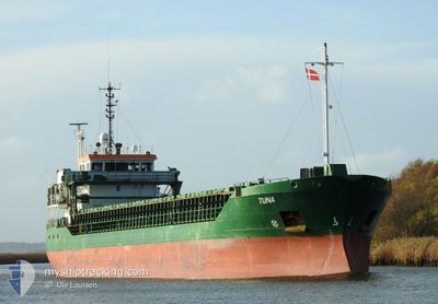
TUNA
General Cargo
Current Trip
| Time Travelled | 14 h, 29 mins |
|---|---|
| Remaining Time | 1 day |
| Distance Travelled | 152.23 nm |
| Remaining Distance | 305.81 nm |
| AVG Speed | 10.2 Knots |
| MAX Speed | 11.8 Knots |
| AVG Wind | 10 knots |
| MAX Wind | 15.2 knots |
| MIN Temp | 4.2°C / 39.56°F |
| MAX Temp | 7.8°C / 46.04°F |
| Dybgang | 3.7 m |
| Position Modtaget | 2 h, 25 m siden |
Current Position
| Longitude | --- |
|---|---|
| Latitude | --- |
| Status | Under way using engine |
| Fart | 11.7 Knots |
| Kurs | 41.7° |
| Område | Baltic Sea |
| Station | T-AIS |
| Position Modtaget | 2 h, 25 m siden |
Info
Information
The current position of TUNA is in Baltic Sea with coordinates 54.45544° / 12.23905° as reported on 2025-12-13 06:07 by AIS to our vessel tracker app. The vessel's current speed is 11.7 Knots and is heading at the port of KLAIPEDA. The estimated time of arrival as calculated by MyShipTracking vessel tracking app is 2025-12-14 14:28 LT
The vessel TUNA (IMO: 9306691, MMSI: 244321000) is a General Cargo that was built in 2004 ( 21 år gamle ). It's sailing under the flag of [NL] Netherlands.
In this page you can find informations about the vessels current position, last detected port calls, and current voyage information. If the vessels is not in coverage by AIS you will find the latest position.
The current position of TUNA is detected by our AIS receivers and we are not responsible for the reliability of the data. The last position was recorded while the vessel was in Coverage by the Ais receivers of our vessel tracking app.
The current draught of TUNA as reported by AIS is 3.7 meters
Weather
| Temperature | 7.8°C / 46.04°F |
|---|---|
| Wind Speed | 15 knots |
| Direction | 235° SW |
| Pressure | 1022 hPa |
| Humidity | 95.4 % |
| Cloud Coverage | 100 % |
Featured Company
Last Port Calls
| Port | Arrival | Departure | Time In Port |
|---|---|---|---|
| 2025-12-12 08:53 | 2025-12-12 19:03 | 10 h | |
| 2025-12-09 09:57 | 2025-12-10 20:17 | 1 d | |
| 2025-12-08 11:37 | 2025-12-09 06:05 | 18 h | |
| 2025-12-07 18:45 | 2025-12-07 19:03 | 18 m | |
| 2025-12-04 08:08 | 2025-12-05 01:05 | 16 h | |
| 2025-11-30 05:19 | 2025-11-30 23:11 | 17 h | |
| 2025-11-26 06:15 | 2025-11-28 10:41 | 2 d | |
| 2025-11-24 03:00 | 2025-11-24 15:31 | 12 h | |
| 2025-11-20 06:57 | 2025-11-22 20:03 | 2 d | |
| 2025-11-16 11:12 | 2025-11-18 16:08 | 2 d |
Last Trips
| Origin | Departure | Destination | Arrival | Distance | |
|---|---|---|---|---|---|
| 2025-12-10 20:17 | 2025-12-12 08:53 | 314.50 nm | |||
| 2025-12-09 06:05 | 2025-12-09 09:57 | 39.82 nm | |||
| 2025-12-07 19:03 | 2025-12-08 11:37 | 119.25 nm | |||
| 2025-12-05 01:05 | 2025-12-07 18:45 | 601.59 nm | |||
| 2025-11-30 23:11 | 2025-12-04 08:08 | 608.88 nm | |||
| 2025-11-28 10:41 | 2025-11-30 05:19 | 436.82 nm | |||
| 2025-11-24 15:31 | 2025-11-26 06:15 | 300.82 nm | |||
| 2025-11-22 20:03 | 2025-11-24 03:00 | 245.11 nm | |||
| 2025-11-18 16:08 | 2025-11-20 06:57 | 264.72 nm | |||
| 2025-11-14 18:16 | 2025-11-16 11:12 | 315.08 nm |
Events
| Tid | Hændelsen | Detaljer | Position / Dest | Info |
|---|---|---|---|---|
| 2025-12-13 06:13 | Status er ændret | Default Under way using engine |
54.47452 / 12.25207
LTKLJ
|
Fart: 11.7 kn Kurs: 41.7° |
| 2025-12-13 06:07 | Udenfor Dækning |
54.45544 / 12.23905
Baltic Sea
LTKLJ
|
Fart: 11.7 kn Kurs: 41.7° |
|
| 2025-12-13 05:38 | Ændre havområde | German part of the Baltic Sea Danish part of the Baltic Sea |
54.40909 / 12.11614
Baltic Sea
LTKLJ
|
Fart: 11.5 kn Kurs: 90.9° |
| 2025-12-13 03:21 | Ændre havområde | Danish part of the Baltic Sea German part of the Baltic Sea |
54.51856 / 11.40881
Baltic Sea
LTKLJ
|
Fart: 11.3 kn Kurs: 117.8° |
| 2025-12-13 01:37 | Ændre havområde | German part of the Baltic Sea Danish part of the Baltic Sea |
54.62040 / 10.89506
Baltic Sea
LTKLJ
|
Fart: 11.5 kn Kurs: 120.9° |
| 2025-12-13 00:18 | Status er ændret | Under way using engine Default |
54.74829 / 10.52267
LTKLJ
|
Fart: 10.9 kn Kurs: 119° |
| 2025-12-13 00:13 | Status er ændret | Default Under way using engine |
54.75617 / 10.49814
LTKLJ
|
Fart: 10.9 kn Kurs: 118.2° |
| 2025-12-13 00:06 | Status er ændret | Under way using engine Default |
54.76595 / 10.46739
LTKLJ
|
Fart: 10.9 kn Kurs: 118° |
| 2025-12-13 00:05 | Status er ændret | Default Under way using engine |
54.76785 / 10.46125
LTKLJ
|
Fart: 10.6 kn Kurs: 118.2° |
| 2025-12-12 23:37 | Ændre havområde | Danish part of the Baltic Sea Danish part of the Kattegat |
54.80807 / 10.33742
Baltic Sea
LTKLJ
|
Fart: 10.5 kn Kurs: 120.1° |