
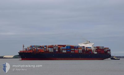
TRAIGUEN
Container Ship
Current Trip
| Time Travelled | 2 days |
|---|---|
| Remaining Time | 5 days |
| Distance Travelled | 1064.92 nm |
| Remaining Distance | 1933.82 nm |
| AVG Speed | 17.4 Knots |
| MAX Speed | 20.9 Knots |
| AVG Wind | 9.7 knots |
| MAX Wind | 20 knots |
| MIN Temp | 7.8°C / 46.04°F |
| MAX Temp | 17.6°C / 63.68°F |
| Draught | 9.5 m |
| Position Received | 1 d ago |
Current Position
| Longitude | --- |
|---|---|
| Latitude | --- |
| Status | Under way using engine |
| Speed | 17.1 Knots |
| Course | 285.3° |
| Area | Mediterranean Sea - Eastern Basin |
| Station | T-AIS |
| Position Received | 1 d ago |
Info
Information
The current position of TRAIGUEN is in Mediterranean Sea - Eastern Basin with coordinates 36.42421° / 14.52938° as reported on 2025-12-12 10:37 by AIS to our vessel tracker app. The vessel's current speed is 17.1 Knots and is heading at the port of FELIXSTOWE. The estimated time of arrival as calculated by MyShipTracking vessel tracking app is 2025-12-18 19:54 LT
The vessel TRAIGUEN (IMO: 9627904, MMSI: 636016125) is a Container Ship that was built in 2013 ( 12 years old ). It's sailing under the flag of [LR] Liberia.
In this page you can find informations about the vessels current position, last detected port calls, and current voyage information. If the vessels is not in coverage by AIS you will find the latest position.
The current position of TRAIGUEN is detected by our AIS receivers and we are not responsible for the reliability of the data. The last position was recorded while the vessel was in Coverage by the Ais receivers of our vessel tracking app.
The current draught of TRAIGUEN as reported by AIS is 9.5 meters
Weather
| Temperature | 16.6°C / 61.88°F |
|---|---|
| Wind Speed | 8 knots |
| Direction | 81° E |
| Pressure | 1021.8 hPa |
| Humidity | 68.3 % |
| Cloud Coverage | 3 % |
Featured Company
Last Port Calls
| Port | Arrival | Departure | Time In Port |
|---|---|---|---|
| 2025-12-10 02:53 | 2025-12-11 02:12 | 23 h | |
| 2025-12-07 21:24 | 2025-12-09 07:39 | 1 d | |
| 2025-12-06 14:48 | 2025-12-07 15:31 | 1 d | |
| 2025-12-03 08:36 | 2025-12-05 10:43 | 2 d | |
| 2025-11-23 07:14 | 2025-11-26 06:54 | 2 d | |
| 2025-11-19 22:14 | 2025-11-21 03:12 | 1 d | |
| 2025-11-17 14:57 | 2025-11-19 07:21 | 1 d | |
| 2025-11-14 07:57 | 2025-11-16 11:54 | 2 d | |
| 2025-11-04 15:25 | 2025-11-06 16:00 | 2 d | |
| 2025-11-02 10:09 | 2025-11-03 14:13 | 1 d |
Most Visited Ports (Last year)
| Port | Arrivals | |
|---|---|---|
| 8 | ||
| 6 | ||
| 6 | ||
| 6 | ||
| 6 | ||
| 6 |
Last Trips
| Origin | Departure | Destination | Arrival | Distance | |
|---|---|---|---|---|---|
| 2025-12-09 07:39 | 2025-12-10 02:53 | 265.51 nm | |||
| 2025-12-07 15:31 | 2025-12-07 21:24 | 56.15 nm | |||
| 2025-12-05 10:43 | 2025-12-06 14:48 | 396.49 nm | |||
| 2025-11-26 06:54 | 2025-12-03 08:36 | 2972.77 nm | |||
| 2025-11-21 03:12 | 2025-11-23 07:14 | 410.66 nm | |||
| 2025-11-19 07:21 | 2025-11-19 22:14 | 147.61 nm | |||
| 2025-11-16 11:54 | 2025-11-17 14:57 | 399.73 nm | |||
| 2025-11-06 16:00 | 2025-11-14 07:57 | 3079.35 nm | |||
| 2025-11-03 14:13 | 2025-11-04 15:25 | 292.30 nm | |||
| 2025-11-02 06:35 | 2025-11-02 10:09 | 47.29 nm |
Events
| Time | Event | Details | Position / Dest | Info |
|---|---|---|---|---|
| 2025-12-12 10:39 | Status Changed | Default Under way using engine |
36.42706 / 14.51729
TRALI>GBFXT
|
Speed: 17.1 kn Course: 285.3° |
| 2025-12-12 10:37 | OUT of Coverage |
36.42421 / 14.52938
Mediterranean Sea - Eastern Basin
TRALI>GBFXT
|
Speed: 17.1 kn Course: 285.3° |
|
| 2025-12-12 10:32 | Change Sea Area | Italian part of the Mediterranean Sea - Eastern Basin Greek part of the Aegean Sea |
36.41733 / 14.55876
Mediterranean Sea - Eastern Basin
TRALI>GBFXT
|
Speed: 17.4 kn Course: 285.8° |
| 2025-12-12 10:31 | Status Changed | Under way using engine Default |
36.41575 / 14.56568
TRALI>GBFXT
|
Speed: 17.1 kn Course: 284° |
| 2025-12-12 10:31 | IN Coverage |
36.41733 / 14.55876
Mediterranean Sea - Eastern Basin
TRALI>GBFXT
|
Speed: 17.4 kn Course: 285.8° |
|
| 2025-12-11 09:01 | Status Changed | Default Under way using engine |
37.15187 / 23.99657
TRALI>GBFXT
|
Speed: 20.1 kn Course: 215.7° |
| 2025-12-11 08:54 | OUT of Coverage |
37.18327 / 24.02474
Aegean Sea
TRALI>GBFXT
|
Speed: 20.1 kn Course: 215.7° |
|
| 2025-12-11 08:51 | Status Changed | Under way using engine Default |
37.19774 / 24.03764
TRALI>GBFXT
|
Speed: 20.1 kn Course: 215° |
| 2025-12-11 08:01 | Status Changed | Default Under way using engine |
37.41438 / 24.25774
TRALI>GBFXT
|
Speed: 20.2 kn Course: 224.4° |
| 2025-12-11 08:01 | Status Changed | Under way using engine Default |
37.41632 / 24.26012
TRALI>GBFXT
|
Speed: 20.3 kn Course: 215° |