
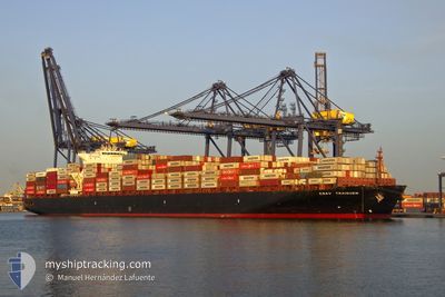
TRAIGUEN
Container Ship
Current Trip
| Time Travelled | 1 day |
|---|---|
| Remaining Time | --- |
| Distance Travelled | 365.46 nm |
| Remaining Distance | --- |
| AVG Speed | 12.2 Knots |
| MAX Speed | 13.3 Knots |
| AVG Wind | 7.9 knots |
| MAX Wind | 11 knots |
| MIN Temp | 15.1°C / 59.18°F |
| MAX Temp | 18.5°C / 65.3°F |
| Dybgang | 13.2 m |
| Position Modtaget | 1 d siden |
Current Position
| Longitude | --- |
|---|---|
| Latitude | --- |
| Status | Under way using engine |
| Fart | 12.2 Knots |
| Kurs | 35.7° |
| Område | North Atlantic Ocean |
| Station | T-AIS |
| Position Modtaget | 1 d siden |
Info
Information
The current position of TRAIGUEN is in North Atlantic Ocean with coordinates 28.84737° / -14.59301° as reported on 2024-12-31 17:18 by AIS to our vessel tracker app. The vessel's current speed is 12.2 Knots and is heading at the port of TANGER MED. The estimated time of arrival as calculated by MyShipTracking vessel tracking app is 2025-02-01 23:00 LT
The vessel TRAIGUEN (IMO: 9627904, MMSI: 636016125) is a Container Ship that was built in 2013 ( 12 år gamle ). It's sailing under the flag of [LR] Liberia.
In this page you can find informations about the vessels current position, last detected port calls, and current voyage information. If the vessels is not in coverage by AIS you will find the latest position.
The current position of TRAIGUEN is detected by our AIS receivers and we are not responsible for the reliability of the data. The last position was recorded while the vessel was in Coverage by the Ais receivers of our vessel tracking app.
The current draught of TRAIGUEN as reported by AIS is 13.2 meters
Weather
| Temperature | 17.3°C / 63.14°F |
|---|---|
| Wind Speed | 12 knots |
| Direction | 53° NE |
| Pressure | 1023.6 hPa |
| Humidity | 60.3 % |
| Cloud Coverage | --- |
Featured Company
Last Port Calls
| Port | Arrival | Departure | Time In Port |
|---|---|---|---|
| 2024-12-31 06:08 | 2024-12-31 12:09 | 6 h | |
| 2024-12-20 05:01 | 2024-12-21 11:44 | 1 d | |
| 2024-12-18 15:04 | 2024-12-18 15:36 | 32 m | |
| 2024-12-15 04:45 | 2024-12-16 00:32 | 19 h | |
| 2024-12-12 00:11 | 2024-12-12 13:04 | 12 h | |
| 2024-12-09 06:01 | 2024-12-11 09:28 | 2 d | |
| 2024-12-07 10:01 | 2024-12-07 11:02 | 1 h | |
| 2024-12-02 17:57 | 2024-12-04 07:23 | 1 d | |
| 2024-11-24 09:45 | 2024-11-25 04:36 | 18 h | |
| 2024-11-21 13:35 | 2024-11-22 01:09 | 11 h |
Last Trips
| Origin | Departure | Destination | Arrival | Distance | |
|---|---|---|---|---|---|
| 2024-12-21 11:44 | 2024-12-31 06:08 | 3701.51 nm | |||
| 2024-12-18 15:36 | 2024-12-20 05:01 | 222.27 nm | |||
| 2024-12-16 00:32 | 2024-12-18 15:04 | 206.75 nm | |||
| 2024-12-12 13:04 | 2024-12-15 04:45 | 152.33 nm | |||
| 2024-12-11 09:28 | 2024-12-12 00:11 | 4.06 nm | |||
| 2024-12-07 11:02 | 2024-12-09 06:01 | 212.39 nm | |||
| 2024-12-04 07:23 | 2024-12-07 10:01 | 1105.07 nm | |||
| 2024-11-25 04:36 | 2024-12-02 17:57 | 3542.08 nm | |||
| 2024-11-22 01:09 | 2024-11-24 09:45 | 168.34 nm | |||
| 2024-11-21 09:05 | 2024-11-21 13:35 | 4.65 nm |
Events
| Tid | Hændelsen | Detaljer | Position / Dest | Info |
|---|---|---|---|---|
| 2024-12-31 17:23 | Status er ændret | Default Under way using engine |
28.86067 / -14.58202
MAPTM
|
Fart: 12.2 kn Kurs: 35.7° |
| 2024-12-31 17:18 | Udenfor Dækning |
28.84737 / -14.59301
North Atlantic Ocean
|
Fart: 12.2 kn Kurs: 35.7° |
|
| 2024-12-31 17:17 | Status er ændret | Under way using engine Default |
28.84454 / -14.59530
MAPTM
|
Fart: 12.2 kn Kurs: 36° |
| 2024-12-31 17:11 | Status er ændret | Default Under way using engine |
28.82805 / -14.60880
MAPTM
|
Fart: 12.2 kn Kurs: 35.5° |
| 2024-12-31 16:55 | Status er ændret | Under way using engine Default |
28.78518 / -14.64329
MAPTM
|
Fart: 12.1 kn Kurs: 36° |
| 2024-12-31 16:55 | Status er ændret | Default Under way using engine |
28.78388 / -14.64441
MAPTM
|
Fart: 12.1 kn Kurs: 36.6° |
| 2024-12-31 12:16 | Destination er ændret | MAPTM LAS PALMAS |
28.10834 / -15.39166
MAPTM
|
Fart: 9.2 kn Kurs: 98.6° |
| 2024-12-31 12:16 | ETA er ændret | 2025/02/01 22:00 2024/12/29 18:00 |
28.10834 / -15.39166
MAPTM
|
Fart: 9.2 kn Kurs: 98.6° |
| 2024-12-31 12:12 | Status er ændret | Under way using engine At anchor |
28.11193 / -15.40074
LAS PALMAS
|
Fart: 8 kn Kurs: 127.8° |
| 2024-12-31 12:09 | Afsejlet fra sidste havn |
|
28.11575 / -15.40598
LAS PALMAS
|
Fart: 6.3 kn Kurs: 130° |