
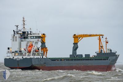
TIDE NAVIGATOR
General Cargo
Current Trip
| Time Travelled | 2 days |
|---|---|
| Remaining Time | 4 days |
| Distance Travelled | 430.20 nm |
| Remaining Distance | 1517.91 nm |
| AVG Speed | 11.1 Knots |
| MAX Speed | 13.3 Knots |
| AVG Wind | 16.9 knots |
| MAX Wind | 25.2 knots |
| MIN Temp | 17.1°C / 62.78°F |
| MAX Temp | 20.4°C / 68.72°F |
| Draught | 6.7 m |
| Position Received | 1 d ago |
Current Position
| Longitude | 25.02021° |
|---|---|
| Latitude | 33.53677° |
| Status | Under way using engine |
| Speed | 11.3 Knots |
| Course | 301.4° |
| Area | Mediterranean Sea - Eastern Basin |
| Station | T-AIS |
| Position Received | 1 d ago |
Info
Information
The current position of TIDE NAVIGATOR is in Mediterranean Sea - Eastern Basin with coordinates 33.53677° / 25.02021° as reported on 2024-05-09 18:15 by AIS to our vessel tracker app. The vessel's current speed is 11.3 Knots and is heading at the port of CEUTA. The estimated time of arrival as calculated by MyShipTracking vessel tracking app is 2024-05-15 09:24 LT
The vessel TIDE NAVIGATOR (IMO: 9526083, MMSI: 245086000) is a General Cargo that was built in 2011 ( 13 years old ). It's sailing under the flag of [NL] Netherlands.
In this page you can find informations about the vessels current position, last detected port calls, and current voyage information. If the vessels is not in coverage by AIS you will find the latest position.
The current position of TIDE NAVIGATOR is detected by our AIS receivers and we are not responsible for the reliability of the data. The last position was recorded while the vessel was in Coverage by the Ais receivers of our vessel tracking app.
The current draught of TIDE NAVIGATOR as reported by AIS is 6.7 meters
Weather
| Temperature | 18.8°C / 65.84°F |
|---|---|
| Wind Speed | 10 knots |
| Direction | 313° NW |
| Pressure | 1011.9 hPa |
| Humidity | 77.9 % |
| Cloud Coverage | --- |
Featured Company
Last Port Calls
| Port | Arrival | Departure | Time In Port |
|---|---|---|---|
| 2024-05-06 12:00 | 2024-05-08 17:20 | 2 d | |
| 2024-05-02 03:23 | 2024-05-02 16:01 | 12 h | |
| 2024-04-30 09:41 | 2024-04-30 17:50 | 8 h | |
| 2024-04-18 03:15 | 2024-04-18 15:24 | 12 h | |
| 2024-04-16 04:13 | 2024-04-16 11:43 | 7 h | |
| 2024-04-06 07:50 | 2024-04-11 06:46 | 4 d | |
| 2024-03-30 16:38 | 2024-04-03 12:27 | 3 d | |
| 2024-03-25 22:59 | 2024-03-27 23:11 | 2 d | |
| 2024-03-23 18:43 | 2024-03-24 11:07 | 16 h | |
| 2024-03-19 03:43 | 2024-03-19 22:00 | 18 h |
Last Trips
| Origin | Departure | Destination | Arrival | Distance | |
|---|---|---|---|---|---|
| 2024-05-02 18:01 | 2024-05-06 14:00 | 1010.97 nm | |||
| 2024-04-30 19:50 | 2024-05-02 05:23 | 361.51 nm | |||
| 2024-04-18 17:24 | 2024-04-30 11:41 | 2838.83 nm | |||
| 2024-04-16 13:43 | 2024-04-18 05:15 | 383.97 nm | |||
| 2024-04-11 08:46 | 2024-04-16 06:13 | 522.57 nm | |||
| 2024-04-03 14:27 | 2024-04-06 09:50 | 714.50 nm | |||
| 2024-03-28 00:11 | 2024-03-30 17:38 | 445.28 nm | |||
| 2024-03-24 12:07 | 2024-03-25 23:59 | 312.74 nm | |||
| 2024-03-19 23:00 | 2024-03-23 19:43 | 900.79 nm | |||
| 2024-03-12 14:09 | 2024-03-19 04:43 | 838.49 nm |
Events
| Time | Event | Details | Position / Dest | Info |
|---|---|---|---|---|
| 2024-05-09 18:26 | Status Changed | Default Under way using engine |
33.55270 / 24.98685
ES CEU
|
Speed: 11.3 kn Course: 301.4° |
| 2024-05-09 18:15 | OUT of Coverage |
33.53677 / 25.02021
Mediterranean Sea - Eastern Basin
ES CEU
|
Speed: 11.3 kn Course: 301.4° |
|
| 2024-05-09 17:16 | Change Sea Area | Greek part of the Mediterranean Sea - Eastern Basin Libyan part of the Mediterranean Sea - Eastern Basin |
33.44530 / 25.21659
Mediterranean Sea - Eastern Basin
ES CEU
|
Speed: 11.7 kn Course: 299.4° |
| 2024-05-09 14:09 | Status Changed | Under way using engine Default |
33.15696 / 25.81404
ES CEU
|
Speed: 11.2 kn Course: 299° |
| 2024-05-09 14:02 | Status Changed | Default Under way using engine |
33.14544 / 25.83785
ES CEU
|
Speed: 11.2 kn Course: 300° |
| 2024-05-09 13:17 | Status Changed | Under way using engine Default |
33.07802 / 25.97829
ES CEU
|
Speed: 11.1 kn Course: 299° |
| 2024-05-09 12:49 | Status Changed | Default Under way using engine |
33.03434 / 26.06914
ES CEU
|
Speed: 11.2 kn Course: 299.9° |
| 2024-05-09 12:48 | Detected in Sea | Libyan part of the Mediterranean Sea - Eastern Basin |
33.03251 / 26.07296
Mediterranean Sea - Eastern Basin
ES CEU
|
Speed: 11.2 kn Course: 299.9° |
| 2024-05-09 12:47 | Status Changed | Under way using engine Default |
33.03146 / 26.07509
ES CEU
|
Speed: 11.2 kn Course: 299° |
| 2024-05-09 12:40 | Status Changed | Default Under way using engine |
33.02089 / 26.09708
ES CEU
|
Speed: 11.3 kn Course: 299.9° |