
TIDE NAVIGATOR
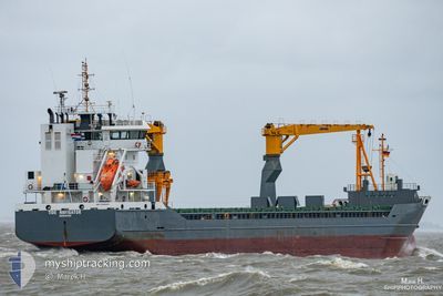
General Cargo
Current Trip
| Time Travelled | 4 days |
|---|---|
| Remaining Time | 2 days |
| Distance Travelled | 1263.37 морская миля |
| Remaining Distance | 712.54 морская миля |
| AVG Speed | 10.8 Узлы |
| MAX Speed | 13.3 Узлы |
| AVG Wind | 11 knots |
| MAX Wind | 26.9 knots |
| MIN Temp | 14.1°C / 57.38°F |
| MAX Temp | 20.4°C / 68.72°F |
| Осадка | 6.7 м |
| Позиция Получена | 11 h, 36 m тому назад |
Current Position
| Долгота | 9.53552° |
|---|---|
| Широта | 37.94123° |
| Статус | Under way using engine |
| Скорость | 11.1 Узлы |
| Курс | 260.5° |
| Район | Mediterranean Sea - Western Basin |
| Станция | T-AIS |
| Позиция Получена | 11 h, 36 m тому назад |
Info
Information
The current position of TIDE NAVIGATOR is in Mediterranean Sea - Western Basin with coordinates 37.94123° / 9.53552° as reported on 2024-05-13 03:33 by AIS to our vessel tracker app. The vessel's current speed is 11.1 Узлы and is heading at the port of CEUTA. The estimated time of arrival as calculated by MyShipTracking vessel tracking app is 2024-05-16 01:13 LT
The vessel TIDE NAVIGATOR (IMO: 9526083, MMSI: 245086000) is a General Cargo that was built in 2011 ( 13 лет ). It's sailing under the flag of [NL] Netherlands.
In this page you can find informations about the vessels current position, last detected port calls, and current voyage information. If the vessels is not in coverage by AIS you will find the latest position.
The current position of TIDE NAVIGATOR is detected by our AIS receivers and we are not responsible for the reliability of the data. The last position was recorded while the vessel was in Coverage by the Ais receivers of our vessel tracking app.
The current draught of TIDE NAVIGATOR as reported by AIS is 6.7 meters
Weather
| Temperature | 18.7°C / 65.66°F |
|---|---|
| Wind Speed | 1 knots |
| Direction | 90° E |
| Pressure | 1010.8 hPa |
| Humidity | 86.3 % |
| Cloud Coverage | 97 % |
Featured Company
Last Port Calls
| Port | Arrival | Departure | Time In Port |
|---|---|---|---|
| 2024-05-06 14:00 | 2024-05-08 19:20 | 2 d | |
| 2024-05-02 05:23 | 2024-05-02 18:01 | 12 h | |
| 2024-04-30 11:41 | 2024-04-30 19:50 | 8 h | |
| 2024-04-18 05:15 | 2024-04-18 17:24 | 12 h | |
| 2024-04-16 06:13 | 2024-04-16 13:43 | 7 h | |
| 2024-04-06 09:50 | 2024-04-11 08:46 | 4 d | |
| 2024-03-30 17:38 | 2024-04-03 14:27 | 3 d | |
| 2024-03-25 23:59 | 2024-03-28 00:11 | 2 d | |
| 2024-03-23 19:43 | 2024-03-24 12:07 | 16 h | |
| 2024-03-19 04:43 | 2024-03-19 23:00 | 18 h |
Last Trips
| Origin | Departure | Destination | Arrival | Distance | |
|---|---|---|---|---|---|
| 2024-05-02 18:01 | 2024-05-06 14:00 | 1010.97 морская миля | |||
| 2024-04-30 19:50 | 2024-05-02 05:23 | 361.51 морская миля | |||
| 2024-04-18 17:24 | 2024-04-30 11:41 | 2838.83 морская миля | |||
| 2024-04-16 13:43 | 2024-04-18 05:15 | 383.97 морская миля | |||
| 2024-04-11 08:46 | 2024-04-16 06:13 | 522.57 морская миля | |||
| 2024-04-03 14:27 | 2024-04-06 09:50 | 714.50 морская миля | |||
| 2024-03-28 00:11 | 2024-03-30 17:38 | 445.28 морская миля | |||
| 2024-03-24 12:07 | 2024-03-25 23:59 | 312.74 морская миля | |||
| 2024-03-19 23:00 | 2024-03-23 19:43 | 900.79 морская миля | |||
| 2024-03-12 14:09 | 2024-03-19 04:43 | 838.49 морская миля |
Events
| Время | Событие | Детали | Позиция / Направление | Информация |
|---|---|---|---|---|
| 2024-05-13 03:38 | Статус изменился | Default Under way using engine |
37.93843 / 9.51399
ES CEU
|
Скорость: 11.1 kn Курс: 260.5° |
| 2024-05-13 03:33 | Статус изменился | Under way using engine Default |
37.94123 / 9.53552
ES CEU
|
Скорость: 11.2 kn Курс: 261° |
| 2024-05-13 03:33 | Вне покрытия |
37.94123 / 9.53552
Mediterranean Sea - Western Basin
ES CEU
|
Скорость: 11.1 kn Курс: 260.5° |
|
| 2024-05-13 02:43 | Статус изменился | Default Under way using engine |
37.96566 / 9.72708
ES CEU
|
Скорость: 11 kn Курс: 260.5° |
| 2024-05-13 02:34 | Статус изменился | Under way using engine Default |
37.97001 / 9.76137
ES CEU
|
Скорость: 11 kn Курс: 260° |
| 2024-05-13 02:28 | Статус изменился | Default Under way using engine |
37.97301 / 9.78496
ES CEU
|
Скорость: 10.9 kn Курс: 260.5° |
| 2024-05-13 02:20 | Статус изменился | Under way using engine Default |
37.97695 / 9.81605
ES CEU
|
Скорость: 10.9 kn Курс: 260° |
| 2024-05-13 02:11 | Статус изменился | Default Under way using engine |
37.98110 / 9.84816
ES CEU
|
Скорость: 10.9 kn Курс: 260° |
| 2024-05-12 21:47 | Изменение морского района | Tunisian part of the Mediterranean Sea - Western Basin Italian part of the Mediterranean Sea - Western Basin |
38.12027 / 10.82821
Mediterranean Sea - Western Basin
ES CEU
|
Скорость: 10.5 kn Курс: 258° |
| 2024-05-12 20:05 | Обнаружено в море | Italian part of the Mediterranean Sea - Western Basin |
38.15368 / 11.20335
Mediterranean Sea - Western Basin
ES CEU
|
Скорость: 10.7 kn Курс: 261.2° |