
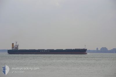
THE UNITY
Bulk Carrier
Current Trip
| Time Travelled | 13 days |
|---|---|
| Remaining Time | 19 h, 7 mins |
| Distance Travelled | 771.47 nm |
| Remaining Distance | 384.36 nm |
| AVG Speed | 7.7 Knots |
| MAX Speed | 10.3 Knots |
| AVG Wind | 11.8 knots |
| MAX Wind | 21.7 knots |
| MIN Temp | 25.5°C / 77.9°F |
| MAX Temp | 29.2°C / 84.56°F |
| Draught | 10.6 m |
| Position Received | 12 d ago |
Current Position
| Longitude | --- |
|---|---|
| Latitude | --- |
| Status | Under way using engine |
| Speed | 10.2 Knots |
| Course | 246.6° |
| Area | Malacca Strait |
| Station | T-AIS |
| Position Received | 12 d ago |
Info
Information
The current position of THE UNITY is in Malacca Strait with coordinates 5.56400° / 100.07292° as reported on 2025-12-08 07:10 by AIS to our vessel tracker app. The vessel's current speed is 10.2 Knots and is heading at the port of SINGAPORE. The estimated time of arrival as calculated by MyShipTracking vessel tracking app is 2025-12-22 08:37 LT
The vessel THE UNITY (IMO: 9301043, MMSI: 351935000) is a Bulk Carrier that was built in 2006 ( 19 years old ). It's sailing under the flag of [PA] Panama.
In this page you can find informations about the vessels current position, last detected port calls, and current voyage information. If the vessels is not in coverage by AIS you will find the latest position.
The current position of THE UNITY is detected by our AIS receivers and we are not responsible for the reliability of the data. The last position was recorded while the vessel was in Coverage by the Ais receivers of our vessel tracking app.
The current draught of THE UNITY as reported by AIS is 10.6 meters
Weather
| Temperature | 27.9°C / 82.22°F |
|---|---|
| Wind Speed | 16 knots |
| Direction | 30° NNE |
| Pressure | 1009.6 hPa |
| Humidity | 75.1 % |
| Cloud Coverage | 93 % |
Featured Company
Last Port Calls
| Port | Arrival | Departure | Time In Port |
|---|---|---|---|
| 2025-11-27 12:20 | 2025-12-08 12:48 | 11 d | |
| 2025-11-27 02:28 | 2025-11-27 09:36 | 7 h | |
| 2025-11-26 13:40 | 2025-11-26 21:00 | 7 h | |
| 2025-11-26 02:04 | 2025-11-26 07:36 | 5 h | |
| 2025-11-25 13:42 | 2025-11-25 18:42 | 5 h | |
| 2025-11-24 22:55 | 2025-11-25 07:51 | 8 h | |
| 2025-11-24 11:30 | 2025-11-24 20:48 | 9 h | |
| 2025-11-23 22:36 | 2025-11-24 07:48 | 9 h | |
| 2025-11-23 11:04 | 2025-11-23 21:18 | 10 h | |
| 2025-11-22 23:39 | 2025-11-23 06:12 | 6 h |
Most Visited Ports (Last year)
| Port | Arrivals | |
|---|---|---|
| 19 | ||
| 2 | ||
| 1 | ||
| 1 | ||
| 1 | ||
| 1 |
Last Trips
| Origin | Departure | Destination | Arrival | Distance | |
|---|---|---|---|---|---|
| 2025-11-27 09:36 | 2025-11-27 12:20 | 5.77 nm | |||
| 2025-11-26 21:00 | 2025-11-27 02:28 | 2.18 nm | |||
| 2025-11-26 07:36 | 2025-11-26 13:40 | 2.86 nm | |||
| 2025-11-25 18:42 | 2025-11-26 02:04 | 2.43 nm | |||
| 2025-11-25 07:51 | 2025-11-25 13:42 | 1.76 nm | |||
| 2025-11-24 20:48 | 2025-11-24 22:55 | 0.67 nm | |||
| 2025-11-24 07:48 | 2025-11-24 11:30 | 1.53 nm | |||
| 2025-11-23 21:18 | 2025-11-23 22:36 | 0.27 nm | |||
| 2025-11-23 06:12 | 2025-11-23 11:04 | 1.99 nm | |||
| 2025-11-22 17:48 | 2025-11-22 23:39 | 2.13 nm |
Events
| Time | Event | Details | Position / Dest | Info |
|---|---|---|---|---|
| 2025-12-21 03:20 | STOP Moving |
5.49667 / 99.24834
SINGAPORE
|
Speed: Course: -1° |
|
| 2025-12-21 00:11 | START Moving |
5.19669 / 98.97031
SINGAPORE
|
Speed: 5.2 kn Course: 35° |
|
| 2025-12-20 03:26 | STOP Moving |
5.48500 / 99.24333
SINGAPORE
|
Speed: Course: -1° |
|
| 2025-12-20 00:20 | START Moving |
5.16667 / 98.97500
SINGAPORE
|
Speed: 6 kn Course: 35° |
|
| 2025-12-19 10:35 | STOP Moving |
5.41833 / 99.19167
SINGAPORE
|
Speed: Course: -1° |
|
| 2025-12-18 17:39 | START Moving |
5.19018 / 99.19941
SINGAPORE
|
Speed: 5.7 kn Course: 17° |
|
| 2025-12-18 09:47 | STOP Moving |
5.38833 / 99.25833
SINGAPORE
|
Speed: Course: -1° |
|
| 2025-12-17 23:10 | START Moving |
5.15085 / 99.08685
SINGAPORE
|
Speed: 4.4 kn Course: 52° |
|
| 2025-12-17 02:22 | STOP Moving |
5.48167 / 99.36500
SINGAPORE
|
Speed: Course: -1° |
|
| 2025-12-16 23:16 | START Moving |
5.19624 / 99.07473
SINGAPORE
|
Speed: 6.4 kn Course: 44° |