
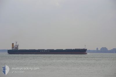
THE UNITY
Bulk Carrier
Current Trip
| Time Travelled | 16 days |
|---|---|
| Remaining Time | --- |
| Distance Travelled | 932.98 nm |
| Remaining Distance | --- |
| AVG Speed | 7.8 Knopen |
| MAX Speed | 10.3 Knopen |
| AVG Wind | 11.3 knots |
| MAX Wind | 21.7 knots |
| MIN Temp | 25.5°C / 77.9°F |
| MAX Temp | 29.2°C / 84.56°F |
| Diepgang | 10.6 M |
| Positie ontvangen | 16 d geleden |
Current Position
| Lengtegraad | --- |
|---|---|
| Breedtegraat | --- |
| Status | Under way using engine |
| Snelheid | 10.2 Knopen |
| Koers | 246.6° |
| Gebied | Malacca Strait |
| Station | T-AIS |
| Positie ontvangen | 16 d geleden |
Info
Information
The current position of THE UNITY is in Malacca Strait with coordinates 5.56400° / 100.07292° as reported on 2025-12-08 07:10 by AIS to our vessel tracker app. The vessel's current speed is 10.2 Knopen
The vessel THE UNITY (IMO: 9301043, MMSI: 351935000) is a Bulk Carrier that was built in 2006 ( 19 Jaar oud ). It's sailing under the flag of [PA] Panama.
In this page you can find informations about the vessels current position, last detected port calls, and current voyage information. If the vessels is not in coverage by AIS you will find the latest position.
The current position of THE UNITY is detected by our AIS receivers and we are not responsible for the reliability of the data. The last position was recorded while the vessel was in Coverage by the Ais receivers of our vessel tracking app.
The current draught of THE UNITY as reported by AIS is 10.6 meters
Weather
| Temperature | 27.9°C / 82.22°F |
|---|---|
| Wind Speed | 10 knots |
| Direction | 1° N |
| Pressure | 1006.2 hPa |
| Humidity | 75.9 % |
| Cloud Coverage | 86 % |
Featured Company
Last Port Calls
| Port | Arrival | Departure | Time In Port |
|---|---|---|---|
| 2025-11-27 12:20 | 2025-12-08 12:48 | 11 d | |
| 2025-11-27 02:28 | 2025-11-27 09:36 | 7 h | |
| 2025-11-26 13:40 | 2025-11-26 21:00 | 7 h | |
| 2025-11-26 02:04 | 2025-11-26 07:36 | 5 h | |
| 2025-11-25 13:42 | 2025-11-25 18:42 | 5 h | |
| 2025-11-24 22:55 | 2025-11-25 07:51 | 8 h | |
| 2025-11-24 11:30 | 2025-11-24 20:48 | 9 h | |
| 2025-11-23 22:36 | 2025-11-24 07:48 | 9 h | |
| 2025-11-23 11:04 | 2025-11-23 21:18 | 10 h | |
| 2025-11-22 23:39 | 2025-11-23 06:12 | 6 h |
Most Visited Ports (Last year)
| Port | Arrivals | |
|---|---|---|
| 19 | ||
| 2 | ||
| 1 | ||
| 1 | ||
| 1 | ||
| 1 |
Last Trips
| Origin | Departure | Destination | Arrival | Distance | |
|---|---|---|---|---|---|
| 2025-11-27 09:36 | 2025-11-27 12:20 | 5.77 nm | |||
| 2025-11-26 21:00 | 2025-11-27 02:28 | 2.18 nm | |||
| 2025-11-26 07:36 | 2025-11-26 13:40 | 2.86 nm | |||
| 2025-11-25 18:42 | 2025-11-26 02:04 | 2.43 nm | |||
| 2025-11-25 07:51 | 2025-11-25 13:42 | 1.76 nm | |||
| 2025-11-24 20:48 | 2025-11-24 22:55 | 0.67 nm | |||
| 2025-11-24 07:48 | 2025-11-24 11:30 | 1.53 nm | |||
| 2025-11-23 21:18 | 2025-11-23 22:36 | 0.27 nm | |||
| 2025-11-23 06:12 | 2025-11-23 11:04 | 1.99 nm | |||
| 2025-11-22 17:48 | 2025-11-22 23:39 | 2.13 nm |
Events
| Tijd | Evenement | Details | Positie / Bestemming | Info |
|---|---|---|---|---|
| 2025-12-24 05:17 | Start beweging |
5.38667 / 98.83334
SINGAPORE
|
Snelheid: 5 kn Koers: 34° |
|
| 2025-12-23 08:26 | Stop beweging |
5.46667 / 99.25166
SINGAPORE
|
Snelheid: Koers: -1° |
|
| 2025-12-23 05:35 | Start beweging |
5.31833 / 98.91167
SINGAPORE
|
Snelheid: 7 kn Koers: 61° |
|
| 2025-12-22 03:20 | Stop beweging |
5.48333 / 99.23167
SINGAPORE
|
Snelheid: Koers: -1° |
|
| 2025-12-22 00:11 | Start beweging |
5.18323 / 98.96016
SINGAPORE
|
Snelheid: 4.3 kn Koers: 49° |
|
| 2025-12-21 03:20 | Stop beweging |
5.49667 / 99.24834
SINGAPORE
|
Snelheid: Koers: -1° |
|
| 2025-12-21 00:11 | Start beweging |
5.19669 / 98.97031
SINGAPORE
|
Snelheid: 5.2 kn Koers: 35° |
|
| 2025-12-20 03:26 | Stop beweging |
5.48500 / 99.24333
SINGAPORE
|
Snelheid: Koers: -1° |
|
| 2025-12-20 00:20 | Start beweging |
5.16667 / 98.97500
SINGAPORE
|
Snelheid: 6 kn Koers: 35° |
|
| 2025-12-19 10:35 | Stop beweging |
5.41833 / 99.19167
SINGAPORE
|
Snelheid: Koers: -1° |