
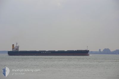
THE UNITY
Bulk Carrier
Current Trip
| Time Travelled | 29 days |
|---|---|
| Remaining Time | 22 days |
| Distance Travelled | 3785.04 nm |
| Remaining Distance | 6683.30 nm |
| AVG Speed | 10 Knop |
| MAX Speed | 14.2 Knop |
| AVG Wind | 10.7 knots |
| MAX Wind | 21.7 knots |
| MIN Temp | 24.2°C / 75.56°F |
| MAX Temp | 29.2°C / 84.56°F |
| Djupgående | 8.5 m |
| Position mottagen | 8 d sen |
Current Position
| Longitud | --- |
|---|---|
| Latitude | --- |
| Status | Under way using engine |
| Fart | 11.2 Knop |
| Kurs | 310.9° |
| Område | Malacca Strait |
| Station | T-AIS |
| Position mottagen | 8 d sen |
Info
Information
The current position of THE UNITY is in Malacca Strait with coordinates 2.16119° / 102.03074° as reported on 2025-12-29 19:28 by AIS to our vessel tracker app. The vessel's current speed is 11.2 Knop and is heading at the port of SANTOS. The estimated time of arrival as calculated by MyShipTracking vessel tracking app is 2026-01-29 13:54 LT
The vessel THE UNITY (IMO: 9301043, MMSI: 351935000) is a Bulk Carrier that was built in 2006 ( 20 År gammal ). It's sailing under the flag of [PA] Panama.
In this page you can find informations about the vessels current position, last detected port calls, and current voyage information. If the vessels is not in coverage by AIS you will find the latest position.
The current position of THE UNITY is detected by our AIS receivers and we are not responsible for the reliability of the data. The last position was recorded while the vessel was in Coverage by the Ais receivers of our vessel tracking app.
The current draught of THE UNITY as reported by AIS is 8.5 meters
Weather
| Temperature | 27.8°C / 82.04°F |
|---|---|
| Wind Speed | 3 knots |
| Direction | 17° NNE |
| Pressure | 1007.3 hPa |
| Humidity | 69.2 % |
| Cloud Coverage | 94 % |
Featured Company
Last Port Calls
| Port | Arrival | Departure | Time In Port |
|---|---|---|---|
| 2025-11-27 12:20 | 2025-12-08 12:48 | 11 d | |
| 2025-11-27 02:28 | 2025-11-27 09:36 | 7 h | |
| 2025-11-26 13:40 | 2025-11-26 21:00 | 7 h | |
| 2025-11-26 02:04 | 2025-11-26 07:36 | 5 h | |
| 2025-11-25 13:42 | 2025-11-25 18:42 | 5 h | |
| 2025-11-24 22:55 | 2025-11-25 07:51 | 8 h | |
| 2025-11-24 11:30 | 2025-11-24 20:48 | 9 h | |
| 2025-11-23 22:36 | 2025-11-24 07:48 | 9 h | |
| 2025-11-23 11:04 | 2025-11-23 21:18 | 10 h | |
| 2025-11-22 23:39 | 2025-11-23 06:12 | 6 h |
Most Visited Ports (Last year)
| Port | Arrivals | |
|---|---|---|
| 19 | ||
| 2 | ||
| 1 | ||
| 1 | ||
| 1 | ||
| 1 |
Last Trips
| Origin | Departure | Destination | Arrival | Distance | |
|---|---|---|---|---|---|
| 2025-11-27 09:36 | 2025-11-27 12:20 | 5.77 nm | |||
| 2025-11-26 21:00 | 2025-11-27 02:28 | 2.18 nm | |||
| 2025-11-26 07:36 | 2025-11-26 13:40 | 2.86 nm | |||
| 2025-11-25 18:42 | 2025-11-26 02:04 | 2.43 nm | |||
| 2025-11-25 07:51 | 2025-11-25 13:42 | 1.76 nm | |||
| 2025-11-24 20:48 | 2025-11-24 22:55 | 0.67 nm | |||
| 2025-11-24 07:48 | 2025-11-24 11:30 | 1.53 nm | |||
| 2025-11-23 21:18 | 2025-11-23 22:36 | 0.27 nm | |||
| 2025-11-23 06:12 | 2025-11-23 11:04 | 1.99 nm | |||
| 2025-11-22 17:48 | 2025-11-22 23:39 | 2.13 nm |
Events
| Tid | Event | Detaljer | Position / Dest | Information |
|---|---|---|---|---|
| 2026-01-05 07:05 | STARTAR förflyttning |
-6.51833 / 78.53667
SANTOS
|
Fart: 5 kn Kurs: 272° |
|
| 2026-01-05 06:47 | STOPPAR förflyttning |
-6.52667 / 78.54166
SANTOS
|
Fart: Kurs: -1° |
|
| 2026-01-05 05:59 | STARTAR förflyttning |
-6.51167 / 78.58833
SANTOS
|
Fart: 5 kn Kurs: 228° |
|
| 2026-01-05 02:56 | STOPPAR förflyttning |
-6.50167 / 78.57000
SANTOS
|
Fart: Kurs: -1° |
|
| 2025-12-29 19:33 | Status ändrad | Default Under way using engine |
2.17122 / 102.01949
SANTOS
|
Fart: 11.2 kn Kurs: 310.9° |
| 2025-12-29 19:28 | UTANFÖR täckningsområde |
2.16119 / 102.03074
Malacca Strait
SANTOS
|
Fart: 11.2 kn Kurs: 310.9° |
|
| 2025-12-29 19:05 | Status ändrad | Under way using engine Default |
2.11359 / 102.08290
SANTOS
|
Fart: 11.2 kn Kurs: 312° |
| 2025-12-29 19:04 | Status ändrad | Default Under way using engine |
2.11113 / 102.08556
SANTOS
|
Fart: 11.3 kn Kurs: 311.9° |
| 2025-12-29 17:37 | Byter havsområde | Malaysian part of the Malacca Strait Malaysian part of the Singapore Strait |
1.92442 / 102.29283
Malacca Strait
SANTOS
|
Fart: 11.6 kn Kurs: 307.1° |
| 2025-12-29 17:36 | Status ändrad | Under way using engine Default |
1.92341 / 102.29418
SANTOS
|
Fart: 11.8 kn Kurs: 294° |