

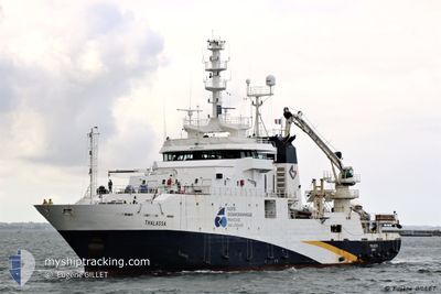
THALASSA
Fishery Research Vessel

Current Trip
CVVXE
| Time Travelled | 2 days |
|---|---|
| Remaining Time | --- |
| Distance Travelled | 150.25 nm |
| Remaining Distance | --- |
| AVG Speed | 9.4 Knots |
| MAX Speed | 13.5 Knots |
| AVG Wind | 17 knots |
| MAX Wind | 22 knots |
| MIN Temp | 7°C / 44.6°F |
| MAX Temp | 12.1°C / 53.78°F |
| Draught | 6 m |
| Position Received | 1 d ago |
Current Position
| Longitude | --- |
|---|---|
| Latitude | --- |
| Status | Under way using engine |
| Speed | 7.9 Knots |
| Course | 221.8° |
| Area | North Atlantic Ocean |
| Station | T-AIS |
| Position Received | 1 d ago |
Information
The current position of THALASSA is in North Atlantic Ocean with coordinates 46.71101° / -7.24919° as reported on 2025-02-16 02:13 by AIS to our vessel tracker app. The vessel's current speed is 7.9 Knots
The vessel THALASSA (IMO: 9070307, MMSI: 227297000) is a Fishery Research Vessel that was built in 1995 ( 30 years old ). It's sailing under the flag of [FR] France.
In this page you can find informations about the vessels current position, last detected port calls, and current voyage information. If the vessels is not in coverage by AIS you will find the latest position.
The current position of THALASSA is detected by our AIS receivers and we are not responsible for the reliability of the data. The last position was recorded while the vessel was in Coverage by the Ais receivers of our vessel tracking app.
The current draught of THALASSA as reported by AIS is 6 meters
Weather
| Temperature | 12.1°C / 53.78°F |
|---|---|
| Wind Speed | 10 knots |
| Direction | 134° SE |
| Pressure | 1010 hPa |
| Humidity | 90.6 % |
| Cloud Coverage | 100 % |


Featured Company
Last Port Calls
| Port | Arrival | Departure | Time In Port |
|---|---|---|---|
| 2025-02-10 06:40 | 2025-02-15 08:24 | 5 d | |
| 2025-02-07 13:26 | 2025-02-08 17:19 | 1 d | |
| 2025-01-27 15:09 | 2025-01-28 17:48 | 1 d | |
| 2025-01-16 15:05 | 2025-01-18 07:17 | 1 d | |
| 2024-12-05 08:35 | 2025-01-15 07:53 |
Most Visited Ports (Last year)
| Port | Arrivals | |
|---|---|---|
| 10 | ||
| 3 | ||
| 2 | ||
| 1 | ||
| 1 | ||
| 1 |
Last Trips
| Origin | Departure | Destination | Arrival | Distance | |
|---|---|---|---|---|---|
| 2025-02-08 18:19 | 2025-02-10 07:40 | 320.03 nm | |||
| 2025-01-28 18:48 | 2025-02-07 14:26 | 1359.16 nm | |||
| 2025-01-18 08:17 | 2025-01-27 16:09 | 1179.95 nm | |||
| 2025-01-15 08:53 | 2025-01-16 16:05 | 319.06 nm | |||
| 2024-11-10 08:19 | 2024-12-05 09:35 | 1164.69 nm |
Events
| Time | Event | Details | Position / Dest | Info |
|---|---|---|---|---|
| 2025-02-16 02:13 | OUT of Coverage |
46.71101 / -7.24919
North Atlantic Ocean
CVVXE
|
Speed: 7.9 kn Course: 221.8° |
|
| 2025-02-16 01:28 | IN Coverage |
46.78142 / -7.14291
North Atlantic Ocean
CVVXE
|
Speed: 8.2 kn Course: 226.6° |
|
| 2025-02-16 00:16 | OUT of Coverage |
46.89882 / -6.96531
North Atlantic Ocean
CVVXE
|
Speed: 8.2 kn Course: 224.8° |
|
| 2025-02-15 23:22 | Change Sea Area | French part of the North Atlantic Ocean French part of the Celtic Sea |
46.98838 / -6.82958
North Atlantic Ocean
CVVXE
|
Speed: 8.5 kn Course: 222.4° |
| 2025-02-15 23:22 | IN Coverage |
46.98838 / -6.82958
North Atlantic Ocean
CVVXE
|
Speed: 8.5 kn Course: 222.4° |
|
| 2025-02-15 20:19 | OUT of Coverage |
47.29159 / -6.36829
Celtic Sea
CVVXE
|
Speed: 8.7 kn Course: 223.1° |
|
| 2025-02-15 15:00 | IN Coverage |
47.76389 / -5.64426
Celtic Sea
CVVXE
|
Speed: 6.9 kn Course: 224.9° |
|
| 2025-02-15 13:26 | OUT of Coverage |
47.89142 / -5.44769
Celtic Sea
CVVXE
|
Speed: 6.9 kn Course: 226.8° |
|
| 2025-02-15 08:24 | PORT DEPARTURE |
|
48.36556 / -4.49347
CVVXE
|
Speed: 7.4 kn Course: 238° |
| 2025-02-15 08:11 | START Moving |
48.38106 / -4.47872
[FR] BREST
|
Speed: 3.2 kn Course: 202° |