
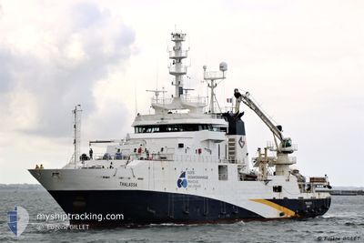
THALASSA
Fishery Research Vessel
Current Trip
| Trip Time | 4 days |
|---|---|
| Trip Distance | 249.43 nm |
| AVG Speed | 7.5 Noeuds |
| MAX Speed | 13.1 Noeuds |
| Tirant d eau | 5.9 m |
| AVG Wind | 12.4 knots |
| MAX Wind | 20 knots |
| MIN Temp | 9.4°C / 48.92°F |
| MAX Temp | 13.1°C / 55.58°F |
| Position reçue | 2 m depuis |
Current Position
| Longitude | -4.48216° |
|---|---|
| Latitude | 48.38086° |
| Etat | Moored |
| Vitesse | |
| Parcours | 75° |
| Zone | Celtic Sea |
| Station | T-AIS |
| Position reçue | 2 m depuis |
Info
Information
The current position of THALASSA is in Celtic Sea with coordinates 48.38086° / -4.48216° as reported on 2024-04-25 19:20 by AIS to our vessel tracker app. The vessel's current speed is 0 Noeuds and is currently inside the port of BREST.
The vessel THALASSA (IMO: 9070307, MMSI: 227297000) is a Fishery Research Vessel that was built in 1995 ( 29 Age ). It's sailing under the flag of [FR] France.
In this page you can find informations about the vessels current position, last detected port calls, and current voyage information. If the vessels is not in coverage by AIS you will find the latest position.
The current position of THALASSA is detected by our AIS receivers and we are not responsible for the reliability of the data. The last position was recorded while the vessel was in Coverage by the Ais receivers of our vessel tracking app.
The current draught of THALASSA as reported by AIS is 5.9 meters
Weather
| Temperature | 9.3°C / 48.74°F |
|---|---|
| Wind Speed | 6 knots |
| Direction | 262° W |
| Pressure | 1004.6 hPa |
| Humidity | 85.6 % |
| Cloud Coverage | 100 % |
Featured Company
Last Port Calls
| Port | Arrival | Departure | Time In Port |
|---|---|---|---|
| 2024-04-24 13:08 | |||
| 2024-04-16 12:45 | 2024-04-20 07:16 | 3 d | |
| 2024-02-12 07:09 | 2024-02-17 08:27 | 5 d | |
| 2024-02-09 15:22 | 2024-02-10 14:11 | 22 h |
Most Visited Ports (Last year)
| Port | Arrivals | |
|---|---|---|
| 14 | ||
| 3 | ||
| 3 | ||
| 1 | ||
| 1 | ||
| 1 |
Last Trips
| Origin | Departure | Destination | Arrival | Distance | |
|---|---|---|---|---|---|
| 2024-04-20 09:16 | 2024-04-24 15:08 | 249.43 nm | |||
| 2024-02-17 09:27 | 2024-04-16 14:45 | 1294.59 nm | |||
| 2024-02-10 15:11 | 2024-02-12 08:09 | 325.00 nm | |||
| 2024-01-30 18:09 | 2024-02-09 16:22 | 1336.57 nm |
Events
| Heure | Evenement | Détails | Position/ Destination | Info |
|---|---|---|---|---|
| 2024-04-24 13:32 | Etat Changé | Moored Under way using engine |
48.38066 / -4.48232
[FR] BREST
|
Vitesse: 0.3 kn Parcours: 70° |
| 2024-04-24 13:31 | Arret |
48.38063 / -4.48237
[FR] BREST
|
Vitesse: 0.3 kn Parcours: 70° |
|
| 2024-04-24 13:08 | Port d'arrivée |
|
48.36840 / -4.48735
[FR] BREST
|
Vitesse: 6 kn Parcours: 337.5° |
| 2024-04-24 09:36 | Etat Changé | Under way using engine Engaged in Fishing |
48.12954 / -4.47005
FR BES
|
Vitesse: 5.5 kn Parcours: 278.7° |
| 2024-04-24 08:33 | Etat Changé | Engaged in Fishing Under way using engine |
48.13477 / -4.37142
FR BES
|
Vitesse: 5.5 kn Parcours: 238.5° |
| 2024-04-24 05:11 | Changement d'ETA | 2024/04/24 15:00 2024/04/24 12:45 |
48.09101 / -5.21736
FR BES
|
Vitesse: 12.2 kn Parcours: 84.9° |
| 2024-04-24 01:13 | Dans la zone couverte |
48.00311 / -6.38778
Celtic Sea
FR BES
|
Vitesse: 10 kn Parcours: 89.6° |
|
| 2024-04-21 21:30 | Hors de la zone couverte |
48.18474 / -5.85641
Celtic Sea
FR BES
|
Vitesse: 4.6 kn Parcours: 120.2° |
|
| 2024-04-21 21:00 | Dans la zone couverte |
48.18913 / -5.85956
Celtic Sea
FR BES
|
Vitesse: 5.7 kn Parcours: 297.5° |
|
| 2024-04-21 19:38 | Hors de la zone couverte |
48.18686 / -5.89155
Celtic Sea
FR BES
|
Vitesse: 3.5 kn Parcours: 110.9° |