
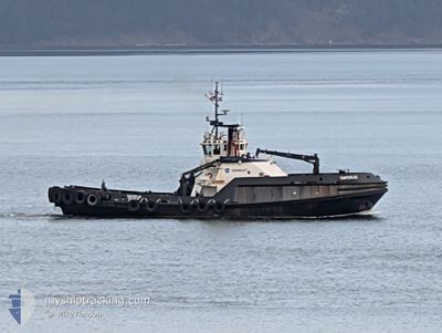
TANERLIQ
Tug
Current Trip
US^0UN8>0U5Q
| Time Travelled | 4 h, 34 mins |
|---|---|
| Remaining Time | --- |
| Distance Travelled | 51.25 nm |
| Remaining Distance | --- |
| AVG Speed | 12 Knots |
| MAX Speed | 14.1 Knots |
| AVG Wind | 14.8 knots |
| MAX Wind | 20 knots |
| MIN Temp | 9.7°C / 49.46°F |
| MAX Temp | 10.2°C / 50.36°F |
| Draught | 7 m |
| Position Received | Now |
Current Position
| Longitude | --- |
|---|---|
| Latitude | --- |
| Status | Under way using engine |
| Speed | 8.9 Knots |
| Course | 57.9° |
| Area | The Coastal Waters of Southeast Alaska and British Columbia |
| Station | T-AIS |
| Position Received | Now |
Info
Information
The current position of TANERLIQ is in The Coastal Waters of Southeast Alaska and British Columbia with coordinates 48.34310° / -122.93359° as reported on 2025-12-06 21:57 by AIS to our vessel tracker app. The vessel's current speed is 8.9 Knots
The vessel TANERLIQ (IMO: 9178445, MMSI: 366760670) is a Tug It's sailing under the flag of [US] USA.
In this page you can find informations about the vessels current position, last detected port calls, and current voyage information. If the vessels is not in coverage by AIS you will find the latest position.
The current position of TANERLIQ is detected by our AIS receivers and we are not responsible for the reliability of the data. The last position was recorded while the vessel was in Coverage by the Ais receivers of our vessel tracking app.
The current draught of TANERLIQ as reported by AIS is 7 meters
Weather
| Temperature | 10.1°C / 50.18°F |
|---|---|
| Wind Speed | 4 knots |
| Direction | 211° SSW |
| Pressure | 1015 hPa |
| Humidity | 80.7 % |
| Cloud Coverage | 38 % |
Featured Company
Last Port Calls
| Port | Arrival | Departure | Time In Port |
|---|---|---|---|
| 2025-12-06 08:35 | 2025-12-06 09:23 | 48 m | |
| 2025-12-05 19:37 | 2025-12-05 20:15 | 38 m | |
| 2025-12-05 07:41 | 2025-12-05 09:11 | 1 h | |
| 2025-12-04 14:19 | 2025-12-04 15:16 | 57 m | |
| 2025-12-04 12:56 | 2025-12-04 13:09 | 12 m | |
| 2025-12-04 09:29 | 2025-12-04 10:04 | 34 m | |
| 2025-12-04 07:29 | 2025-12-04 08:31 | 1 h | |
| 2025-12-02 20:00 | 2025-12-02 20:51 | 51 m | |
| 2025-12-01 11:17 | 2025-12-02 09:12 | 21 h | |
| 2025-12-01 08:56 | 2025-12-01 09:40 | 43 m |
Most Visited Ports (Last year)
| Port | Arrivals | |
|---|---|---|
| 179 | ||
| 172 | ||
| 64 | ||
| 42 | ||
| 20 | ||
| 12 |
Last Trips
| Origin | Departure | Destination | Arrival | Distance | |
|---|---|---|---|---|---|
| 2025-12-05 20:15 | 2025-12-06 08:35 | 11.21 nm | |||
| 2025-12-05 09:11 | 2025-12-05 19:37 | 1.81 nm | |||
| 2025-12-04 15:16 | 2025-12-05 07:41 | 4.47 nm | |||
| 2025-12-04 13:09 | 2025-12-04 14:19 | 3.51 nm | |||
| 2025-12-04 10:04 | 2025-12-04 12:56 | 2.38 nm | |||
| 2025-12-04 08:31 | 2025-12-04 09:29 | 3.11 nm | |||
| 2025-12-02 20:51 | 2025-12-04 07:29 | 5.34 nm | |||
| 2025-12-02 09:12 | 2025-12-02 20:00 | 24.52 nm | |||
| 2025-12-01 09:40 | 2025-12-01 11:17 | 15.13 nm | |||
| 2025-11-30 21:03 | 2025-12-01 08:56 | 83.37 nm |
Events
| Time | Event | Details | Position / Dest | Info |
|---|---|---|---|---|
| 2025-12-06 21:11 | Destination Changed | US^0UN8>0U5Q US^0UN8> |
48.28029 / -123.07605
US^0UN8>0U5Q
|
Speed: 8.6 kn Course: 57.6° |
| 2025-12-06 17:23 | PORT DEPARTURE |
|
48.85943 / -122.76859
US^0UN8>
|
Speed: 6.2 kn Course: 355° |
| 2025-12-06 17:20 | START Moving |
48.86248 / -122.76633
[US] CHERRY POINT
|
Speed: 3.5 kn Course: 54° |
|
| 2025-12-06 16:42 | STOP Moving |
48.86125 / -122.76416
[US] CHERRY POINT
|
Speed: 0.2 kn Course: 320° |
|
| 2025-12-06 16:35 | PORT ARRIVAL |
|
48.86196 / -122.76770
[US] CHERRY POINT
|
Speed: 0.6 kn Course: 279° |
| 2025-12-06 15:48 | START Moving | 2.99 nm, North West of CHERRY POINT |
48.90648 / -122.79167
US^0UN8>
|
Speed: 5.5 kn Course: 242.3° |
| 2025-12-06 15:45 | Status Changed | Under way using engine At anchor |
48.90772 / -122.78850
US^0UN8>
|
Speed: 0.3 kn Course: 177° |
| 2025-12-06 14:31 | Status Changed | At anchor Default |
48.90835 / -122.78795
US^0UN8>
|
Speed: Course: -1° |
| 2025-12-06 14:29 | Status Changed | Default At anchor |
48.90833 / -122.78667
US^0UN8>
|
Speed: 0.1 kn Course: 267° |
| 2025-12-06 13:52 | Destination Changed | US^0UN8> US^0UN8>02JK |
48.90839 / -122.78802
US^0UN8>
|
Speed: 0.1 kn Course: 262° |