

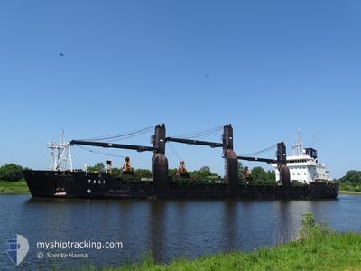
TALI
General Cargo

Current Trip
| Time Travelled | 2 days |
|---|---|
| Remaining Time | --- |
| Distance Travelled | 658.61 nm |
| Remaining Distance | --- |
| AVG Speed | 9.4 Knots |
| MAX Speed | 14.1 Knots |
| AVG Wind | 10.3 knots |
| MAX Wind | 25 knots |
| MIN Temp | 4.2°C / 39.56°F |
| MAX Temp | 9.6°C / 49.28°F |
| Draught | 6.3 m |
| Position Received | 1 m ago |
Current Position
| Longitude | --- |
|---|---|
| Latitude | --- |
| Status | Under way using engine |
| Speed | 9.3 Knots |
| Course | 53.1° |
| Area | North Sea |
| Station | T-AIS |
| Position Received | 1 m ago |
Information
The current position of TALI is in North Sea with coordinates 59.07981° / 5.36709° as reported on 2025-03-31 11:38 by AIS to our vessel tracker app. The vessel's current speed is 9.3 Knots and is heading at the port of JELSA. The estimated time of arrival as calculated by MyShipTracking vessel tracking app is 2025-03-31 18:00 LT
The vessel TALI (IMO: 9173692, MMSI: 230916000) is a General Cargo that was built in 1998 ( 27 years old ). It's sailing under the flag of [FI] Finland.
In this page you can find informations about the vessels current position, last detected port calls, and current voyage information. If the vessels is not in coverage by AIS you will find the latest position.
The current position of TALI is detected by our AIS receivers and we are not responsible for the reliability of the data. The last position was recorded while the vessel was in Coverage by the Ais receivers of our vessel tracking app.
The current draught of TALI as reported by AIS is 6.3 meters
Weather
| Temperature | 5.9°C / 42.62°F |
|---|---|
| Wind Speed | 5 knots |
| Direction | 334° NNW |
| Pressure | 1026.2 hPa |
| Humidity | 82.3 % |
| Cloud Coverage | 90 % |


Featured Company
Last Port Calls
| Port | Arrival | Departure | Time In Port |
|---|---|---|---|
| 2025-03-26 20:22 | 2025-03-28 12:55 | 1 d | |
| 2025-03-21 07:10 | 2025-03-22 05:23 | 22 h | |
| 2025-03-15 12:39 | 2025-03-16 09:13 | 20 h | |
| 2025-03-08 04:38 | 2025-03-10 19:25 | 2 d | |
| 2025-02-28 09:21 | 2025-03-01 20:28 | 1 d | |
| 2025-02-17 23:46 | 2025-02-20 01:12 | 2 d | |
| 2025-02-15 06:31 | 2025-02-17 23:25 | 2 d | |
| 2025-02-11 11:43 | 2025-02-13 12:42 | 2 d | |
| 2025-02-10 13:52 | 2025-02-11 01:50 | 11 h | |
| 2025-02-07 11:51 | 2025-02-08 12:37 | 1 d |
Last Trips
| Origin | Departure | Destination | Arrival | Distance | |
|---|---|---|---|---|---|
| 2025-03-22 05:23 | 2025-03-26 20:22 | 519.60 nm | |||
| 2025-03-16 09:13 | 2025-03-21 07:10 | 895.37 nm | |||
| 2025-03-10 19:25 | 2025-03-15 12:39 | 1008.07 nm | |||
| 2025-03-01 20:28 | 2025-03-08 04:38 | 1381.37 nm | |||
| 2025-02-20 01:12 | 2025-02-28 09:21 | 1424.72 nm | |||
| 2025-02-17 23:25 | 2025-02-17 23:46 | 0.65 nm | |||
| 2025-02-13 12:42 | 2025-02-15 06:31 | 445.04 nm | |||
| 2025-02-11 01:50 | 2025-02-11 11:43 | 77.80 nm | |||
| 2025-02-08 12:37 | 2025-02-10 13:52 | 517.23 nm | |||
| 2025-02-06 11:45 | 2025-02-07 11:51 | 87.17 nm |
Events
| Time | Event | Details | Position / Dest | Info |
|---|---|---|---|---|
| 2025-03-31 00:33 | Detected in Sea | Norwegian part of the North Sea |
57.78968 / 7.36736
North Sea
NOJEL
|
Speed: 9.7 kn Course: 272.9° |
| 2025-03-30 18:55 | Detected in Sea | Norwegian part of the Skaggerak |
57.83002 / 9.10798
Skaggerak
NOJEL
|
Speed: 10.9 kn Course: 268.3° |
| 2025-03-30 13:46 | Change Sea Area | Danish part of the Skaggerak Danish part of the Kattegat |
57.80089 / 10.93540
Skaggerak
NOJEL
|
Speed: 10.8 kn Course: 318.4° |
| 2025-03-30 12:43 | Detected in Sea | Danish part of the Kattegat |
57.65982 / 11.19676
Kattegat
NOJEL
|
Speed: 11.8 kn Course: 316.4° |
| 2025-03-29 22:56 | Change Sea Area | Swedish part of the Kattegat Danish part of the Kattegat |
55.80747 / 12.73021
Kattegat
NOJEL
|
Speed: 9 kn Course: 18.1° |
| 2025-03-29 20:38 | Change Sea Area | Danish part of the Kattegat Swedish part of the Kattegat |
55.48834 / 12.71233
Kattegat
NOJEL
|
Speed: 9.5 kn Course: 14.4° |
| 2025-03-29 19:41 | Change Sea Area | Swedish part of the Kattegat Swedish part of the Baltic Sea |
55.33942 / 12.67522
Kattegat
NOJEL
|
Speed: 9.4 kn Course: 345° |
| 2025-03-29 14:02 | Draught Changed | 6.3 6.2 |
54.99421 / 13.91299
NOJEL
|
Speed: 6.2 kn Course: 294.5° |
| 2025-03-29 13:32 | Change Sea Area | Swedish part of the Baltic Sea Danish part of the Kattegat |
54.97221 / 13.99693
Baltic Sea
NOJEL
|
Speed: 6.1 kn Course: 293.8° |
| 2025-03-29 06:49 | Change Sea Area | Danish part of the Kattegat Polish part of the Baltic Sea |
54.86358 / 15.37669
Kattegat
NOJEL
|
Speed: 7.7 kn Course: 271° |