
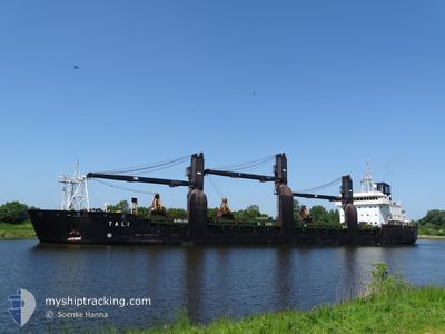
TALI
General Cargo
Current Trip
| Time Travelled | 10 h, 43 mins |
|---|---|
| Remaining Time | --- |
| Distance Travelled | 124.31 nm |
| Remaining Distance | --- |
| AVG Speed | 12 Noeuds |
| MAX Speed | 12.9 Noeuds |
| AVG Wind | 9.5 knots |
| MAX Wind | 14.6 knots |
| MIN Temp | 9.4°C / 48.92°F |
| MAX Temp | 16.1°C / 60.98°F |
| Tirant d eau | 7.9 m |
| Position reçue | 4 h, 32 m depuis |
Current Position
| Longitude | 21.07897° |
|---|---|
| Latitude | 59.45201° |
| Etat | Under way using engine |
| Vitesse | 11.4 Noeuds |
| Parcours | 206.5° |
| Zone | Baltic Sea |
| Station | T-AIS |
| Position reçue | 4 h, 32 m depuis |
Info
Information
The current position of TALI is in Baltic Sea with coordinates 59.45201° / 21.07897° as reported on 2024-05-17 21:18 by AIS to our vessel tracker app. The vessel's current speed is 11.4 Noeuds and is heading at the port of PASAJES. The estimated time of arrival as calculated by MyShipTracking vessel tracking app is 2024-05-26 20:00 LT
The vessel TALI (IMO: 9173692, MMSI: 230916000) is a General Cargo that was built in 1998 ( 26 Age ). It's sailing under the flag of [FI] Finland.
In this page you can find informations about the vessels current position, last detected port calls, and current voyage information. If the vessels is not in coverage by AIS you will find the latest position.
The current position of TALI is detected by our AIS receivers and we are not responsible for the reliability of the data. The last position was recorded while the vessel was in Coverage by the Ais receivers of our vessel tracking app.
The current draught of TALI as reported by AIS is 7.9 meters
Weather
| Temperature | 9.9°C / 49.82°F |
|---|---|
| Wind Speed | 5 knots |
| Direction | 61° ENE |
| Pressure | 1021.2 hPa |
| Humidity | 66.4 % |
| Cloud Coverage | 6 % |
Featured Company
Last Port Calls
| Port | Arrival | Departure | Time In Port |
|---|---|---|---|
| 2024-05-12 20:00 | 2024-05-17 15:07 | 4 d | |
| 2024-05-09 16:47 | 2024-05-11 02:58 | 1 d | |
| 2024-05-06 07:13 | 2024-05-07 08:47 | 1 d | |
| 2024-05-01 19:27 | 2024-05-03 05:58 | 1 d | |
| 2024-04-23 15:30 | 2024-04-24 12:43 | 21 h | |
| 2024-04-20 15:38 | 2024-04-20 16:57 | 1 h | |
| 2024-04-19 13:29 | 2024-04-20 14:30 | 1 d | |
| 2024-04-17 10:04 | 2024-04-19 00:44 | 1 d | |
| 2024-04-07 13:29 | 2024-04-10 19:11 | 3 d | |
| 2024-04-05 13:29 | 2024-04-07 06:13 | 1 d |
Last Trips
| Origin | Departure | Destination | Arrival | Distance | |
|---|---|---|---|---|---|
| 2024-05-11 04:58 | 2024-05-12 23:00 | 509.37 nm | |||
| 2024-05-07 10:47 | 2024-05-09 18:47 | 595.37 nm | |||
| 2024-05-03 06:58 | 2024-05-06 09:13 | 708.70 nm | |||
| 2024-04-24 14:43 | 2024-05-01 20:27 | 1751.14 nm | |||
| 2024-04-20 18:57 | 2024-04-23 17:30 | 736.72 nm | |||
| 2024-04-20 16:30 | 2024-04-20 17:38 | 4.92 nm | |||
| 2024-04-19 02:44 | 2024-04-19 15:29 | 145.00 nm | |||
| 2024-04-10 22:11 | 2024-04-17 12:04 | 1282.27 nm | |||
| 2024-04-07 09:13 | 2024-04-07 16:29 | 72.08 nm | |||
| 2024-04-05 01:29 | 2024-04-05 16:29 | 83.91 nm |
Events
| Heure | Evenement | Détails | Position/ Destination | Info |
|---|---|---|---|---|
| 2024-05-17 21:24 | Etat Changé | Default Under way using engine |
59.43266 / 21.05972
ES PAS
|
Vitesse: 11.4 kn Parcours: 206.5° |
| 2024-05-17 21:18 | Etat Changé | Under way using engine Default |
59.45201 / 21.07897
ES PAS
|
Vitesse: 11.4 kn Parcours: 206° |
| 2024-05-17 21:18 | Hors de la zone couverte |
59.45201 / 21.07897
Baltic Sea
ES PAS
|
Vitesse: 11.4 kn Parcours: 206.5° |
|
| 2024-05-17 21:13 | Etat Changé | Default Under way using engine |
59.46629 / 21.09280
ES PAS
|
Vitesse: 11.4 kn Parcours: 205.9° |
| 2024-05-17 19:47 | Changement de zone | Finnish part of the Baltic Sea Finnish part of the Gulf of Bothnia |
59.70663 / 21.33270
Baltic Sea
ES PAS
|
Vitesse: 11.5 kn Parcours: 190.2° |
| 2024-05-17 16:43 | Etat Changé | Under way using engine Moored |
60.22293 / 21.74500
ES PAS
|
Vitesse: 12.3 kn Parcours: 260.7° |
| 2024-05-17 15:07 | PORT DE DEPART |
|
60.45133 / 22.06035
ES PAS
|
Vitesse: 8.5 kn Parcours: 130° |
| 2024-05-17 15:04 | Démarrage |
60.45548 / 22.05066
[FI] NAANTALI
|
Vitesse: 3.6 kn Parcours: 130° |
|
| 2024-05-17 14:27 | Changement d'ETA | 2024/05/26 20:00 2024/05/13 00:00 |
60.45731 / 22.04843
[FI] NAANTALI
|
Vitesse: Parcours: 288° |
| 2024-05-17 14:27 | Changement de destination | ES PAS FI NLI |
60.45731 / 22.04843
[FI] NAANTALI
|
Vitesse: Parcours: 288° |