

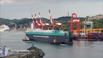
TAIPAN
Vehicles Carrier
Current Trip
| Time Travelled | 1 day |
|---|---|
| Remaining Time | 22 h, 48 mins |
| Distance Travelled | 412.43 nm |
| Remaining Distance | 291.09 nm |
| AVG Speed | 13.5 Knots |
| MAX Speed | 15 Knots |
| AVG Wind | 13.9 knots |
| MAX Wind | 21 knots |
| MIN Temp | 5.6°C / 42.08°F |
| MAX Temp | 8°C / 46.4°F |
| Draught | 9.5 m |
| Position Received | 6 h, 16 m ago |
Current Position
| Longitude | --- |
|---|---|
| Latitude | --- |
| Status | Under way using engine |
| Speed | 12.4 Knots |
| Course | 211.8° |
| Area | North Sea |
| Station | T-AIS |
| Position Received | 6 h, 16 m ago |
Information
The current position of TAIPAN is in North Sea with coordinates 54.44369° / 4.86217° as reported on 2025-03-27 16:14 by AIS to our vessel tracker app. The vessel's current speed is 12.4 Knots and is heading at the port of SOUTHAMPTON. The estimated time of arrival as calculated by MyShipTracking vessel tracking app is 2025-03-28 21:19 LT
The vessel TAIPAN (IMO: 9311866, MMSI: 308921000) is a Vehicles Carrier that was built in 2006 ( 19 years old ). It's sailing under the flag of [BS] Bahamas.
In this page you can find informations about the vessels current position, last detected port calls, and current voyage information. If the vessels is not in coverage by AIS you will find the latest position.
The current position of TAIPAN is detected by our AIS receivers and we are not responsible for the reliability of the data. The last position was recorded while the vessel was in Coverage by the Ais receivers of our vessel tracking app.
The current draught of TAIPAN as reported by AIS is 9.5 meters
Weather
| Temperature | 8°C / 46.4°F |
|---|---|
| Wind Speed | 18 knots |
| Direction | 207° SSW |
| Pressure | 1013.9 hPa |
| Humidity | 91 % |
| Cloud Coverage | 44 % |
Featured Company
Last Port Calls
| Port | Arrival | Departure | Time In Port |
|---|---|---|---|
| 2025-03-26 04:25 | 2025-03-26 17:25 | 12 h | |
| 2025-03-24 03:41 | 2025-03-25 00:58 | 21 h | |
| 2025-03-19 10:22 | 2025-03-23 02:04 | 3 d | |
| 2025-03-17 05:09 | 2025-03-18 20:17 | 1 d | |
| 2025-03-14 05:13 | 2025-03-15 20:14 | 1 d | |
| 2025-02-04 16:52 | 2025-02-05 05:21 | 12 h | |
| 2025-01-26 18:50 | 2025-01-27 16:53 | 22 h | |
| 2025-01-26 06:53 | 2025-01-26 18:11 | 11 h | |
| 2025-01-25 06:59 | 2025-01-25 16:10 | 9 h |
Most Visited Ports (Last year)
| Port | Arrivals | |
|---|---|---|
| 3 | ||
| 2 | ||
| 2 | ||
| 2 | ||
| 2 | ||
| 2 |
Last Trips
| Origin | Departure | Destination | Arrival | Distance | |
|---|---|---|---|---|---|
| 2025-03-25 00:58 | 2025-03-26 04:25 | 375.05 nm | |||
| 2025-03-23 02:04 | 2025-03-24 03:41 | 311.34 nm | |||
| 2025-03-18 20:17 | 2025-03-19 10:22 | 213.55 nm | |||
| 2025-03-15 20:14 | 2025-03-17 05:09 | 405.83 nm | |||
| 2025-02-05 05:21 | 2025-03-14 05:13 | 13964.56 nm | |||
| 2025-01-27 16:53 | 2025-02-04 16:52 | 948.99 nm | |||
| 2025-01-26 18:11 | 2025-01-26 18:50 | 8.14 nm | |||
| 2025-01-25 16:10 | 2025-01-26 06:53 | 204.61 nm | |||
| 2024-12-29 12:45 | 2025-01-25 06:59 | 10547.46 nm |
Events
| Time | Event | Details | Position / Dest | Info |
|---|---|---|---|---|
| 2025-03-27 16:19 | Status Changed | Default Under way using engine |
54.42811 / 4.84567
GB SOU
|
Speed: 12.4 kn Course: 211.8° |
| 2025-03-27 16:14 | OUT of Coverage |
54.44369 / 4.86217
North Sea
GB SOU
|
Speed: 12.4 kn Course: 211.8° |
|
| 2025-03-27 16:12 | Change Sea Area | Dutch part of the North Sea German part of the North Sea |
54.44956 / 4.86845
North Sea
GB SOU
|
Speed: 12.5 kn Course: 212.5° |
| 2025-03-27 16:12 | Status Changed | Under way using engine Default |
54.45054 / 4.86951
GB SOU
|
Speed: 12.5 kn Course: 212° |
| 2025-03-27 16:05 | IN Coverage |
54.44956 / 4.86845
North Sea
GB SOU
|
Speed: 12.5 kn Course: 212.5° |
|
| 2025-03-27 13:15 | Status Changed | Default Under way using engine |
55.04143 / 5.50556
GB SOU
|
Speed: 14.6 kn Course: 211.6° |
| 2025-03-27 13:12 | OUT of Coverage |
55.05255 / 5.51740
North Sea
GB SOU
|
Speed: 14.6 kn Course: 211.6° |
|
| 2025-03-27 11:10 | Detected in Sea | German part of the North Sea |
55.46505 / 5.98801
North Sea
GB SOU
|
Speed: 14.5 kn Course: 213.1° |
| 2025-03-27 01:50 | Change Sea Area | Danish part of the North Sea Danish part of the Skaggerak |
57.31855 / 8.23286
North Sea
GB SOU
|
Speed: 13.7 kn Course: 217.4° |
| 2025-03-26 18:58 | ETA Changed | 2025/03/28 21:05 2025/03/28 21:00 |
57.82216 / 10.88842
GB SOU
|
Speed: 14.4 kn Course: 294.1° |