
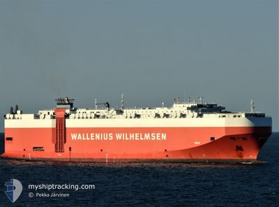
TAIPAN
Vehicles Carrier
Current Trip
| Trip Time | 2 days |
|---|---|
| Trip Distance | 748.94 nm |
| AVG Speed | 12.3 Knots |
| MAX Speed | 16 Knots |
| Dybgang | 8.3 m |
| AVG Wind | 10.7 knots |
| MAX Wind | 17.8 knots |
| MIN Temp | 13.1°C / 55.58°F |
| MAX Temp | 30.2°C / 86.36°F |
| Position Modtaget | 1 h, 32 m siden |
Current Position
| Longitude | -75.14023° |
|---|---|
| Latitude | 39.89627° |
| Status | Under way using engine |
| Fart | |
| Kurs | 278° |
| Område | North Atlantic Ocean |
| Station | T-AIS |
| Position Modtaget | 1 h, 32 m siden |
Info
Information
The current position of TAIPAN is in North Atlantic Ocean with coordinates 39.89627° / -75.14023° as reported on 2024-04-29 18:24 by AIS to our vessel tracker app. The vessel's current speed is 0 Knots and is currently inside the port of PHILADELPHIA.
The vessel TAIPAN (IMO: 9311866, MMSI: 308921000) is a Vehicles Carrier that was built in 2006 ( 18 år gamle ). It's sailing under the flag of [BS] Bahamas.
In this page you can find informations about the vessels current position, last detected port calls, and current voyage information. If the vessels is not in coverage by AIS you will find the latest position.
The current position of TAIPAN is detected by our AIS receivers and we are not responsible for the reliability of the data. The last position was recorded while the vessel was in Coverage by the Ais receivers of our vessel tracking app.
The current draught of TAIPAN as reported by AIS is 8.3 meters
Weather
| Temperature | 30.8°C / 87.44°F |
|---|---|
| Wind Speed | 6 knots |
| Direction | 300° WNW |
| Pressure | 1014.5 hPa |
| Humidity | 36.1 % |
| Cloud Coverage | 28 % |
Featured Company
Last Port Calls
| Port | Arrival | Departure | Time In Port |
|---|---|---|---|
| 2024-04-29 18:02 | |||
| 2024-04-26 19:23 | 2024-04-27 07:29 | 12 h | |
| 2024-03-19 12:35 | 2024-03-22 07:38 | 2 d | |
| 2024-02-28 06:51 | 2024-03-03 00:57 | 3 d | |
| 2024-02-22 10:17 | 2024-02-25 15:29 | 3 d | |
| 2024-02-02 08:49 | 2024-02-05 09:14 | 3 d |
Most Visited Ports (Last year)
| Port | Arrivals | |
|---|---|---|
| 4 | ||
| 4 | ||
| 3 | ||
| 3 | ||
| 3 | ||
| 3 |
Last Trips
| Origin | Departure | Destination | Arrival | Distance | |
|---|---|---|---|---|---|
| 2024-04-27 03:29 | 2024-04-29 14:02 | 748.94 nm | |||
| 2024-03-22 16:38 | 2024-04-26 15:23 | 10529.82 nm | |||
| 2024-03-02 16:57 | 2024-03-19 21:35 | 5237.11 nm | |||
| 2024-02-25 07:29 | 2024-02-27 22:51 | 36.99 nm | |||
| 2024-02-05 18:14 | 2024-02-22 02:17 | 4703.42 nm | |||
| 2024-01-30 17:37 | 2024-02-02 17:49 | 522.25 nm |
Events
| Tid | Hændelsen | Detaljer | Position / Dest | Info |
|---|---|---|---|---|
| 2024-04-29 18:30 | Status er ændret | Default Under way using engine |
39.89628 / -75.14023
[US] PHILADELPHIA
|
Fart: Kurs: 278° |
| 2024-04-29 18:24 | Udenfor Dækning |
39.89627 / -75.14023
North Atlantic Ocean
[US] PHILADELPHIA
|
Fart: Kurs: 16.9° |
|
| 2024-04-29 18:21 | STOP Sejllads |
39.89619 / -75.14002
[US] PHILADELPHIA
|
Fart: 0.3 kn Kurs: 282° |
|
| 2024-04-29 18:02 | Skibe i havn |
|
39.89373 / -75.13621
[US] PHILADELPHIA
|
Fart: 6.7 kn Kurs: 42.3° |
| 2024-04-29 16:49 | Status er ændret | Under way using engine Default |
39.84506 / -75.34252
USPHL
|
Fart: 11.9 kn Kurs: 59° |
| 2024-04-29 16:49 | Indenfor Dækning |
39.84506 / -75.34252
North Atlantic Ocean
|
Fart: 11.6 kn Kurs: 60.7° |
|
| 2024-04-29 13:14 | Status er ændret | Default Under way using engine |
39.34793 / -75.43491
USPHL
|
Fart: 7.8 kn Kurs: 318.7° |
| 2024-04-29 13:07 | Udenfor Dækning |
39.33834 / -75.42376
North Atlantic Ocean
USPHL
|
Fart: 7.8 kn Kurs: 318.7° |
|
| 2024-04-29 09:41 | Status er ændret | Under way using engine Default |
38.76355 / -74.98556
USPHL
|
Fart: 8.9 kn Kurs: 301° |
| 2024-04-29 09:26 | Status er ændret | Default Under way using engine |
38.74267 / -74.94772
USPHL
|
Fart: 9.3 kn Kurs: 320.2° |