
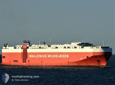
TAIPAN
Vehicles Carrier
Current Trip
| Time Travelled | 25 days |
|---|---|
| Remaining Time | --- |
| Distance Travelled | 8216.72 nm |
| Remaining Distance | 685.08 nm |
| AVG Speed | 13.3 Knop |
| MAX Speed | 18.4 Knop |
| AVG Wind | 14.7 knots |
| MAX Wind | 30 knots |
| MIN Temp | 10.7°C / 51.26°F |
| MAX Temp | 29.6°C / 85.28°F |
| Djupgående | 8.9 m |
| Position mottagen | 3 d sen |
Current Position
| Longitud | -105.68004° |
|---|---|
| Latitude | 19.26679° |
| Status | Under way using engine |
| Fart | 14 Knop |
| Kurs | 124.8° |
| Område | North Pacific Ocean |
| Station | T-AIS |
| Position mottagen | 3 d sen |
Info
Information
The current position of TAIPAN is in North Pacific Ocean with coordinates 19.26679° / -105.68004° as reported on 2024-04-12 21:37 by AIS to our vessel tracker app. The vessel's current speed is 14 Knop and is heading at the port of BALBOA. The estimated time of arrival as calculated by MyShipTracking vessel tracking app is 2024-04-18 22:00 LT
The vessel TAIPAN (IMO: 9311866, MMSI: 308921000) is a Vehicles Carrier that was built in 2006 ( 18 År gammal ). It's sailing under the flag of [BS] Bahamas.
In this page you can find informations about the vessels current position, last detected port calls, and current voyage information. If the vessels is not in coverage by AIS you will find the latest position.
The current position of TAIPAN is detected by our AIS receivers and we are not responsible for the reliability of the data. The last position was recorded while the vessel was in Coverage by the Ais receivers of our vessel tracking app.
The current draught of TAIPAN as reported by AIS is 8.9 meters
Weather
| Temperature | 25.2°C / 77.36°F |
|---|---|
| Wind Speed | 19 knots |
| Direction | 77° ENE |
| Pressure | 1009.5 hPa |
| Humidity | 88.2 % |
| Cloud Coverage | 12 % |
Featured Company
Most Visited Ports (Last year)
| Port | Arrivals | |
|---|---|---|
| 4 | ||
| 4 | ||
| 3 | ||
| 3 | ||
| 3 | ||
| 3 |
Events
| Tid | Event | Detaljer | Position / Dest | Information |
|---|---|---|---|---|
| 2024-04-15 22:04 | STARTAR förflyttning |
11.87954 / -90.90536
PABLB
|
Fart: 4.7 kn Kurs: 79° |
|
| 2024-04-15 21:56 | STOPPAR förflyttning |
11.87667 / -90.90667
PABLB
|
Fart: Kurs: -1° |
|
| 2024-04-12 21:51 | Status ändrad | Default Under way using engine |
19.23617 / -105.63281
PABLB
|
Fart: 14 kn Kurs: 124.8° |
| 2024-04-12 21:37 | UTANFÖR täckningsområde |
19.26679 / -105.68004
North Pacific Ocean
PABLB
|
Fart: 14 kn Kurs: 124.8° |
|
| 2024-04-12 21:36 | Status ändrad | Under way using engine Default |
19.26753 / -105.68116
PABLB
|
Fart: 14 kn Kurs: 125° |
| 2024-04-12 20:57 | Status ändrad | Default Under way using engine |
19.35659 / -105.81613
PABLB
|
Fart: 14.1 kn Kurs: 124.4° |
| 2024-04-12 20:54 | Status ändrad | Under way using engine Default |
19.36261 / -105.82528
PABLB
|
Fart: 14 kn Kurs: 124° |
| 2024-04-12 20:39 | Status ändrad | Default Under way using engine |
19.39537 / -105.87554
PABLB
|
Fart: 13.9 kn Kurs: 123.8° |
| 2024-04-12 20:30 | Status ändrad | Under way using engine Default |
19.41668 / -105.90854
PABLB
|
Fart: 13.7 kn Kurs: 126° |
| 2024-04-12 19:15 | UTANFÖR täckningsområde |
19.58371 / -106.15932
North Pacific Ocean
PABLB
|
Fart: 13.8 kn Kurs: 125.1° |