
TAGUS RIVER
General Cargo
Current Trip
| Time Travelled | 1 day |
|---|---|
| Remaining Time | 1 day |
| Distance Travelled | 204.28 nm |
| Remaining Distance | 268.86 nm |
| AVG Speed | 8 Knots |
| MAX Speed | 8.7 Knots |
| AVG Wind | 11.1 knots |
| MAX Wind | 21.6 knots |
| MIN Temp | 16.8°C / 62.24°F |
| MAX Temp | 17.9°C / 64.22°F |
| Draught | 0.4 m |
| Position Received | 10 m ago |
Current Position
| Longitude | -8.90766° |
|---|---|
| Latitude | 36.69134° |
| Status | Under way using engine |
| Speed | 8.2 Knots |
| Course | 288.5° |
| Area | North Atlantic Ocean |
| Station | T-AIS |
| Position Received | 10 m ago |
Info
Information
The current position of TAGUS RIVER is in North Atlantic Ocean with coordinates 36.69134° / -8.90766° as reported on 2024-05-21 20:19 by AIS to our vessel tracker app. The vessel's current speed is 8.2 Knots and is heading at the port of AVEIRO. The estimated time of arrival as calculated by MyShipTracking vessel tracking app is 2024-05-23 06:08 LT
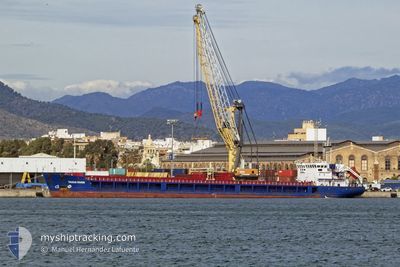
The vessel TAGUS RIVER (IMO: 9368596, MMSI: 351365000) is a General Cargo that was built in 2007 ( 17 years old ). It's sailing under the flag of [PA] Panama.
In this page you can find informations about the vessels current position, last detected port calls, and current voyage information. If the vessels is not in coverage by AIS you will find the latest position.
The current position of TAGUS RIVER is detected by our AIS receivers and we are not responsible for the reliability of the data. The last position was recorded while the vessel was in Coverage by the Ais receivers of our vessel tracking app.
The current draught of TAGUS RIVER as reported by AIS is 0.4 meters
Weather
| Temperature | 16.8°C / 62.24°F |
|---|---|
| Wind Speed | 12 knots |
| Direction | 325° NW |
| Pressure | 1021.6 hPa |
| Humidity | 75.5 % |
| Cloud Coverage | --- |
Featured Company
Last Port Calls
| Port | Arrival | Departure | Time In Port |
|---|---|---|---|
| 2024-05-19 08:15 | 2024-05-20 20:29 | 1 d | |
| 2024-05-01 11:04 | 2024-05-08 22:15 | 7 d | |
| 2024-04-24 06:47 | 2024-04-30 17:48 | 6 d | |
| 2024-04-15 06:54 | 2024-04-19 16:43 | 4 d | |
| 2024-04-05 18:49 | 2024-04-10 12:18 | 4 d | |
| 2024-03-16 13:29 | 2024-03-18 08:45 | 1 d | |
| 2024-03-12 09:06 | 2024-03-12 19:36 | 10 h | |
| 2024-03-02 08:32 | 2024-03-05 12:05 | 3 d | |
| 2024-03-01 14:12 |
Last Trips
| Origin | Departure | Destination | Arrival | Distance | |
|---|---|---|---|---|---|
| 2024-05-08 22:15 | 2024-05-19 08:15 | 1886.27 nm | |||
| 2024-04-30 17:48 | 2024-05-01 11:04 | 140.51 nm | |||
| 2024-04-19 16:43 | 2024-04-24 06:47 | 662.24 nm | |||
| 2024-04-10 12:18 | 2024-04-15 06:54 | 639.41 nm | |||
| 2024-03-18 08:45 | 2024-04-05 18:49 | 409.70 nm | |||
| 2024-03-12 19:36 | 2024-03-16 13:29 | 268.67 nm | |||
| 2024-03-05 12:05 | 2024-03-12 09:06 | 1210.41 nm | |||
| 2024-03-01 14:12 | 2024-03-02 08:32 | 87.25 nm |
Events
| Time | Event | Details | Position / Dest | Info |
|---|---|---|---|---|
| 2024-05-21 20:26 | Status Changed | Default Under way using engine |
36.69718 / -8.92862
PT AVE
|
Speed: 8.2 kn Course: 288.5° |
| 2024-05-21 20:15 | Status Changed | Under way using engine Default |
36.68861 / -8.89791
PT AVE
|
Speed: 8.4 kn Course: 296° |
| 2024-05-21 20:07 | Status Changed | Default Under way using engine |
36.68025 / -8.87607
PT AVE
|
Speed: 8.3 kn Course: 294.1° |
| 2024-05-21 20:06 | Status Changed | Under way using engine Default |
36.67959 / -8.87428
PT AVE
|
Speed: 8.3 kn Course: 296° |
| 2024-05-21 20:02 | Status Changed | Default Under way using engine |
36.67618 / -8.86519
PT AVE
|
Speed: 8.1 kn Course: 294.6° |
| 2024-05-21 19:43 | Status Changed | Under way using engine Default |
36.65852 / -8.81570
PT AVE
|
Speed: 8.2 kn Course: 292° |
| 2024-05-21 19:43 | Status Changed | Default Under way using engine |
36.65777 / -8.81357
PT AVE
|
Speed: 8.2 kn Course: 292.8° |
| 2024-05-21 19:37 | Status Changed | Under way using engine Default |
36.65272 / -8.79877
PT AVE
|
Speed: 8.2 kn Course: 293° |
| 2024-05-21 19:34 | Status Changed | Default Under way using engine |
36.65047 / -8.79215
PT AVE
|
Speed: 8.2 kn Course: 292.3° |
| 2024-05-21 19:28 | Status Changed | Under way using engine Default |
36.64510 / -8.77588
PT AVE
|
Speed: 8.2 kn Course: 292° |