

TAGUS RIVER
General Cargo

Current Trip
| Time Travelled | 4 days |
|---|---|
| Remaining Time | --- |
| Distance Travelled | 613.80 nm |
| Remaining Distance | --- |
| AVG Speed | 6.1 Knop |
| MAX Speed | 8.4 Knop |
| AVG Wind | 17.2 knots |
| MAX Wind | 28.8 knots |
| MIN Temp | 13.1°C / 55.58°F |
| MAX Temp | 15.3°C / 59.54°F |
| Djupgående | 5.2 m |
| Position mottagen | 8 h, 11 m sen |
Current Position
| Longitud | --- |
|---|---|
| Latitude | --- |
| Status | Under way using engine |
| Fart | 7.2 Knop |
| Kurs | 114.9° |
| Område | Mediterranean Sea - Eastern Basin |
| Station | T-AIS |
| Position mottagen | 8 h, 11 m sen |
Information
The current position of TAGUS RIVER is in Mediterranean Sea - Eastern Basin with coordinates 37.48111° / 12.37938° as reported on 2025-03-08 03:21 by AIS to our vessel tracker app. The vessel's current speed is 7.2 Knop and is heading at the port of BURGAS. The estimated time of arrival as calculated by MyShipTracking vessel tracking app is 2025-03-14 08:00 LT
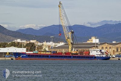
The vessel TAGUS RIVER (IMO: 9368596, MMSI: 351365000) is a General Cargo that was built in 2007 ( 18 År gammal ). It's sailing under the flag of [PA] Panama.
In this page you can find informations about the vessels current position, last detected port calls, and current voyage information. If the vessels is not in coverage by AIS you will find the latest position.
The current position of TAGUS RIVER is detected by our AIS receivers and we are not responsible for the reliability of the data. The last position was recorded while the vessel was in Coverage by the Ais receivers of our vessel tracking app.
The current draught of TAGUS RIVER as reported by AIS is 5.2 meters
Weather
| Temperature | 15.3°C / 59.54°F |
|---|---|
| Wind Speed | 4 knots |
| Direction | 328° NNW |
| Pressure | 1013.3 hPa |
| Humidity | 78.3 % |
| Cloud Coverage | 50 % |


Featured Company
Last Port Calls
| Port | Arrival | Departure | Time In Port |
|---|---|---|---|
| 2025-03-02 13:45 | 2025-03-03 21:30 | 1 d | |
| 2025-02-22 03:11 | 2025-02-26 19:41 | 4 d | |
| 2025-02-17 14:13 | 2025-02-19 17:24 | 2 d | |
| 2025-02-13 21:00 | 2025-02-14 19:29 | 22 h | |
| 2025-02-05 08:55 | 2025-02-07 10:26 | 2 d | |
| 2025-01-31 12:28 | 2025-02-01 23:20 | 1 d | |
| 2025-01-09 03:42 | 2025-01-16 20:20 | 7 d | |
| 2025-01-02 00:09 | 2025-01-03 10:17 | 1 d |
Last Trips
| Origin | Departure | Destination | Arrival | Distance | |
|---|---|---|---|---|---|
| 2025-02-26 20:41 | 2025-03-02 14:45 | 324.36 nm | |||
| 2025-02-19 18:24 | 2025-02-22 04:11 | 250.41 nm | |||
| 2025-02-14 20:29 | 2025-02-17 15:13 | 29.26 nm | |||
| 2025-02-07 10:26 | 2025-02-13 22:00 | 866.96 nm | |||
| 2025-02-02 00:20 | 2025-02-05 08:55 | 446.62 nm | |||
| 2025-01-16 23:20 | 2025-01-31 13:28 | 1980.49 nm | |||
| 2025-01-03 12:17 | 2025-01-09 06:42 | 201.50 nm | |||
| 2024-12-23 16:56 | 2025-01-02 02:09 | 1110.82 nm |
Events
| Tid | Event | Detaljer | Position / Dest | Information |
|---|---|---|---|---|
| 2025-03-08 03:27 | Status ändrad | Default Under way using engine |
37.47510 / 12.39339
BG BOJ
|
Fart: 7.2 kn Kurs: 114.9° |
| 2025-03-08 03:21 | UTANFÖR täckningsområde |
37.48111 / 12.37938
Mediterranean Sea - Eastern Basin
BG BOJ
|
Fart: 7.2 kn Kurs: 114.9° |
|
| 2025-03-08 00:49 | Byter havsområde | Italian part of the Mediterranean Sea - Eastern Basin Italian part of the Mediterranean Sea - Western Basin |
37.60584 / 12.05007
Mediterranean Sea - Eastern Basin
BG BOJ
|
Fart: 6.8 kn Kurs: 117.9° |
| 2025-03-07 22:50 | ETA ändrat | 2025/03/14 08:00 2025/03/12 06:00 |
37.70013 / 11.79692
BG BOJ
|
Fart: 6.7 kn Kurs: 115.1° |
| 2025-03-07 22:43 | Upptäckt i hav | Italian part of the Mediterranean Sea - Western Basin |
37.70484 / 11.78463
Mediterranean Sea - Western Basin
BG BOJ
|
Fart: 6.4 kn Kurs: 115.7° |
| 2025-03-07 22:43 | Status ändrad | Under way using engine Default |
37.70484 / 11.78463
BG BOJ
|
Fart: 6.2 kn Kurs: 103° |
| 2025-03-07 22:43 | I täckningsområde |
37.70484 / 11.78463
Mediterranean Sea - Western Basin
BG BOJ
|
Fart: 6.4 kn Kurs: 115.7° |
|
| 2025-03-04 01:16 | Status ändrad | Default Under way using engine |
40.90604 / 1.66778
BG BOJ
|
Fart: 6.5 kn Kurs: 115.6° |
| 2025-03-04 01:14 | UTANFÖR täckningsområde |
40.90731 / 1.66340
Balearic Sea
BG BOJ
|
Fart: 6.5 kn Kurs: 115.6° |
|
| 2025-03-04 00:21 | Status ändrad | Under way using engine Default |
40.94259 / 1.55225
BG BOJ
|
Fart: 6.1 kn Kurs: 110° |