
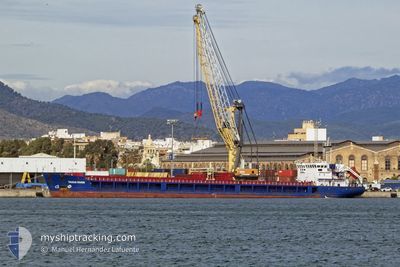
TAGUS RIVER
General Cargo
Current Trip
| Time Travelled | 2 days |
|---|---|
| Remaining Time | --- |
| Distance Travelled | 537.31 nm |
| Remaining Distance | --- |
| AVG Speed | 8.6 Knopen |
| MAX Speed | 9.7 Knopen |
| AVG Wind | 14.8 knots |
| MAX Wind | 27.5 knots |
| MIN Temp | 13°C / 55.4°F |
| MAX Temp | 18.9°C / 66.02°F |
| Diepgang | 5.1 M |
| Positie ontvangen | 35 m geleden |
Current Position
| Lengtegraad | 16.93507° |
|---|---|
| Breedtegraat | 38.32817° |
| Status | Under way using engine |
| Snelheid | 8.5 Knopen |
| Koers | 218.1° |
| Gebied | Ionian Sea |
| Station | T-AIS |
| Positie ontvangen | 35 m geleden |
Info
Information
The current position of TAGUS RIVER is in Ionian Sea with coordinates 38.32817° / 16.93507° as reported on 2024-05-11 11:22 by AIS to our vessel tracker app. The vessel's current speed is 8.5 Knopen
The vessel TAGUS RIVER (IMO: 9368596, MMSI: 351365000) is a General Cargo that was built in 2007 ( 17 Jaar oud ). It's sailing under the flag of [PA] Panama.
In this page you can find informations about the vessels current position, last detected port calls, and current voyage information. If the vessels is not in coverage by AIS you will find the latest position.
The current position of TAGUS RIVER is detected by our AIS receivers and we are not responsible for the reliability of the data. The last position was recorded while the vessel was in Coverage by the Ais receivers of our vessel tracking app.
The current draught of TAGUS RIVER as reported by AIS is 5.1 meters
Weather
| Temperature | 18.9°C / 66.02°F |
|---|---|
| Wind Speed | 5 knots |
| Direction | 70° ENE |
| Pressure | 1016.4 hPa |
| Humidity | 68.7 % |
| Cloud Coverage | 19 % |
Featured Company
Last Port Calls
| Port | Arrival | Departure | Time In Port |
|---|---|---|---|
| 2024-05-01 09:04 | 2024-05-08 20:15 | 7 d | |
| 2024-04-24 04:47 | 2024-04-30 15:48 | 6 d | |
| 2024-04-15 04:54 | 2024-04-19 14:43 | 4 d | |
| 2024-04-05 15:49 | 2024-04-10 09:18 | 4 d | |
| 2024-03-16 10:29 | 2024-03-18 05:45 | 1 d | |
| 2024-03-12 06:06 | 2024-03-12 16:36 | 10 h | |
| 2024-03-02 07:32 | 2024-03-05 11:05 | 3 d | |
| 2024-03-01 13:12 |
Last Trips
| Origin | Departure | Destination | Arrival | Distance | |
|---|---|---|---|---|---|
| 2024-04-30 17:48 | 2024-05-01 11:04 | 140.51 nm | |||
| 2024-04-19 16:43 | 2024-04-24 06:47 | 662.24 nm | |||
| 2024-04-10 12:18 | 2024-04-15 06:54 | 639.41 nm | |||
| 2024-03-18 08:45 | 2024-04-05 18:49 | 409.70 nm | |||
| 2024-03-12 19:36 | 2024-03-16 13:29 | 268.67 nm | |||
| 2024-03-05 12:05 | 2024-03-12 09:06 | 1210.41 nm | |||
| 2024-03-01 14:12 | 2024-03-02 08:32 | 87.25 nm |
Events
| Tijd | Evenement | Details | Positie / Bestemming | Info |
|---|---|---|---|---|
| 2024-05-11 11:32 | Status Changed | Default Under way using engine |
38.31057 / 16.91637
MA CAS
|
Snelheid: 8.5 kn Koers: 218.1° |
| 2024-05-11 11:22 | Status Changed | Under way using engine Default |
38.32817 / 16.93507
MA CAS
|
Snelheid: 8.5 kn Koers: 220° |
| 2024-05-11 11:22 | Binnenbereik |
38.32817 / 16.93507
Ionian Sea
MA CAS
|
Snelheid: 8.5 kn Koers: 218.1° |
|
| 2024-05-11 10:22 | Status Changed | Default Under way using engine |
38.43869 / 17.04771
MA CAS
|
Snelheid: 8.7 kn Koers: 216.6° |
| 2024-05-11 10:09 | Gevonden in zee | Italian part of the Ionian Sea |
38.46488 / 17.07342
Ionian Sea
MA CAS
|
Snelheid: 8.7 kn Koers: 216.6° |
| 2024-05-11 10:09 | Status Changed | Under way using engine Default |
38.46488 / 17.07342
MA CAS
|
Snelheid: 8.5 kn Koers: 219° |
| 2024-05-11 10:09 | Buitenbereik |
38.46488 / 17.07342
Ionian Sea
MA CAS
|
Snelheid: 8.7 kn Koers: 216.6° |
|
| 2024-05-11 09:51 | Binnenbereik |
38.46488 / 17.07342
Ionian Sea
MA CAS
|
Snelheid: 8.7 kn Koers: 216.6° |
|
| 2024-05-10 19:41 | Status Changed | Default Under way using engine |
40.07098 / 18.69943
MA CAS
|
Snelheid: 8.8 kn Koers: 178.8° |
| 2024-05-10 19:33 | Buitenbereik |
40.08931 / 18.69917
Adriatic Sea
MA CAS
|
Snelheid: 8.8 kn Koers: 178.8° |