
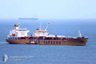
STOLT VISION
Oil/Chemical Tanker
Current Trip
| Time Travelled | 10 days |
|---|---|
| Remaining Time | 9 h, 59 mins |
| Distance Travelled | 1723.92 nm |
| Remaining Distance | 151.11 nm |
| AVG Speed | 9.2 Knots |
| MAX Speed | 15.4 Knots |
| AVG Wind | 18.7 knots |
| MAX Wind | 38 knots |
| MIN Temp | 7.4°C / 45.32°F |
| MAX Temp | 17.5°C / 63.5°F |
| Draught | 9.3 m |
| Position Received | 2 d ago |
Current Position
| Longitude | --- |
|---|---|
| Latitude | --- |
| Status | Under way using engine |
| Speed | 10.6 Knots |
| Course | 264.7° |
| Area | North Atlantic Ocean |
| Station | T-AIS |
| Position Received | 2 d ago |
Info
Information
The current position of STOLT VISION is in North Atlantic Ocean with coordinates 43.97396° / -7.86361° as reported on 2025-12-09 20:03 by AIS to our vessel tracker app. The vessel's current speed is 10.6 Knots and is heading at the port of ALGECIRAS. The estimated time of arrival as calculated by MyShipTracking vessel tracking app is 2025-12-12 17:38 LT
The vessel STOLT VISION (IMO: 9274329, MMSI: 636015738) is a Oil/Chemical Tanker that was built in 2005 ( 20 years old ). It's sailing under the flag of [LR] Liberia.
In this page you can find informations about the vessels current position, last detected port calls, and current voyage information. If the vessels is not in coverage by AIS you will find the latest position.
The current position of STOLT VISION is detected by our AIS receivers and we are not responsible for the reliability of the data. The last position was recorded while the vessel was in Coverage by the Ais receivers of our vessel tracking app.
The current draught of STOLT VISION as reported by AIS is 9.3 meters
Weather
| Temperature | 16.9°C / 62.42°F |
|---|---|
| Wind Speed | 11 knots |
| Direction | 198° SSW |
| Pressure | 1013.6 hPa |
| Humidity | 65.2 % |
| Cloud Coverage | 100 % |
Featured Company
Last Port Calls
| Port | Arrival | Departure | Time In Port |
|---|---|---|---|
| 2025-11-27 08:19 | 2025-12-01 23:32 | 4 d | |
| 2025-11-26 12:41 | 2025-11-27 07:31 | 18 h | |
| 2025-11-23 23:55 | 2025-11-26 12:26 | 2 d | |
| 2025-11-21 22:24 | 2025-11-23 23:41 | 2 d | |
| 2025-11-13 23:24 | 2025-11-20 10:38 | 6 d | |
| 2025-10-08 19:48 | 2025-10-09 09:48 | 14 h | |
| 2025-10-07 13:00 | 2025-10-08 17:04 | 1 d | |
| 2025-10-02 21:28 | 2025-10-04 04:40 | 1 d |
Most Visited Ports (Last year)
| Port | Arrivals | |
|---|---|---|
| 4 | ||
| 3 | ||
| 3 | ||
| 3 | ||
| 3 | ||
| 2 |
Last Trips
| Origin | Departure | Destination | Arrival | Distance | |
|---|---|---|---|---|---|
| 2025-11-27 07:31 | 2025-11-27 08:19 | 2.57 nm | |||
| 2025-11-26 12:26 | 2025-11-26 12:41 | 0.95 nm | |||
| 2025-11-23 23:41 | 2025-11-23 23:55 | 0.67 nm | |||
| 2025-11-20 10:38 | 2025-11-21 22:24 | 191.28 nm | |||
| 2025-10-09 09:48 | 2025-11-13 23:24 | 11709.55 nm | |||
| 2025-10-08 17:04 | 2025-10-08 19:48 | 22.80 nm | |||
| 2025-10-04 04:40 | 2025-10-07 13:00 | 442.14 nm | |||
| 2025-10-01 03:41 | 2025-10-02 21:28 | 587.58 nm |
Events
| Time | Event | Details | Position / Dest | Info |
|---|---|---|---|---|
| 2025-12-09 20:09 | Status Changed | Default Under way using engine |
43.97129 / -7.88856
ESALG
|
Speed: 10.6 kn Course: 264.7° |
| 2025-12-09 20:03 | OUT of Coverage |
43.97396 / -7.86361
North Atlantic Ocean
ESALG
|
Speed: 10.6 kn Course: 264.7° |
|
| 2025-12-09 19:57 | Status Changed | Under way using engine Default |
43.97573 / -7.83884
ESALG
|
Speed: 10.9 kn Course: 268° |
| 2025-12-09 19:45 | Status Changed | Default Under way using engine |
43.97673 / -7.78473
ESALG
|
Speed: 11.4 kn Course: 262.4° |
| 2025-12-09 19:37 | ETA Changed | 2025/12/12 19:00 2025/12/10 10:30 |
43.97772 / -7.74986
ESALG
|
Speed: 11 kn Course: 266.2° |
| 2025-12-09 19:19 | Change Sea Area | Spanish part of the North Atlantic Ocean Spanish part of the Bay of Biscay |
43.98249 / -7.67532
North Atlantic Ocean
ESALG
|
Speed: 10.8 kn Course: 267.2° |
| 2025-12-09 19:01 | Status Changed | Under way using engine Default |
43.99003 / -7.59965
ESALG
|
Speed: 11.2 kn Course: 261° |
| 2025-12-09 18:45 | IN Coverage |
43.99003 / -7.59965
Bay of Biscay
ESALG
|
Speed: 10.9 kn Course: 263° |
|
| 2025-12-08 16:51 | Status Changed | Default Under way using engine |
43.97550 / -7.32735
ESALG
|
Speed: 5.3 kn Course: 355° |
| 2025-12-08 16:47 | OUT of Coverage |
43.97323 / -7.33633
Bay of Biscay
ESALG
|
Speed: 5.3 kn Course: 355° |