
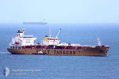
STOLT VISION
Oil/Chemical Tanker
Current Trip
| Time Travelled | 8 days |
|---|---|
| Remaining Time | 6 days |
| Distance Travelled | 2913.88 nm |
| Remaining Distance | 2058.69 nm |
| AVG Speed | 13.8 Knopen |
| MAX Speed | 16.6 Knopen |
| AVG Wind | 13.2 knots |
| MAX Wind | 21.1 knots |
| MIN Temp | 17.4°C / 63.32°F |
| MAX Temp | 29.1°C / 84.38°F |
| Diepgang | 10 M |
| Positie ontvangen | 1 d geleden |
Current Position
| Lengtegraad | -34.61761° |
|---|---|
| Breedtegraat | -6.47416° |
| Status | Under way using engine |
| Snelheid | 15.6 Knopen |
| Koers | 351.8° |
| Gebied | South Atlantic Ocean |
| Station | T-AIS |
| Positie ontvangen | 1 d geleden |
Info
Information
The current position of STOLT VISION is in South Atlantic Ocean with coordinates -6.47416° / -34.61761° as reported on 2024-04-29 20:41 by AIS to our vessel tracker app. The vessel's current speed is 15.6 Knopen and is heading at the port of SANTA MARTA. The estimated time of arrival as calculated by MyShipTracking vessel tracking app is 2024-05-08 06:38 LT
The vessel STOLT VISION (IMO: 9274329, MMSI: 636015738) is a Oil/Chemical Tanker that was built in 2005 ( 19 Jaar oud ). It's sailing under the flag of [LR] Liberia.
In this page you can find informations about the vessels current position, last detected port calls, and current voyage information. If the vessels is not in coverage by AIS you will find the latest position.
The current position of STOLT VISION is detected by our AIS receivers and we are not responsible for the reliability of the data. The last position was recorded while the vessel was in Coverage by the Ais receivers of our vessel tracking app.
The current draught of STOLT VISION as reported by AIS is 10 meters
Weather
| Temperature | 28.4°C / 83.12°F |
|---|---|
| Wind Speed | 12 knots |
| Direction | 66° ENE |
| Pressure | 1008.4 hPa |
| Humidity | 78.4 % |
| Cloud Coverage | 61 % |
Featured Company
Last Port Calls
| Port | Arrival | Departure | Time In Port |
|---|---|---|---|
| 2024-04-21 19:05 | 2024-04-23 04:13 | 1 d | |
| 2024-04-13 00:35 | 2024-04-17 22:25 | 4 d | |
| 2024-04-09 04:34 | 2024-04-09 18:41 | 14 h | |
| 2024-03-17 06:33 | 2024-03-17 07:24 | 50 m | |
| 2024-03-07 15:13 | 2024-03-07 15:31 | 17 m | |
| 2024-03-01 23:32 | 2024-03-04 02:27 | 2 d |
Most Visited Ports (Last year)
| Port | Arrivals | |
|---|---|---|
| 9 | ||
| 5 | ||
| 3 | ||
| 3 | ||
| 3 | ||
| 2 |
Last Trips
| Origin | Departure | Destination | Arrival | Distance | |
|---|---|---|---|---|---|
| 2024-04-17 19:25 | 2024-04-21 16:05 | 344.67 nm | |||
| 2024-04-09 15:41 | 2024-04-12 21:35 | 889.12 nm | |||
| 2024-03-17 04:24 | 2024-04-09 01:34 | 2512.38 nm | |||
| 2024-03-07 12:31 | 2024-03-17 03:33 | 43.82 nm | |||
| 2024-03-03 23:27 | 2024-03-07 12:13 | 842.51 nm | |||
| 2024-02-21 16:12 | 2024-03-01 20:32 | 2611.07 nm |
Events
| Tijd | Evenement | Details | Positie / Bestemming | Info |
|---|---|---|---|---|
| 2024-04-29 20:45 | Status Changed | Default Under way using engine |
-6.45519 / -34.62080
COSMR
|
Snelheid: 15.6 kn Koers: 351.8° |
| 2024-04-29 20:41 | Status Changed | Under way using engine Default |
-6.47416 / -34.61761
COSMR
|
Snelheid: 15.6 kn Koers: 350° |
| 2024-04-29 20:41 | Buitenbereik |
-6.47416 / -34.61761
South Atlantic Ocean
COSMR
|
Snelheid: 15.6 kn Koers: 351.8° |
|
| 2024-04-29 20:25 | Binnenbereik |
-6.47416 / -34.61761
South Atlantic Ocean
COSMR
|
Snelheid: 15.6 kn Koers: 351.8° |
|
| 2024-04-24 07:28 | Status Changed | Default Under way using engine |
-32.21833 / -50.21333
COSMR
|
Snelheid: 13.8 kn Koers: 47.4° |
| 2024-04-24 07:21 | Wijzig zee gebeid | Brazilian part of the South Atlantic Ocean Uruguayan part of the South Atlantic Ocean |
-32.23634 / -50.23768
South Atlantic Ocean
COSMR
|
Snelheid: 13.8 kn Koers: 47.4° |
| 2024-04-24 07:21 | Buitenbereik |
-32.23634 / -50.23768
South Atlantic Ocean
COSMR
|
Snelheid: 13.8 kn Koers: 47.4° |
|
| 2024-04-24 07:21 | Binnenbereik |
-32.23634 / -50.23768
South Atlantic Ocean
COSMR
|
Snelheid: 13.8 kn Koers: 47.4° |
|
| 2024-04-24 07:20 | Status Changed | Under way using engine Default |
-32.23735 / -50.23900
COSMR
|
Snelheid: 13 kn Koers: 48° |
| 2024-04-23 10:20 | Buitenbereik |
-35.06889 / -54.75368
South Atlantic Ocean
COSMR
|
Snelheid: 13.4 kn Koers: 80.6° |