
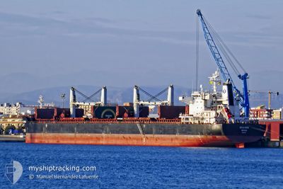
SPAR MIRA
Bulk Carrier
Current Trip
| Time Travelled | 10 h, 28 mins |
|---|---|
| Remaining Time | 7 h, 20 mins |
| Distance Travelled | 92.43 nm |
| Remaining Distance | 47.17 nm |
| AVG Speed | 10 Knots |
| MAX Speed | 13.1 Knots |
| AVG Wind | 12 knots |
| MAX Wind | 16 knots |
| MIN Temp | 14.4°C / 57.92°F |
| MAX Temp | 15.9°C / 60.62°F |
| Draught | 6.9 m |
| Position Received | 2 m ago |
Current Position
| Longitude | 3.65087° |
|---|---|
| Latitude | 52.29845° |
| Status | Under way using engine |
| Speed | 6.4 Knots |
| Course | 31.6° |
| Area | North Sea |
| Station | T-AIS |
| Position Received | 2 m ago |
Info
Information
The current position of SPAR MIRA is in North Sea with coordinates 52.29845° / 3.65087° as reported on 2024-07-02 15:38 by AIS to our vessel tracker app. The vessel's current speed is 6.4 Knots and is heading at the port of AMSTERDAM. The estimated time of arrival as calculated by MyShipTracking vessel tracking app is 2024-07-02 23:00 LT
The vessel SPAR MIRA (IMO: 9490727, MMSI: 257556000) is a Bulk Carrier that was built in 2010 ( 14 years old ). It's sailing under the flag of [NO] Norway.
In this page you can find informations about the vessels current position, last detected port calls, and current voyage information. If the vessels is not in coverage by AIS you will find the latest position.
The current position of SPAR MIRA is detected by our AIS receivers and we are not responsible for the reliability of the data. The last position was recorded while the vessel was in Coverage by the Ais receivers of our vessel tracking app.
The current draught of SPAR MIRA as reported by AIS is 6.9 meters
Weather
| Temperature | 14.5°C / 58.1°F |
|---|---|
| Wind Speed | 14 knots |
| Direction | 336° NNW |
| Pressure | 1015.8 hPa |
| Humidity | 72.9 % |
| Cloud Coverage | 100 % |
Featured Company
Most Visited Ports (Last year)
| Port | Arrivals | |
|---|---|---|
| 2 | ||
| 2 | ||
| 2 | ||
| 2 | ||
| 1 | ||
| 1 |
Events
| Time | Event | Details | Position / Dest | Info |
|---|---|---|---|---|
| 2024-07-02 14:20 | Status Changed | Under way using engine Default |
52.17612 / 3.52283
AMSTERDAM
|
Speed: 7.4 kn Course: 36° |
| 2024-07-02 13:35 | Status Changed | Default Under way using engine |
52.11117 / 3.45483
AMSTERDAM
|
Speed: 4.9 kn Course: 24° |
| 2024-07-02 13:34 | Status Changed | Under way using engine Default |
52.10999 / 3.45377
AMSTERDAM
|
Speed: 5.1 kn Course: 29° |
| 2024-07-02 13:11 | Status Changed | Default Under way using engine |
52.08253 / 3.42785
AMSTERDAM
|
Speed: 5.4 kn Course: 31.8° |
| 2024-07-02 13:09 | Status Changed | Under way using engine Default |
52.07964 / 3.42484
AMSTERDAM
|
Speed: 5.5 kn Course: 11° |
| 2024-07-02 12:56 | Status Changed | Default Under way using engine |
52.05960 / 3.41382
AMSTERDAM
|
Speed: 6.8 kn Course: 2° |
| 2024-07-02 05:12 | PORT DEPARTURE |
|
51.36924 / 4.22067
AMSTERDAM
|
Speed: 13.5 kn Course: 344° |
| 2024-07-02 04:54 | START Moving |
51.34636 / 4.28342
[BE] ANTWERP
|
Speed: 3.1 kn Course: 279° |
|
| 2024-07-02 03:45 | STOP Moving |
51.34619 / 4.28631
[BE] ANTWERP
|
Speed: 0.3 kn Course: 280° |
|
| 2024-07-02 02:34 | START Moving |
51.24852 / 4.35977
[BE] ANTWERP
|
Speed: 3.1 kn Course: 1° |