

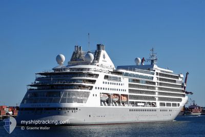
SILVER MUSE
Passenger

Current Trip
| Trip Time | 2 days |
|---|---|
| Trip Distance | 950.02 nm |
| AVG Speed | 15.2 Knots |
| MAX Speed | 16.8 Knots |
| Draught | 6.7 m |
| AVG Wind | 4.4 knots |
| MAX Wind | 8.8 knots |
| MIN Temp | 25.7°C / 78.26°F |
| MAX Temp | 31°C / 87.8°F |
| Position Received | 5 d ago |
Current Position
| Longitude | --- |
|---|---|
| Latitude | --- |
| Status | Under way using engine |
| Speed | 12.9 Knots |
| Course | 266.3° |
| Area | Coral Sea |
| Station | T-AIS |
| Position Received | 5 d ago |
Information
The current position of SILVER MUSE is in Coral Sea with coordinates -10.56370° / 142.02822° as reported on 2025-02-23 18:29 by AIS to our vessel tracker app. The vessel's current speed is 12.9 Knots and is currently inside the port of BENOA.
The vessel SILVER MUSE (IMO: 9784350, MMSI: 311000637) is a Passenger It's sailing under the flag of [BS] Bahamas.
In this page you can find informations about the vessels current position, last detected port calls, and current voyage information. If the vessels is not in coverage by AIS you will find the latest position.
The current position of SILVER MUSE is detected by our AIS receivers and we are not responsible for the reliability of the data. The last position was recorded while the vessel was in Coverage by the Ais receivers of our vessel tracking app.
The current draught of SILVER MUSE as reported by AIS is 6.7 meters
Weather
| Temperature | 28.9°C / 84.02°F |
|---|---|
| Wind Speed | 6 knots |
| Direction | 133° SE |
| Pressure | 1007 hPa |
| Humidity | 70.2 % |
| Cloud Coverage | 4 % |


Featured Company
Last Port Calls
| Port | Arrival | Departure | Time In Port |
|---|---|---|---|
| 2025-02-28 23:00 | |||
| 2025-02-25 21:28 | 2025-02-26 09:12 | 11 h | |
| 2025-02-20 22:50 | 2025-02-22 08:02 | 1 d | |
| 2025-02-20 01:45 | 2025-02-20 08:44 | 6 h | |
| 2025-02-17 20:53 | 2025-02-18 07:25 | 10 h | |
| 2025-02-15 19:14 | 2025-02-16 07:49 | 12 h | |
| 2025-02-13 20:48 | 2025-02-14 07:04 | 10 h | |
| 2025-02-11 20:33 | 2025-02-12 11:49 | 15 h | |
| 2025-02-07 18:48 | 2025-02-08 05:10 | 10 h | |
| 2025-02-06 18:19 | 2025-02-07 05:14 | 10 h |
Last Trips
| Origin | Departure | Destination | Arrival | Distance | |
|---|---|---|---|---|---|
| 2025-02-26 18:42 | 2025-03-01 07:00 | 950.02 nm | |||
| 2025-02-22 18:02 | 2025-02-26 06:58 | 1215.40 nm | |||
| 2025-02-20 18:44 | 2025-02-21 08:50 | 174.03 nm | |||
| 2025-02-18 17:25 | 2025-02-20 11:45 | 695.12 nm | |||
| 2025-02-16 18:49 | 2025-02-18 06:53 | 529.63 nm | |||
| 2025-02-14 18:04 | 2025-02-16 06:14 | 534.65 nm | |||
| 2025-02-12 22:49 | 2025-02-14 07:48 | 347.96 nm | |||
| 2025-02-08 18:10 | 2025-02-12 07:33 | 1279.45 nm | |||
| 2025-02-07 18:14 | 2025-02-08 07:48 | 201.63 nm | |||
| 2025-02-06 18:08 | 2025-02-07 07:19 | 172.87 nm |
Events
| Time | Event | Details | Position / Dest | Info |
|---|---|---|---|---|
| 2025-02-28 23:30 | STOP Moving |
-8.74220 / 115.21278
[ID] BENOA
|
Speed: 0.1 kn Course: 195° |
|
| 2025-02-28 23:00 | PORT ARRIVAL |
|
-8.74991 / 115.21770
[ID] BENOA
|
Speed: 7.1 kn Course: 295° |
| 2025-02-26 09:12 | PORT DEPARTURE |
|
-12.39426 / 130.75420
AU DRW
|
Speed: 14.7 kn Course: 321° |
| 2025-02-25 21:28 | PORT ARRIVAL |
|
-12.40265 / 130.76044
[AU] DARWIN
|
Speed: 14.4 kn Course: 140° |
| 2025-02-23 18:37 | Status Changed | Default Under way using engine |
-10.56541 / 142.00093
AU DRW
|
Speed: 12.9 kn Course: 266.3° |
| 2025-02-23 18:29 | OUT of Coverage |
-10.56370 / 142.02822
Coral Sea
AU DRW
|
Speed: 12.9 kn Course: 266.3° |
|
| 2025-02-23 18:24 | Status Changed | Under way using engine Default |
-10.56244 / 142.04750
AU DRW
|
Speed: 12.8 kn Course: 266° |
| 2025-02-23 18:17 | Status Changed | Default Under way using engine |
-10.56061 / 142.07342
AU DRW
|
Speed: 12.5 kn Course: 265.8° |
| 2025-02-23 16:33 | Status Changed | Under way using engine Default |
-10.51634 / 142.39655
AU DRW
|
Speed: 13.1 kn Course: 300° |
| 2025-02-23 16:32 | Status Changed | Default Under way using engine |
-10.51759 / 142.39874
AU DRW
|
Speed: 13.1 kn Course: 298.9° |