

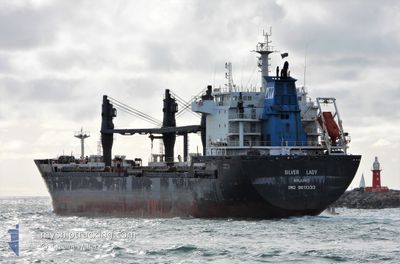
SILVER LADY
Bulk Carrier

Current Trip
AU GOV
| Time Travelled | 2 days |
|---|---|
| Remaining Time | --- |
| Distance Travelled | 538.86 nm |
| Remaining Distance | --- |
| AVG Speed | 12.2 Knots |
| MAX Speed | 13.8 Knots |
| AVG Wind | 10.7 knots |
| MAX Wind | 15.7 knots |
| MIN Temp | 20.8°C / 69.44°F |
| MAX Temp | 24.9°C / 76.82°F |
| Draught | 6 m |
| Position Received | 26 d ago |
Current Position
| Longitude | --- |
|---|---|
| Latitude | --- |
| Status | Under way using engine |
| Speed | 12.7 Knots |
| Course | 326.7° |
| Area | Coral Sea |
| Station | T-AIS |
| Position Received | 26 d ago |
Information
The current position of SILVER LADY is in Coral Sea with coordinates -12.26008° / 143.26548° as reported on 2025-03-01 06:45 by AIS to our vessel tracker app. The vessel's current speed is 12.7 Knots
The vessel SILVER LADY (IMO: 9611333, MMSI: 538008184) is a Bulk Carrier that was built in 2013 ( 12 years old ). It's sailing under the flag of [MH] Marshall Is.
In this page you can find informations about the vessels current position, last detected port calls, and current voyage information. If the vessels is not in coverage by AIS you will find the latest position.
The current position of SILVER LADY is detected by our AIS receivers and we are not responsible for the reliability of the data. The last position was recorded while the vessel was in Coverage by the Ais receivers of our vessel tracking app.
The current draught of SILVER LADY as reported by AIS is 6 meters
Weather
| Temperature | 22.3°C / 72.14°F |
|---|---|
| Wind Speed | 5 knots |
| Direction | 187° S |
| Pressure | 1007.8 hPa |
| Humidity | 96.8 % |
| Cloud Coverage | 100 % |


Featured Company
Last Port Calls
| Port | Arrival | Departure | Time In Port |
|---|---|---|---|
| 2025-03-21 19:02 | 2025-03-25 16:42 | 3 d | |
| 2025-03-03 01:07 | 2025-03-08 02:39 | 5 d | |
| 2025-02-18 18:56 | 2025-02-20 22:24 | 2 d | |
| 2025-02-13 12:15 | 2025-02-16 11:59 | 2 d | |
| 2025-01-21 01:12 | 2025-01-23 00:13 | 1 d | |
| 2025-01-15 14:37 | 2025-01-17 16:25 | 2 d |
Last Trips
| Origin | Departure | Destination | Arrival | Distance | |
|---|---|---|---|---|---|
| 2025-03-08 12:09 | 2025-03-22 02:02 | 2573.54 nm | |||
| 2025-02-21 09:24 | 2025-03-03 10:37 | 2652.05 nm | |||
| 2025-02-16 22:29 | 2025-02-19 05:56 | 523.21 nm | |||
| 2025-01-23 08:13 | 2025-02-13 22:45 | 4793.68 nm | |||
| 2025-01-17 22:25 | 2025-01-21 09:12 | 266.70 nm | |||
| 2024-12-23 15:24 | 2025-01-15 20:37 | 5550.25 nm |
Events
| Time | Event | Details | Position / Dest | Info |
|---|---|---|---|---|
| 2025-03-27 13:10 | STOP Moving | 7.83 nm, South of HONG KONG |
22.16086 / 114.15934
AU GOV
|
Speed: 0.2 kn Course: 242° |
| 2025-03-25 16:42 | PORT DEPARTURE |
|
15.42310 / 108.77514
AU GOV
|
Speed: 5.8 kn Course: 319° |
| 2025-03-25 16:18 | START Moving |
15.40458 / 108.79865
[VN] DUNG QUAT
|
Speed: 3.1 kn Course: 261° |
|
| 2025-03-21 19:30 | STOP Moving |
15.40318 / 108.80124
[VN] DUNG QUAT
|
Speed: 0.3 kn Course: 49° |
|
| 2025-03-21 19:02 | PORT ARRIVAL |
|
15.41474 / 108.78098
[VN] DUNG QUAT
|
Speed: 5.8 kn Course: 130° |
| 2025-03-21 18:46 | START Moving | 1.93 nm, North West of DUNG QUAT |
15.43083 / 108.76397
AU GOV
|
Speed: 3.4 kn Course: 139° |
| 2025-03-21 18:26 | STOP Moving | 2.13 nm, North West of DUNG QUAT |
15.43600 / 108.76488
AU GOV
|
Speed: 0.2 kn Course: 311° |
| 2025-03-21 17:54 | START Moving | 2.62 nm, North West of DUNG QUAT |
15.44607 / 108.76612
AU GOV
|
Speed: 3.3 kn Course: 190° |