
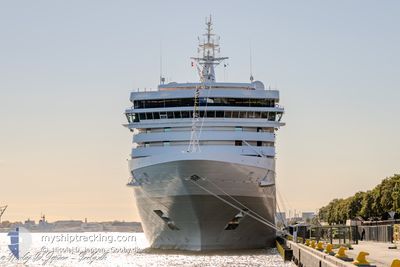
SILVER DAWN
Passenger
Current Trip
| Trip Time | 11 h, 4 mins |
|---|---|
| Trip Distance | 160.37 nm |
| AVG Speed | 14.3 Knots |
| MAX Speed | 16 Knots |
| Draught | 6.7 m |
| AVG Wind | 8.2 knots |
| MAX Wind | 18.8 knots |
| MIN Temp | 24.6°C / 76.28°F |
| MAX Temp | 27.5°C / 81.5°F |
| Position Received | 7 h, 33 m ago |
Current Position
| Longitude | --- |
|---|---|
| Latitude | --- |
| Status | Under way using engine |
| Speed | 14.4 Knots |
| Course | 286.2° |
| Area | Laccadive Sea |
| Station | T-AIS |
| Position Received | 7 h, 33 m ago |
Info
Information
The current position of SILVER DAWN is in Laccadive Sea with coordinates 5.94280° / 80.03787° as reported on 2025-02-16 18:45 by AIS to our vessel tracker app. The vessel's current speed is 14.4 Knots and is currently inside the port of COLOMBO.
The vessel SILVER DAWN (IMO: 9857937, MMSI: 311001044) is a Passenger It's sailing under the flag of [BS] Bahamas.
In this page you can find informations about the vessels current position, last detected port calls, and current voyage information. If the vessels is not in coverage by AIS you will find the latest position.
The current position of SILVER DAWN is detected by our AIS receivers and we are not responsible for the reliability of the data. The last position was recorded while the vessel was in Coverage by the Ais receivers of our vessel tracking app.
The current draught of SILVER DAWN as reported by AIS is 6.7 meters
Weather
| Temperature | 24.5°C / 76.1°F |
|---|---|
| Wind Speed | 9 knots |
| Direction | 42° NE |
| Pressure | 1013.3 hPa |
| Humidity | 78.5 % |
| Cloud Coverage | 98 % |
Featured Company
Last Port Calls
| Port | Arrival | Departure | Time In Port |
|---|---|---|---|
| 2025-02-17 00:53 | |||
| 2025-02-15 21:55 | 2025-02-16 13:49 | 15 h | |
| 2025-02-14 00:41 | 2025-02-14 17:45 | 17 h | |
| 2025-02-06 23:02 | 2025-02-08 11:26 | 1 d | |
| 2025-01-25 23:09 | 2025-01-27 14:01 | 1 d | |
| 2025-01-23 23:37 | 2025-01-25 05:05 | 1 d | |
| 2025-01-19 23:28 | 2025-01-20 13:13 | 13 h | |
| 2025-01-18 21:26 | 2025-01-19 07:09 | 9 h | |
| 2025-01-17 21:17 | 2025-01-18 13:41 | 16 h | |
| 2025-01-14 23:07 | 2025-01-16 14:21 | 1 d |
Most Visited Ports (Last year)
| Port | Arrivals | |
|---|---|---|
| 11 | ||
| 9 | ||
| 8 | ||
| 6 | ||
| 5 | ||
| 5 |
Last Trips
| Origin | Departure | Destination | Arrival | Distance | |
|---|---|---|---|---|---|
| 2025-02-16 19:19 | 2025-02-17 06:23 | 160.37 nm | |||
| 2025-02-14 23:15 | 2025-02-16 03:25 | 235.29 nm | |||
| 2025-02-08 19:26 | 2025-02-14 06:11 | 1602.81 nm | |||
| 2025-01-27 22:01 | 2025-02-07 07:02 | 2006.35 nm | |||
| 2025-01-25 13:05 | 2025-01-26 07:09 | 311.01 nm | |||
| 2025-01-20 22:13 | 2025-01-24 07:37 | 938.25 nm | |||
| 2025-01-19 16:09 | 2025-01-20 08:28 | 254.91 nm | |||
| 2025-01-18 22:41 | 2025-01-19 06:26 | 113.20 nm | |||
| 2025-01-16 23:21 | 2025-01-18 06:17 | 363.37 nm | |||
| 2025-01-13 23:34 | 2025-01-15 08:07 | 369.91 nm |
Events
| Time | Event | Details | Position / Dest | Info |
|---|---|---|---|---|
| 2025-02-17 01:17 | STOP Moving |
6.94048 / 79.84462
[LK] COLOMBO
|
Speed: Course: 195° |
|
| 2025-02-17 00:53 | PORT ARRIVAL |
|
6.96452 / 79.84035
[LK] COLOMBO
|
Speed: 10.3 kn Course: 148° |
| 2025-02-16 18:52 | Status Changed | Default Under way using engine |
5.95064 / 80.01241
LK CMB
|
Speed: 14.4 kn Course: 286.2° |
| 2025-02-16 18:45 | OUT of Coverage |
5.94280 / 80.03787
Laccadive Sea
|
Speed: 14.4 kn Course: 286.2° |
|
| 2025-02-16 17:23 | Destination Changed | LK CMB TH HKT |
5.84860 / 80.35518
LK CMB
|
Speed: 14.5 kn Course: 278.1° |
| 2025-02-16 17:23 | ETA Changed | 2025/02/16 00:45 2025/02/10 00:00 |
5.84860 / 80.35518
LK CMB
|
Speed: 14.5 kn Course: 278.1° |
| 2025-02-16 17:17 | Change Sea Area | Sri Lankan part of the Laccadive Sea Thailand part of the Malacca Strait |
5.84475 / 80.38204
Laccadive Sea
|
Speed: 14.6 kn Course: 277° |
| 2025-02-16 17:14 | Status Changed | Under way using engine Default |
5.84321 / 80.39287
TH HKT
|
Speed: 14.5 kn Course: 288° |
| 2025-02-16 17:14 | IN Coverage |
5.84475 / 80.38204
Laccadive Sea
|
Speed: 14.6 kn Course: 277° |
|
| 2025-02-16 13:49 | PORT DEPARTURE |
|
6.09630 / 81.11232
TH HKT
|
Speed: 7.3 kn Course: 150° |